Gmina Kamionka Wielka is a rural gmina in Nowy Sącz County, Lesser Poland Voivodeship, in southern Poland. Its seat is the village of Kamionka Wielka, which lies approximately 9 kilometres (6 mi) south-east of Nowy Sącz and 82 km (51 mi) south-east of the regional capital Kraków.
Gmina Krynica-Zdrój is an urban-rural gmina in Nowy Sącz County, Lesser Poland Voivodeship, in southern Poland, on the Slovak border. Its seat is the town of Krynica-Zdrój, which lies approximately 31 kilometres (19 mi) south-east of Nowy Sącz and 103 km (64 mi) south-east of the regional capital Kraków.
Gmina Muszyna is an urban-rural gmina in Nowy Sącz County, Lesser Poland Voivodeship, in southern Poland, on the Slovak border. Its seat is the town of Muszyna, which lies approximately 33 kilometres (21 mi) south-east of Nowy Sącz and 105 km (65 mi) south-east of the regional capital Kraków.
Gmina Nawojowa is a rural gmina in Nowy Sącz County, Lesser Poland Voivodeship, in southern Poland. Its seat is the village of Nawojowa, which lies approximately 8 kilometres (5 mi) south-east of Nowy Sącz and 81 km (50 mi) south-east of the regional capital Kraków.
Gmina Piwniczna-Zdrój is an urban-rural gmina in Nowy Sącz County, Lesser Poland Voivodeship, in southern Poland, on the Slovak border. Its seat is the town of Piwniczna-Zdrój, which lies approximately 21 kilometres (13 mi) south of Nowy Sącz and 89 km (55 mi) south-east of the regional capital Kraków.

Barnowiec is a village in the administrative district of Gmina Łabowa, within Nowy Sącz County, Lesser Poland Voivodeship, in southern Poland. It lies approximately 7 kilometres (4 mi) west of Łabowa, 14 km (9 mi) south-east of Nowy Sącz, and 86 km (53 mi) south-east of the regional capital Kraków.
Czaczów is a village in the administrative district of Gmina Łabowa, within Nowy Sącz County, Lesser Poland Voivodeship, in southern Poland. It lies approximately 5 kilometres (3 mi) west of Łabowa, 13 km (8 mi) south-east of Nowy Sącz, and 86 km (53 mi) south-east of the regional capital Kraków.
Kotów is a village in the administrative district of Gmina Łabowa, within Nowy Sącz County, Lesser Poland Voivodeship, in southern Poland. It lies approximately 3 kilometres (2 mi) south-east of Łabowa, 18 km (11 mi) south-east of Nowy Sącz, and 91 km (57 mi) south-east of the regional capital Kraków.
Krzyżówka is a village in the administrative district of Gmina Łabowa, within Nowy Sącz County, Lesser Poland Voivodeship, in southern Poland. It lies approximately 9 kilometres (6 mi) south-east of Łabowa, 25 km (16 mi) south-east of Nowy Sącz, and 97 km (60 mi) south-east of the regional capital Kraków.

Łabowa is a village in Nowy Sącz County, Lesser Poland Voivodeship, in southern Poland. It is the seat of the gmina called Gmina Łabowa. It lies approximately 16 kilometres (10 mi) south-east of Nowy Sącz and 90 km (56 mi) south-east of the regional capital Kraków.
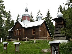
Łosie is a village in the administrative district of Gmina Łabowa, within Nowy Sącz County, Lesser Poland Voivodeship, in southern Poland. It lies approximately 9 kilometres (6 mi) south-east of Łabowa, 24 km (15 mi) south-east of Nowy Sącz, and 97 km (60 mi) south-east of the regional capital Kraków.
Maciejowa is a village in the administrative district of Gmina Łabowa, within Nowy Sącz County, Lesser Poland Voivodeship, in southern Poland. It lies approximately 16 kilometres (10 mi) south-east of Nowy Sącz and 89 km (55 mi) south-east of the regional capital Kraków.
Nowa Wieś is a village in the administrative district of Gmina Łabowa, within Nowy Sącz County, Lesser Poland Voivodeship, in southern Poland. It lies approximately 4 kilometres (2 mi) south-east of Łabowa, 19 km (12 mi) south-east of Nowy Sącz, and 92 km (57 mi) south-east of the regional capital Kraków.
Roztoka Wielka is a village in the administrative district of Gmina Łabowa, within Nowy Sącz County, Lesser Poland Voivodeship, in southern Poland. It lies approximately 9 kilometres (6 mi) south-east of Łabowa, 25 km (16 mi) south-east of Nowy Sącz, and 98 km (61 mi) south-east of the regional capital Kraków.
Składziste is a village in the administrative district of Gmina Łabowa, within Nowy Sącz County, Lesser Poland Voivodeship, in southern Poland. It lies approximately 5 kilometres (3 mi) south-west of Łabowa, 15 km (9 mi) south-east of Nowy Sącz, and 88 km (55 mi) south-east of the regional capital Kraków.
Uhryń is a village in the administrative district of Gmina Łabowa, within Nowy Sącz County, Lesser Poland Voivodeship, in southern Poland. It lies approximately 6 kilometres (4 mi) south of Łabowa, 20 km (12 mi) south-east of Nowy Sącz, and 93 km (58 mi) south-east of the regional capital Kraków.
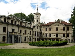
Nawojowa is a village in Nowy Sącz County, Lesser Poland Voivodeship, in southern Poland. It is the seat of the gmina called Gmina Nawojowa. It lies approximately 8 kilometres (5 mi) south-east of Nowy Sącz and 81 km (50 mi) south-east of the regional capital Kraków.
Myślec is a village in the administrative district of Gmina Stary Sącz, within Nowy Sącz County, Lesser Poland Voivodeship, in southern Poland. It lies approximately 3 kilometres (2 mi) south-east of Stary Sącz, 9 km (6 mi) south of Nowy Sącz, and 78 km (48 mi) south-east of the regional capital Kraków.
Popowice is a village in the administrative district of Gmina Stary Sącz, within Nowy Sącz County, Lesser Poland Voivodeship, in southern Poland. It lies approximately 4 kilometres (2 mi) south-east of Stary Sącz, 10 km (6 mi) south of Nowy Sącz, and 78 km (48 mi) south-east of the regional capital Kraków.