Angleworm Lake is an unorganized territory in Saint Louis County, Minnesota, United States. As of the 2000 census, the unorganized territory had a total population of 0.

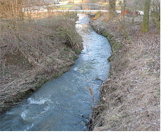
The Mamer is a river flowing through Luxembourg, joining the Alzette at Mersch. It flows through the towns of Mamer and Kopstal. The river is a tributary to the Moselle river.
Motyczyn is a village in the administrative district of Gmina Prochowice, within Legnica County, Lower Silesian Voivodeship, in south-western Poland. Prior to 1945 it was in Germany.

Czarnowo is a village in the administrative district of Gmina Zławieś Wielka, within Toruń County, Kuyavian-Pomeranian Voivodeship, in north-central Poland. It lies approximately 17 km (11 mi) east of Bydgoszcz and 26 km (16 mi) west of Toruń.

Fabianki is a village in Włocławek County, Kuyavian-Pomeranian Voivodeship, in north-central Poland. It is the seat of the gmina called Gmina Fabianki. It lies approximately 9 kilometres (6 mi) north-east of Włocławek and 49 km (30 mi) south-east of Toruń.
Wola Korybutowa Druga is a village in the administrative district of Gmina Siedliszcze, within Chełm County, Lublin Voivodeship, in eastern Poland.

Tarnawa Wyżna is a former village in the administrative district of Gmina Lutowiska, within Bieszczady County, Subcarpathian Voivodeship, in south-eastern Poland, close to the border with Ukraine.

Rabe is a village in the administrative district of Gmina Czarna, within Bieszczady County, Subcarpathian Voivodeship, in south-eastern Poland, close to the border with Ukraine. It lies approximately 5 kilometres (3 mi) north of Czarna, 10 km (6 mi) south-east of Ustrzyki Dolne, and 89 km (55 mi) south-east of the regional capital Rzeszów.
Sewerynów is a village in the administrative district of Gmina Szczawin Kościelny, within Gostynin County, Masovian Voivodeship, in east-central Poland.
Romany-Sebory is a village in the administrative district of Gmina Krzynowłoga Mała, within Przasnysz County, Masovian Voivodeship, in east-central Poland.
Rudno Kmiece is a village in the administrative district of Gmina Krzynowłoga Mała, within Przasnysz County, Masovian Voivodeship, in east-central Poland.

Szczęście is a village in the administrative district of Gmina Zwoleń, within Zwoleń County, Masovian Voivodeship, in east-central Poland. It lies approximately 7 kilometres (4 mi) east of Zwoleń and 106 km (66 mi) south-east of Warsaw.
Chudoba is a village in the administrative district of Gmina Brzeziny, within Kalisz County, Greater Poland Voivodeship, in west-central Poland.

Czaple is a settlement in the administrative district of Gmina Lipnica, within Bytów County, Pomeranian Voivodeship, in northern Poland. It lies approximately 7 kilometres (4 mi) south-west of Lipnica, 24 km (15 mi) south-west of Bytów, and 96 km (60 mi) south-west of the regional capital Gdańsk.

Melgrowa Góra is a settlement in the administrative district of Gmina Kartuzy, within Kartuzy County, Pomeranian Voivodeship, in northern Poland. It lies approximately 4 kilometres (2 mi) north of Kartuzy and 28 km (17 mi) west of the regional capital Gdańsk.
Słępy is a village in the administrative district of Gmina Korsze, within Kętrzyn County, Warmian-Masurian Voivodeship, in northern Poland.

Buczek is a village in the administrative district of Gmina Białogard, within Białogard County, West Pomeranian Voivodeship, in north-western Poland. It lies approximately 10 kilometres (6 mi) north-east of Białogard and 122 km (76 mi) north-east of the regional capital Szczecin.
Ukłejki is a settlement in the administrative district of Gmina Radowo Małe, within Łobez County, West Pomeranian Voivodeship, in north-western Poland.
Tibiri (Doutchi) is a village and rural commune in Niger.
Baata is a town and commune in Médéa Province, Algeria. According to the 1998 census it has a population of 3192.


