
Korytów is a village in the administrative district of Gmina Kłodzko, within Kłodzko County, Lower Silesian Voivodeship, in south-western Poland. Prior to 1945 it was in Germany. It lies approximately 5 kilometres (3 mi) north-west of Kłodzko and 81 km (50 mi) south of the regional capital Wrocław.
Potasznia is a village in the administrative district of Gmina Milicz, within Milicz County, Lower Silesian Voivodeship, in south-western Poland. Prior to 1945 it was in Germany.

Bogusławice is a village in the administrative district of Gmina Oleśnica, within Oleśnica County, Lower Silesian Voivodeship, in south-western Poland. Prior to 1945 it was in Germany.
Szyszkówka is a village in the administrative district of Gmina Lubiewo, within Tuchola County, Kuyavian-Pomeranian Voivodeship, in north-central Poland. It lies approximately 5 kilometres (3 mi) west of Lubiewo, 18 km (11 mi) south-east of Tuchola, and 38 km (24 mi) north of Bydgoszcz.
Węglewice is a village in the administrative district of Gmina Witonia, within Łęczyca County, Łódź Voivodeship, in central Poland. It lies approximately 3 kilometres (2 mi) south of Witonia, 11 km (7 mi) north-east of Łęczyca, and 40 km (25 mi) north of the regional capital Łódź.
Dobrydział is a village in the administrative district of Gmina Wieruszów, within Wieruszów County, Łódź Voivodeship, in central Poland. It lies approximately 3 kilometres (2 mi) south-west of Wieruszów and 109 km (68 mi) south-west of the regional capital Łódź.
Lipka is a village in the administrative district of Gmina Tomaszów Lubelski, within Tomaszów Lubelski County, Lublin Voivodeship, in eastern Poland.
Nowa Wieś is a village in the administrative district of Gmina Busko-Zdrój, within Busko County, Świętokrzyskie Voivodeship, in south-central Poland. It lies approximately 9 kilometres (6 mi) east of Busko-Zdrój and 50 km (31 mi) south of the regional capital Kielce.
Dziurów is a village in the administrative district of Gmina Brody, within Starachowice County, Świętokrzyskie Voivodeship, in south-central Poland. It lies approximately 7 kilometres (4 mi) west of Brody, 6 km (4 mi) south-east of Starachowice, and 39 km (24 mi) east of the regional capital Kielce.
Rumunki is a village in the administrative district of Gmina Gostynin, within Gostynin County, Masovian Voivodeship, in east-central Poland.
Czarnówka is a village in the administrative district of Gmina Wiązowna, within Otwock County, Masovian Voivodeship, in east-central Poland.
Bielice is a village in the administrative district of Gmina Wyszogród, within Płock County, Masovian Voivodeship, in east-central Poland. It lies approximately 9 kilometres (6 mi) north of Wyszogród, 37 km (23 mi) east of Płock, and 60 km (37 mi) north-west of Warsaw.
Jabłonna-Kolonia is a village in the administrative district of Gmina Jabłonna Lacka, within Sokołów County, Masovian Voivodeship, in east-central Poland.
Nowa Wieś is a village in the administrative district of Gmina Trzcianka, within Czarnków-Trzcianka County, Greater Poland Voivodeship, in west-central Poland. It lies approximately 6 kilometres (4 mi) south of Trzcianka, 14 km (9 mi) north-west of Czarnków, and 74 km (46 mi) north-west of the regional capital Poznań.
Wierzyce is a village in the administrative district of Gmina Łubowo, within Gniezno County, Greater Poland Voivodeship, in west-central Poland.
Gurowo is a village in the administrative district of Gmina Niechanowo, within Gniezno County, Greater Poland Voivodeship, in west-central Poland.
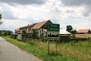
Frącki is a village in the administrative district of Gmina Biała, within Prudnik County, Opole Voivodeship, in south-western Poland. It lies approximately 7 kilometres (4 mi) north of Biała Prudnicka, 17 km (11 mi) north-east of Prudnik, and 30 km (19 mi) south-west of the regional capital Opole.
Skrzydłowo is a village in the administrative district of Gmina Nowa Karczma, within Kościerzyna County, Pomeranian Voivodeship, in northern Poland. It lies approximately 4 kilometres (2 mi) east of Nowa Karczma, 18 km (11 mi) east of Kościerzyna, and 37 km (23 mi) south-west of the regional capital Gdańsk.
Nowy Folwark is a village in the administrative district of Gmina Stary Dzierzgoń, within Sztum County, Pomeranian Voivodeship, in northern Poland. It lies approximately 5 kilometres (3 mi) north-east of Stary Dzierzgoń, 29 km (18 mi) east of Sztum, and 78 km (48 mi) south-east of the regional capital Gdańsk.
Będargowo is a village in the administrative district of Gmina Szemud, within Wejherowo County, Pomeranian Voivodeship, in northern Poland. It lies approximately 10 kilometres (6 mi) south-west of Szemud, 21 km (13 mi) south-west of Wejherowo, and 34 km (21 mi) west of the regional capital Gdańsk.


