
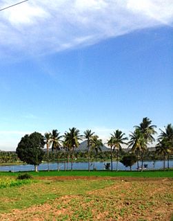
Kampalapura is a village in Mysore district of Karnataka state in India.
Kampalapura is a village in Mysore district of Karnataka state in India.
Kampalapura is located between Mysuru and Madikeri cities at latitude 12.335401 and longitude 76.158353. It is also sometimes referred to as Kamplapura. [1] Coordinates: 12°20′07″N76°09′30″E / 12.335401°N 76.158353°E
Periyapatna. 7 km Kushalnagar 28 km Bettadapura 22 km Ramanathapura 40 km Saligrama 38.5 km Hunasuru 16 km Gonikoppa 34 km Virajpete 50 km [2]
The population of Kampalapura village is 4,721, and there were 1,112 families identified in the last census. [3]
The economy of the village is mostly agrarian. The major crops are tobacco, ragi, maize, areca nut and rice.
There is a post office in the village and the pin-code is 571107.

Kanakapura is a town in the Ramanagara district of Karnataka on the banks of the Arkavathi river and the administrative center of the taluk of the same name. Previously belonged to Bangalore Rural District. It was formerly the largest constituency in the country. The taluk is very widespread (1,553 km2 [600 sq mi]). It is located among the lush green forests of the state of Karnataka. The town is a tourism hotspot and an often visited tourist favorite in the entire state of Karnataka, as it has something for everyone ranging from avid trekkers to history buffs and wildlife enthusiasts.The forest area in this taluk is very wide and about half of the Bannerghatta National Park is located in our Kanakapura area.Kodihalli wildlife range and harohalli wildlife range its division.The Kaveri Wildlife Sanctuary consists of two main zones namely the Sangam Wildlife range, the Mugur Wildlife range

Hunsur is a city in Mysore district in the Indian state of Karnataka. It is the headquarters of the Hunsur Taluk administrative division.

Halaguru or Halagur is a town in the southern state of Karnataka, India.

Yachenahalli is a panchayat town in Mysore district in the state of Karnataka, India. It is located 35 km from Mysore and 17 km from Mandya. The nearest city is Bannur with 10 km distance.

Gurur is a small village in Mysore district, Karnataka, India.
Nagarle is a village in Mysore district of Karnataka state, India.
Kahalli is a small village in Mysore district of Karnataka state, India.

Alambur is a village in Mysore district of Karnataka, India.

Konanur or Paduvalamarahalli is a village in Nanjangud taluk of Mysore district, Karnataka state, India.
Naganahalli is a small village in Mysuru district of Karnataka state, India.
Narayanapura is a small village in Mandya district of Karnataka state, India.
Arasu Kallahalli is a village in Mysore district of Karnataka state, India. Birthplace of Devrajarasu former chief minister of Karnataka
Chilkunda is a village in Mysore district of Karnataka state

Keralapura is a village in Hassan district of Karnataka state, India.
Uthanahalli is a small village on Ooty Road near Mysore, Karnataka, India.
Hale Kesare is a small village in Mysore district of Karnataka state in India.

Choranalli is a village near Mysore city, Karnataka state, India.

Bherya is a village in Mysore district of Karnataka State, India. The village is a holy place, hosting 1200 year old Sri Chennakeshava temple.Now it is also famous for Doddamma and Kariyamma temples.

Hootagalli or Hutagalli is a city and a Suburb of Mysore, situated in Mysuru metropolitan area ಮೈಸೂರು ಜಿಲ್ಲೆ of Karnataka, India. Hootagalli is located in the outskirts of the city of Mysuru and forms a continuous urban area. Hootagalli city municipal council consists of previous census towns of Hinkal, Hootagalli and Gram Panchyats of Koorgalli and Belavadi totally covering an area of 28.48 square km. In November 2020, the government of Karnataka approved the formation of Hootagalli City Municipal Council by merging four gram panchayats. The initial plan was to include it with MCC to form Greater Mysuru City Corporation (BMMP) however, due to MCC disputing the proposal, a separate body was created. According to 2011 census, the city municipal council has combined population of 56,876. On November 26, 2020, a gazetted notification was passed making the CMC official.

Kundanahalli is a village in Karnataka, India.