Kamphaeng Phet

Last updated
Kamphaeng Phet
กำแพงเพชร
Town
Kamphaeng Phet City Pillar Shrine.jpg
Kamphaeng Phet city pillar shrine
Histparkkamphet.png
Map of Kamphaeng Phet
CountryFlag of Thailand.svg  Thailand
Province Kamphaeng Phet Province
Area
  Metro
14.9 km2 (5.8 sq mi)
Population
 (2020)
  Town
28,817 [1]
Time zone UTC+7 (ICT)

Kamphaeng Phet is a town ( thesaban mueang ) in central Thailand, former capital of the Kamphaeng Phet Province. It covers the complete tambon Nai Mueang of the Mueang Kamphaeng Phet district. As of 2020, it has a population of 28,817.

Contents

Wat Chang Rop (Kamphaeng Phet).jpg
Wat Chang Rop (Kamphaeng Phet) 04.JPG
Wat Singha (Kamphaeng Phet) 03.JPG
Wat Phra That (Kamphaeng Phet) 05.JPG
Kamphaeng Phet Historical Park.jpg
Kamphaeng Phet historical park 03.JPG
Kamphaeng Phet national museum Kamphaeng Phet National Museum.jpg
Kamphaeng Phet national museum
Wat Phra Borom That Wat Phra Borom That Kamphaeng Phet, Thailand. 03.jpg
Wat Phra Borom That
Wat Bang Wat Bang1.jpg
Wat Bang

History

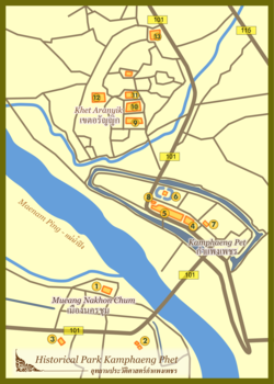
Kamphaeng Phet was an ancient outpost town during the Sukhothai period, as evidenced by the city walls and fortifications that remain today. Before the creation of the city, legends says that there were two cities present in the location; Chakangrao (ชากังราว) and Nakhon Chum (นครชุม). [2] Chakangrao was built on the east bank of the Ping River while Nakhon Chum was built on the west bank of the Ping River. [2]

Kamphaeng Phet received municipality status on March 11, 1936. [3] When the municipality was established, it had an operation area of 4.5 square kilometers. Later in 1966, it expanded to an area of 14.9 square kilometers.

Demographics

Since 2005, the population of Kamphaeng Phet has been decreasing. [4]

Estimation date31 Dec 200531 Dec 201031 Dec 201531 Dec 2019
Population30,11429,37429,19128,817

Climate

Climate data for Kamphaeng Phet (1991–2020, extremes 1981-present)
MonthJanFebMarAprMayJunJulAugSepOctNovDecYear
Record high °C (°F)37.0
(98.6)
39.8
(103.6)
40.8
(105.4)
44.0
(111.2)
43.6
(110.5)
39.6
(103.3)
38.0
(100.4)
37.8
(100.0)
36.2
(97.2)
36.1
(97.0)
36.5
(97.7)
35.4
(95.7)
44.0
(111.2)
Mean daily maximum °C (°F)32.0
(89.6)
34.1
(93.4)
35.9
(96.6)
37.2
(99.0)
35.5
(95.9)
33.9
(93.0)
33.1
(91.6)
32.7
(90.9)
32.8
(91.0)
32.4
(90.3)
32.1
(89.8)
31.2
(88.2)
33.6
(92.4)
Daily mean °C (°F)24.9
(76.8)
26.8
(80.2)
28.9
(84.0)
30.6
(87.1)
29.6
(85.3)
28.7
(83.7)
28.2
(82.8)
27.9
(82.2)
27.9
(82.2)
27.5
(81.5)
26.4
(79.5)
24.6
(76.3)
27.7
(81.8)
Mean daily minimum °C (°F)19.1
(66.4)
20.5
(68.9)
23.0
(73.4)
25.1
(77.2)
25.5
(77.9)
25.4
(77.7)
25.1
(77.2)
24.9
(76.8)
24.7
(76.5)
24.0
(75.2)
22.0
(71.6)
19.5
(67.1)
23.2
(73.8)
Record low °C (°F)10.1
(50.2)
10.5
(50.9)
14.8
(58.6)
18.4
(65.1)
20.8
(69.4)
22.3
(72.1)
21.4
(70.5)
22.5
(72.5)
21.6
(70.9)
17.0
(62.6)
12.6
(54.7)
8.2
(46.8)
8.2
(46.8)
Average precipitation mm (inches)5.3
(0.21)
12.8
(0.50)
40.4
(1.59)
56.2
(2.21)
191.1
(7.52)
157.2
(6.19)
175.8
(6.92)
180.3
(7.10)
268.0
(10.55)
166.3
(6.55)
27.5
(1.08)
8.7
(0.34)
1,289.6
(50.77)
Average precipitation days (≥ 1.0 mm)1.01.43.03.911.712.714.215.415.710.92.90.893.6
Average relative humidity (%)70.666.065.566.075.180.681.683.584.082.977.873.275.6
Average dew point °C (°F)18.5
(65.3)
19.1
(66.4)
21.0
(69.8)
22.7
(72.9)
24.2
(75.6)
24.7
(76.5)
24.5
(76.1)
24.6
(76.3)
24.7
(76.5)
24.0
(75.2)
21.8
(71.2)
19.0
(66.2)
22.4
(72.3)
Mean monthly sunshine hours 257.3243.0238.7243.0198.4156.0120.9117.8144.0179.8219.0257.32,375.2
Mean daily sunshine hours 8.38.67.78.16.45.23.93.84.85.87.38.36.5
Source 1: World Meteorological Organization [5]
Source 2: Office of Water Management and Hydrology, Royal Irrigation Department (sun 1981–2010) [6] (extremes) [7]

See also

References

  1. "Thailand: Major Cities, Towns & Communes - Population Statistics, Maps, Charts, Weather and Web Information".
  2. 1 2 "เล่าเรื่องเมืองชากังราว องค์การบริหารส่วนจังหวัดกำแพงเพชร (อบจ.กำแพงเพชร)".
  3. "ประวัติเทศบาล".
  4. "THAILAND: Major Cities, Towns & Communes".
  5. "World Meteorological Organization Climate Normals for 1991–2020". World Meteorological Organization. Retrieved 12 October 2023.
  6. "ปริมาณการใช้น้ำของพืชอ้างอิงโดยวิธีของ Penman Monteith (Reference Crop Evapotranspiration by Penman Monteith)" (PDF) (in Thai). Office of Water Management and Hydrology, Royal Irrigation Department. p. 36. Retrieved 1 August 2016.
  7. "Climatological Data for the Period 1981–2010". Thai Meteorological Department. Retrieved 4 August 2016.

16°28′52″N99°31′20″E / 16.48111°N 99.52222°E / 16.48111; 99.52222