
Bhiwani district is one of the 22 districts of the northern Indian state of Haryana. Created on 22 December 1972, it was the largest district of the state by area, before the creation of Charkhi Dadri as a separate district, as it occupied an area of 4,778 square kilometres (1,845 sq mi) and administered 442 villages with a population of 1,634,445. Sirsa is now the largest district of the state.

Sirmaur district is the southernmost district of Himachal Pradesh, northern India. It is largely mountainous and rural, with 90% of its population living in villages. Some of its towns include the capital Nahan, Paonta Sahib, LANA PALAR, Tuheri, Bhawan, Shamra, UchaTikker and Suketi, the latter known for Shivalik Fossil Park.

Yamunanagar, is a city and a municipal corporation in Yamunanagar district in the Indian state of Haryana. This town is known for the cluster of plywood units and paper factories. It provides timber to larger industries. The older town is called Jagadhri. The Yamunanagar-Jagadhri railway station (YJUD) services the city. Despite its name, Jagadhri Railway is situated in Yamunanagar. There is also another railway station called Jagadhri Workshop in Yamunanagar.

Nahan is a town in Himachal Pradesh in India and is the headquarters of the Sirmaur District It was the capital of the former Sirmur princely state.Nahan is also known as the Town of ponds.

Nubra, also called Dumra, is a historical region of Ladakh, India that is currently administered as a subdivision and a tehsil in the Leh district. Its inhabited areas form a tri-armed valley cut by the Nubra and Shyok rivers. Its Tibetan name Dumra means "valley of flowers". Demands have been raised and BJP has hinted at creation of Nubra as a new district. Diskit, the headquarters of Nubra, is 120 km north of Leh, the capital of Ladakh.
Chakrata is a cantonment town and also a sub district/tehsil, in Dehradun district in the state of Uttarakhand, India.
Paonta Sahib is an industrial town of Himachal Pradesh in India. It is located in the south of Sirmaur district, on National Highway 72. Paonta Sahib is an important place of worship for Sikhs, hosting a large Gurdwara named Gurudwara Paonta Sahib, on the banks of the river Yamuna. The river is the boundary between the states of Himachal Pradesh and Uttarakhand.
Deoli is a city situated at the point at which Tonk, Shahpura, Kekri and Bundi districts meet, though the bulk of the city is located in Shahpura and Tonk districts. It is officially a part of Tonk district. It is the tehsil headquarters of the Deoli tehsil.
Kotkhai is a town and a Nagar Panchayat in Shimla district in the Indian state of Himachal Pradesh.The name Kotkhai is derived from Hindi and Urdu language where the name "Kot" means Kings Palace and "Khai" means depth, therefore "Kotkhai" means "Kings palace situated in depth". It is a tehsil with around 40 villages under its administration. The whole tehsil is known for quality apple production. Kotkhai is also known for its fairs and traditional values, people of Kotkhai are really devotional towards Devtas where each villages believes in different forms of Devtas.
Vikasnagar is a city and a municipality in Dehradun district in the Indian state of Uttarakhand. Vikas Nagar is also a tehsil in Dehradun district
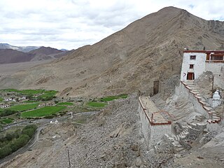
Nyoma is a principal village of southern Ladakh in India, the headquarters of an eponymous subdivision, tehsil, community development block and Indian Air Force Base in the Leh district. It is located on the bank of the Indus river after its 90-degree bend near Dungti east of Nyoma and before the valley narrows to a gorge near Mahe northwest of Nyoma. The Nyoma tehsil and subdivision cover all of southern Ladakh, including the Rupshu plains south of Nyoma, the Indus valley of Skakjung north of Nyoma, and the Hanle valley. Nyoma gompa, a Buddhist monastery, is located on the hill slope north of the village.

Bir is a rural village located in the west of Joginder Nagar Valley in the state of Himachal Pradesh in northern India. It's the paragliding capital of India and the location of the Bir Tibetan Colony, founded in the early 1960s as a settlement for Tibetan refugees after the 1959 Tibetan uprising.
Mandhara is a small village in Tehsil Dadahu, Sirmaur District, Himachal Pradesh. There are about 30 families in this small village with approx 400 population. The nearby Villages are Birla, Baila, Kando Kansar, Dabriya, etc. This village is becoming an example of collective development, cooperation, solar and organics through a special development drive by LD Sharma, an entrepreneur who was born and brought up in the same village and who is now guiding all villagers to develop collectively. This village is around 35 km from Paonta Sahib, a place which is known for Sikh Gurudwaras.
Dhaulakuan or Dhaula Kuan is a small town in the Paonta Sahib tehsil of Sirmour district in the northern Indian state of Himachal Pradesh. It is located between Nahan, one of the tehsils of Sirmour district, and Paonta Sahib. It lies on National Highway 72 between Dehradun and Shimla. It is situated on the foothills between Renuka and Dadahu, another town in Nahan tehsil.

Indian Gorkhas, also known as Nepali Indians, are an ethno-cultural group native to India, who speak Nepali as a common language. They inhabit mainly the states of Sikkim, West Bengal, Northeast and Uttarakhand, including their diaspora elsewhere in India and abroad. The modern term "Indian Gorkha" is used to differentiate the Nepali language Speaking Indians from Nepalis.
Chaudangsi is a Sino-Tibetan language spoken in the Indian state of Uttarakhand.
Darmiya or Darma is a Sino-Tibetan language spoken in the Darma Valley, Dharchula Tehsil, Pithoragarh District of the Indian state of Uttarakhand. It is one of the fifteen tribes, as stated in The Constitution Uttar Pradesh Order, 1967 in clause (1) of Article 342 of the Constitution of India. Majorly it is called Bhotia; Bhotia is the broad term used in Himalayan region: several communities and languages are considered under this term. This tribal language is the member of west Tibeto-Burman language family in the Himalayan region of Uttarakhand. It is related to Rangas, Rongpo, Chaudangsi, and Byangsi. Alternate names for this language include Darma, Darma Lwo, Darma-Lwo, Darmani, Saukas, and Shaukas.
Bainkun is a small village in Tehsil Paonta sahib, district Sirmour, Himachal Pradesh India. It is situated at Paonta-Jamniwala road which is further connected to NH-72 at Majra. This village comes under the Jamniwala Gram Panchayat. This village is about 5 km (3.1 mi) away from the Paonta sahib. The nearest villages are Jamniwala and Kishanpura. It is on the bank of the river Bata.

National Highway 7 is a highway connecting Fazilka (Punjab) to Mana (Uttarakhand) in India. It passes through the Indian states of Punjab, Haryana, Himachal Pradesh, and Uttarakhand.