Umbozero Lake is located in Murmansk Oblast of Russia, between the Khibiny on the west and Lovozero Tundras on the east. Area is 422 km², average depth is 15 m, maximum is 115. The lake freezes from the end of October. Its largest island is Sarvanovsky. Three kinds of fish are found in the lake.
Umbozero is a Soviet Naval Aviation and Russian Navy reserve airfield in Murmansk Oblast, Russia located in the southwest Kola Peninsula 3 km north of Umbozero. It is located 165 km southeast of Murmansk. This airfield provides 20 revetments for combat aircraft.

The R21 highway, also known as the Kola Motorway, is a major highway in Russia, running from Saint Petersburg to Murmansk. The highway is part of the E105 European route. The highway is the main transportation route by road in the Republic of Karelia and the Murmansk Oblast. Its length is 1592 kilometers.

Umba is a 123 km long river on the Kola Peninsula, Murmansk Oblast, Russia.

Lake Vyalozero is a large freshwater lake on the Kola Peninsula, Murmansk Oblast, Russia. It has an area of 98.6 km². Vyala River flows from the lake.

Kanozero is a lake on the Umba River in Murmansk Oblast in Russia.

Ponchozero is a lake on the Umba River in Murmansk Oblast, Russia. It is 10 km long and 3 km wide.

Vyala is a 35 km long river in the southwestern part on the Kola Peninsula, Murmansk Oblast, Russia. The Vyala is a tributary to the Umba River. It flows westwards from Lake Vyalozero through a sparsely populated landscape of forests and bogs. It joins the Umba River 15 km north of the Umba's outlet into the White Sea.

Muna is a 45 km long river in the southwestern part on the Kola Peninsula, Murmansk Oblast, Russia. The Muna is a tributary to the Umba River. Its source is Lake Munozero, about 30 km east of Lake Kanozero. From there it flows towards the west, following a winding course through a sparsely populated, hilly landscape dominated by forests and bogs. A substantial tributary, the Inga River, flows into the Muna from the north. The Munas outlet is at the eastern bank of Lake Kanozero, about 8 km southeast of where the main Umba River falls into the same lake.
Umba is an urban locality in Tersky District of Murmansk Oblast, Russia, located on the Kola Peninsula at the point where the Umba River flows into the Kandalaksha Gulf. Population: 5,532 (2010 Census); 6,497 (2002 Census); 8,309 (1989 Census).

Lapland Nature Reserve is a Russian 'zapovednik' in Murmansk Oblast, Russia, above the Arctic Circle. Officially established in 1957, the reserve protects an area of 2,784 km2 (1,075 sq mi) to the northwest of Lake Imandra, including 86 km² of inland water. The terrain is mountainous tundra and northern taiga. Since 1985 the zapovednik has been designated by UNESCO as a biosphere reserve.

Varzuga is the rural locality in Tersky District of Murmansk Oblast, Russia, located on the Varzuga River. Municipally, it is a part and the administrative center of Varzuga Rural Settlement of Tersky Municipal District. Population: 363.
Umbskaya Volost was an administrative division of the Novgorod Republic and later of the Grand Duchy of Moscow, Tsardom of Russia, the Russian Empire, and the Russian SFSR. Its seat was in Umba.
Tersky District is an administrative district (raion), one of the six in Murmansk Oblast, Russia. Municipally, it is incorporated as Tersky Municipal District. It is located in the south of the Kola Peninsula and borders the White Sea in the south. The area of the district is 19,300 square kilometers (7,500 sq mi). Its administrative center is the urban locality of Umba. District's population: 6,288 (2010 Census); 7,434 (2002 Census); 9,752 (1989 Census). The population of Umba accounts for 88.0% of the district's total population.
Murmansk Governorate was an administrative division of the early Russian SFSR which existed in 1921–1927. The governorate was established on the territory of former Alexandrovsky Uyezd of Arkhangelsk Governorate by the All-Russian Central Executive Committee (VTsIK) Decree issued on June 13, 1921. The administrative center was in Murmansk.
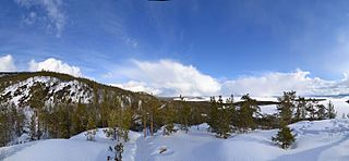
The Kandalaksha Coast is a coastal area in Murmansk Oblast in northwest Russia. It is located on the northern side of the White Sea, between Kandalaksha and mouth of Varzuga River. The major rivers flowing to the sea at the coast are the Umba and the Niva.

The Verman River is a river in Murmansk Oblast, Russia. For much of the Arctic Campaign of World War II stretches of it formed the front line, and much fighting occurred there.
Vilovataya is a river in the Murmansk region of Russia. It flows through Tersky District of Murmansk Oblast. It is a tributary of Vyala. The river is 11 km (6.8 mi) long.