Rayagada district is a district in southern Odisha, a state in India, which became a separate district in October 1992. Its population consists mainly of tribes, primarily the Khonds and the Soras. In addition to Odia, Kui and Sora are spoken by the district's indigenous population. It was founded by Maharajah Biswanatha Deba Gajapati of the Surjyabansha dynasty of Jeypore.
Bargarh is an emerging city and municipality in Bargarh district in the state of odisha in India. It is the administrative headquarters of Bargarh District. Bargarh is popularly known for intensive cultivation of 'paddy', therefore called "Bhata Handi" of Odisha.

Cuttack, is the former capital and the second largest city in the Indian state of Odisha. It is the headquarters of the Cuttack district. The name of the city is an anglicised form of the Odia and Sanskrit name Kataka which literally means The Fort, a reference to the ancient Barabati Fort around which the city initially developed. Cuttack is known as the Millennium City as well as the Silver City due to its history of 1000 years and famous silver filigree works. The Orissa High Court is located there. It is the commercial capital of Odisha which hosts many trading and business houses in and around the city. Cuttack is famous for its Durga Puja which is one of the most important festivals of Odisha. Cuttack is also the birthplace of Indian nationalist & freedom fighter Netaji Subhas Chandra Bose from Bengal. The city is categorised as a Tier-II city as per the ranking system used by Government of India.

Cuttack district is one of the 30 districts of Odisha state in India. It is located in the coastal part of the state and its administrative headquarters are located in the city of Cuttack. As of 2011 Census, after Ganjam, it is the second most populous district of Odisha, with a population of 2,624,470. The name is an anglicized form of Kataka or Katak meaning Fort – referring to the Barabati Fort. The district is bisected by the river Mahanadi and its numerous distributaries and occupies a large portion of the river's delta. It is bounded by the Angul, Dhenkanal, Nayagarh and Khurda districts to the west while its southern and eastern boundaries touch Puri, Jagatsinghpur, Kendrapara and Jajpur districts.

Nayagarh is both a town and the municipality headquarters of the Nayagarh district in the Indian state of Odisha.
Anandapur(ଆନନ୍ଦପୁର) is a town and a municipality of Kendujhar district in the state of Odisha, India.
Barpali is a small town and a block ( Tehsil) within the Bargarh district in the state of Odisha, India. Barpali is largely famous for renowned Odia Poet Swabhaba Kabi Gangadhar Meher who was born here. However, there are several other cultural notations which have made Barpali famous nationally and internationally, like: the indigenous sambalpuri saree weaving art and the earthen pottery handicrafts (Terracotta) etc, creations from the native inhabitants of Barpali. Among others, the name Barpali also draws attention towards the past studies, wide usage and then outward expansion of preliminary versions of sanitary toilets started by foreigners here, known as 'Barpali Toilets' nearly 40 years ago.
Kesinga is a town and a notified area committee in Kalahandi district in the Indian state of Odisha, near India's east coast. It is also called the gate to Kalahandi. Kesinga is rich in agriculture, small industries, and start-ups as well.
Pattamundai is a town and a municipality in Kendrapara district in the Indian state of Odisha, located on the centre of SH-9A from Cuttack to Chandbali along the south end of Brahmani River. It is also the headquarter of Pattamundai Block.

Phulbani is a municipality and administrative headquarters of Kandhamal district in the state of Odisha in India.
Pal Lahara is a small town in Angul district of the state of Odisha and located on NH6, where it intersects with NH23, 91 kilometres (57 mi) by road north of Angul. Not far from the banks of the Rengali Reservoir which is to the west, the Malayagiri Forest Range is to the southeast. Pallahara is one of the sub divisional headquarters in the Angul district.
Barapalli is a village situated 3 km from district Nayagarh in Odisha, India. The village has around 150 houses.
Patrapur is one of the block headquarters of Ganjam district situated south of Odisha bordering to Andhra Pradesh. It is located southwest of Berhampur and southeast of Chikiti. It is one of the biggest villages of Ganjam district, having more than 15,000 people.

Nuakhai is an agricultural festival mainly observed by people of Western Odisha in India. Nuakhai is observed to welcome the new rice of the season. According to the calendar it is observed on panchami tithi of the lunar fortnight of the month of Bhadrapada or Bhadraba (August–September), the day after the Ganesh Chaturthi festival. This is the most important social festival of Western Odisha and adjoining areas of Simdega in Jharkhand, where the culture of Western Odisha is much predominant.

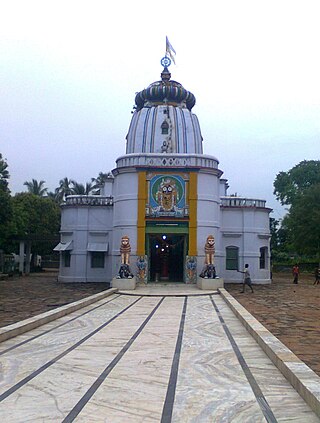
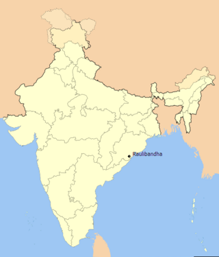
Raulibandha is a village in Malada Gram Panchayat, Ganjam district in the state of Odisha, India.
Panasa is a village in Jajpur Town of Jajpur district in the Indian state of Odisha. Panasa's nearby villages are Ankula, Balighai, Balipokhari, Beherapatana, Bindhan, Korkora, Kusi, Patapur, Kunjabiharipur and Raghunathpur.

Golia is a village located in the Ganjam District of the Indian state of Odisha. It is governed by a panchayat, which also governs several nearby villages, and is famous for the large number of turtles in Nelia Pond beside the temple of Shiva. Golia is 76 kilometres (47 mi) away from the city of Brahampur and 159 kilometres (99 mi) away from the state capital, Bhubaneswar.
Bhatli is a town in Bargarh district, Odisha.
Phalguna Mela is the most important festival associated with the temple of Khatushyam and Shyam Temple Bhatli. The festival occurs 8–9 days before the festival of Holi. Barbarika's head appeared on Phalguna Shuddha Ekadashi, the 11th day of the bright half of the Hindu month of Phalguna. The fair was initially held from the 9th to the 12th of that month, later extended to nearly 12–15 days of the bright half of the Phalguna Month.

Hirlipali is a village in Attabira Tehsil of Bargarh district of Odisha, India. The village is located on the banks of canal that flows reservoir water from Hirakud Dam. It is about 10 km from Attabira and about 20 km from Bargarh town. The total geographical area of Hirlipali Gram Panchayat is 25.19 square kilometers, and has a total population of 8,320 peoples. There are about 1,817 households in Hirlipali Gram Panchayat


