Kangerluarsunnguaq Bay

Last updated
Kangerluarsunnguaq Bay
Ulkebugten
Greenland edcp relief location map.jpg
Red pog.svg
Kangerluarsunnguaq Bay
Location in Greenland
Location Arctic
Coordinates 66°56′40″N53°39′00″W / 66.94444°N 53.65000°W / 66.94444; -53.65000 Coordinates: 66°56′40″N53°39′00″W / 66.94444°N 53.65000°W / 66.94444; -53.65000
Ocean/sea sources Davis Strait
Basin  countries Greenland

Kangerluarsunnguaq Bay ([kaŋeʁluɑʁsuŋːuɑq̚] Danish : Ulkebugten) is a bay of the Davis Strait in the Qeqqata municipality on the western coast of Greenland. It is located directly to the north of Sisimiut.

Danish language North Germanic language spoken in Denmark

Danish is a North Germanic language spoken by around six million people, principally in Denmark and in the region of Southern Schleswig in northern Germany, where it has minority language status. Also, minor Danish-speaking communities are found in Norway, Sweden, Spain, the United States, Canada, Brazil, and Argentina. Due to immigration and language shift in urban areas, around 15–20% of the population of Greenland speak Danish as their first language.

Davis Strait A northern arm of the Labrador Sea that lies between mid-western Greenland and Nunavut, Canadas Baffin Island

Davis Strait is a northern arm of the Labrador Sea. It lies between mid-western Greenland and Nunavut, Canada's Baffin Island. To the north is Baffin Bay. The strait was named for the English explorer John Davis (1550–1605), who explored the area while seeking a Northwest Passage. By the 1650s it was used for whale hunting.

Qeqqata Municipality in Greenland, Kingdom of Denmark

Qeqqata is a municipality in western Greenland, operational from 1 January 2009. The municipality was named after its location in the central-western part of the country. Its population is 9,620 as of January 2013. The administrative center of the municipality is in Sisimiut. It consists of the previously unincorporated area of Kangerlussuaq, as well as two former municipalities of western Greenland:

Contents

Geography

The eastern part of Kangerluarsunnguaq Bay seen from the town bridge. Nasaasaaq mountain is visible on the right in the background. Kangerluarsunnguaq-bay.jpg
The eastern part of Kangerluarsunnguaq Bay seen from the town bridge. Nasaasaaq mountain is visible on the right in the background.

The bay branches off Davis Strait to the east, just north of Sisimiut. It is navigable in its entirety, protected from the open sea by a series of skerries and channels in the west. In the past, at the time of the Saqqaq culture settlements in the area, the bay extended further inland, the shoreline was up to several dozen meters above the present line, covering portions of the Sisimiut valley, and gradually decreasing in time due to post-glacial rebound. [1]

Skerry A rocky island smaller than an islet

A skerry is a small rocky island, usually too small for human habitation. It may simply be a rocky reef. A skerry can also be called a low sea stack.

Saqqaq culture Paleo-Eskimo culture in Greenland existing from around 2500 BCE until about 800 BCE

The Saqqaq culture was a Paleo-Eskimo culture in southern Greenland. Up to this day, no other people seem to have lived in Greenland continually for as long as the Saqqaq.

Post-glacial rebound Rise of land masses that were depressed by the huge weight of ice sheets during the last glacial period

Post-glacial rebound is the rise of land masses after the lifting of the huge weight of ice sheets during the last glacial period, which had caused isostatic depression. Post-glacial rebound and isostatic depression are phases of glacial isostasy, the deformation of the Earth's crust in response to changes in ice mass distribution. The direct raising effects of post-glacial rebound are readily apparent in parts of Northern Eurasia, Northern America, Patagonia, and Antarctica. However, through the processes of ocean siphoning and continental levering, the effects of post-glacial rebound on sea level are felt globally far from the locations of current and former ice sheets.

To the north the bay is bounded by the Palasip Qaqqaa range. Sisimiut Airport is located at the far western end on the northern side, behind the several skerries and small islands of Qeqertarmiut and the Annertusoq skerry group protecting it from the storm waves of the open sea, and separating it from the mouth of Amerloq Fjord in the southwest. [2]

Palasip Qaqqaa

Palasip Qaqqaa is a 544-metre-high (1,785 ft) mountain in the Qeqqata municipality in western Greenland. It is located on the mainland of Greenland on the coast of Davis Strait, immediately to the north of Sisimiut Airport.

Sisimiut Airport airport in Qeqqata, Greenland

Sisimiut Airport is an airport located 2.2 NM northwest of Sisimiut, a town in the Qeqqata municipality in central-western Greenland. The airport has a single runway designated 13/31 which measures 799 by 30 m, built on the northern shore of Kangerluarsunnguaq Bay.

Amerloq Fjord

Amerloq Fjord is a 36 km (22 mi) long fjord in the Qeqqata municipality in western Greenland. The fjord empties into the Davis Strait just south of Sisimiut, whose former Inuit name was also "Amerloq".

Economy

The bay provides a sheltered waterway for the town of Sisimiut. Both the commercial port and the harbour are located on the southern shore of the bay, on the mainland. The bay is used for recreational yachting and boating. The Qeqqata municipality is planning the expansion of the residential area in Sisimiut in the 2010s, with the area north of the bay reserved for real estate. [3] Several camping sites are scattered in Sisimiut valley at the head of the bay.

Yachting using water vessels, called yachts, for sporting purposes

Yachting refers to the use of recreational boats and ships called yachts for sporting purposes. Yachts are distinguished from working ships mainly by their leisure purpose.

Kangerluarsunnguaq-bay-skerries.jpg
The runway at Sisimiut Airport is located behind the skerries at the mouth of Kangerluarsunnguaq Bay.

Related Research Articles

Maniitsoq Place in Greenland, Kingdom of Denmark

Maniitsoq, formerly Sukkertoppen, is a town in Maniitsoq Island, western Greenland located in the Qeqqata municipality. With 2,670 inhabitants as of 2013, it is the sixth-largest town in Greenland.

Itilleq Place in Greenland, Kingdom of Denmark

Itilleq is a settlement in the Qeqqata municipality in central-western Greenland. It is located on a small island around 1 km from the mainland, 45 km south of Sisimiut and 2 km north of the Arctic Circle on the shores of Davis Strait. It had 112 inhabitants in 2010.

Sarfannguit Place in Greenland, Kingdom of Denmark

Sarfannguit is a settlement in the Qeqqata municipality in central-western Greenland. Its population was 126 in 2010. The settlement was founded in 1843.

Sermersooq Municipality in Greenland, Kingdom of Denmark

Sermersooq is a municipality in Greenland, formed on 1 January 2009 from five earlier, smaller municipalities. Its administrative seat is the city of Nuuk, the capital of Greenland, and it is the most populous municipality in the country, with 21,868 inhabitants as of January 2013. The municipality consists of former municipalities of eastern and southwestern Greenland, each named after the largest settlement at the time of formation:

Kangerlussuaq Fjord Fjord Greenland, Qeqqata

Kangerlussuaq Fjord is a long fjord in the Qeqqata municipality in central-western Greenland. The fjord is 190 km (120 mi) long and between 1.5 km (0.93 mi) and 8 km (5.0 mi) wide, flowing from the estuary of Qinnguata Kuussua river to the southwest, and emptying into the Davis Strait. It is the longest fjord of western Greenland.

Simiutaq Island

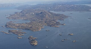
Simiutaq Island is a 13 km × 10 km uninhabited island in the Qeqqata municipality in western Greenland, located in the mouth of the long Kangerlussuaq Fjord. For the former U.S. radio station there, see Simiutak.

Nasaasaaq

Nasaasaaq is a 784-metre-high (2,572 ft) prominent mountain in the Qeqqata municipality in western Greenland. It is located on the mainland of Greenland, immediately to the southeast of Sisimiut on the northern coast of Amerloq Fjord, a tributary of Davis Strait.

Kangerluarsuk Tulleq

Kangerluarsuk Tulleq is a 28 km (17 mi) long fjord in the Qeqqata municipality in western Greenland. The fjord is of roughly east–west orientation, emptying into Davis Strait in the west.

Alanngorsuaq

Alanngorsuaq is a 411-metre-high (1,348 ft) mountain in the Qeqqata municipality in western Greenland. It is located on the mainland of Greenland in Sisimiut valley, approximately 3 km (1.9 mi) east of the town.

Kangerlussuatsiaq Fjord

Kangerlussuatsiaq Fjord is a fjord in the Qeqqata municipality in western Greenland. Taking its source in the tidewater glaciers draining the Maniitsoq ice cap, the fjord flows in a deep canyon through a mountainous, uninhabited region, emptying into Davis Strait near the settlement of Kangaamiut.

Tarajornitsut mountain in Qeqqata Greenland

Tarajornitsut is an uninhabited tundra highland in the Qeqqata municipality in central-western Greenland, within the bounds of Kangaamiut dike swarm. The highland has many lakes, shallow valleys, hills, and wetlands, with plentiful wildlife, such as arctic geese. It is also a major calving ground for reindeer. In the future the area will become a protected nature reserve. The Polar Route from Sisimiut to Kangerlussuaq ends in Tarajornitsut, on the shore of Kangerlussuaq Fjord.

Isortoq Fjord

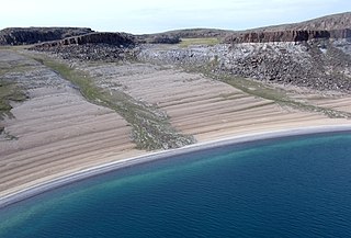
Isortoq Fjord is a fjord in the Qeqqata municipality in western Greenland. The fjord to the east of Maniitsoq, emptying into Davis Strait. Majorqaq, one of the widest rivers in western Greenland draining the Greenland ice sheet, empties into the fjord head.

Ikertooq Fjord

Ikertooq Fjord is a 55 km (34 mi) long fjord in the Qeqqata municipality in western Greenland. The fjord empties into Davis Strait 21 km (13 mi) south of Sisimiut.

Sarfannguit Island

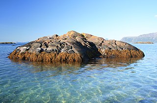
Sarfannguit Island is an island in the Qeqqata municipality in western Greenland.

Nipisat Island island in Greenland

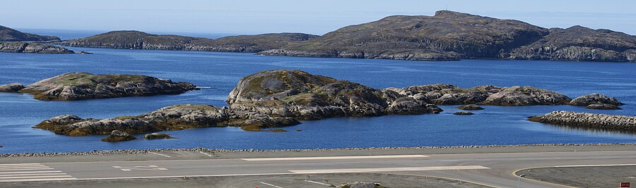
Nipisat Island is a small, uninhabited island in the Qeqqata municipality in central-western Greenland.

References

  1. Sisimiut Museum exhibition
  2. Vandrekort Vestgrønland: Sisimiut (Map) (1996 ed.). Cartography by Compukort, Denmark. Greenland Tourism a/s.
  3. "Commercial and Industrial Development". Sisimiut Town, Official Website. Retrieved 3 July 2010.