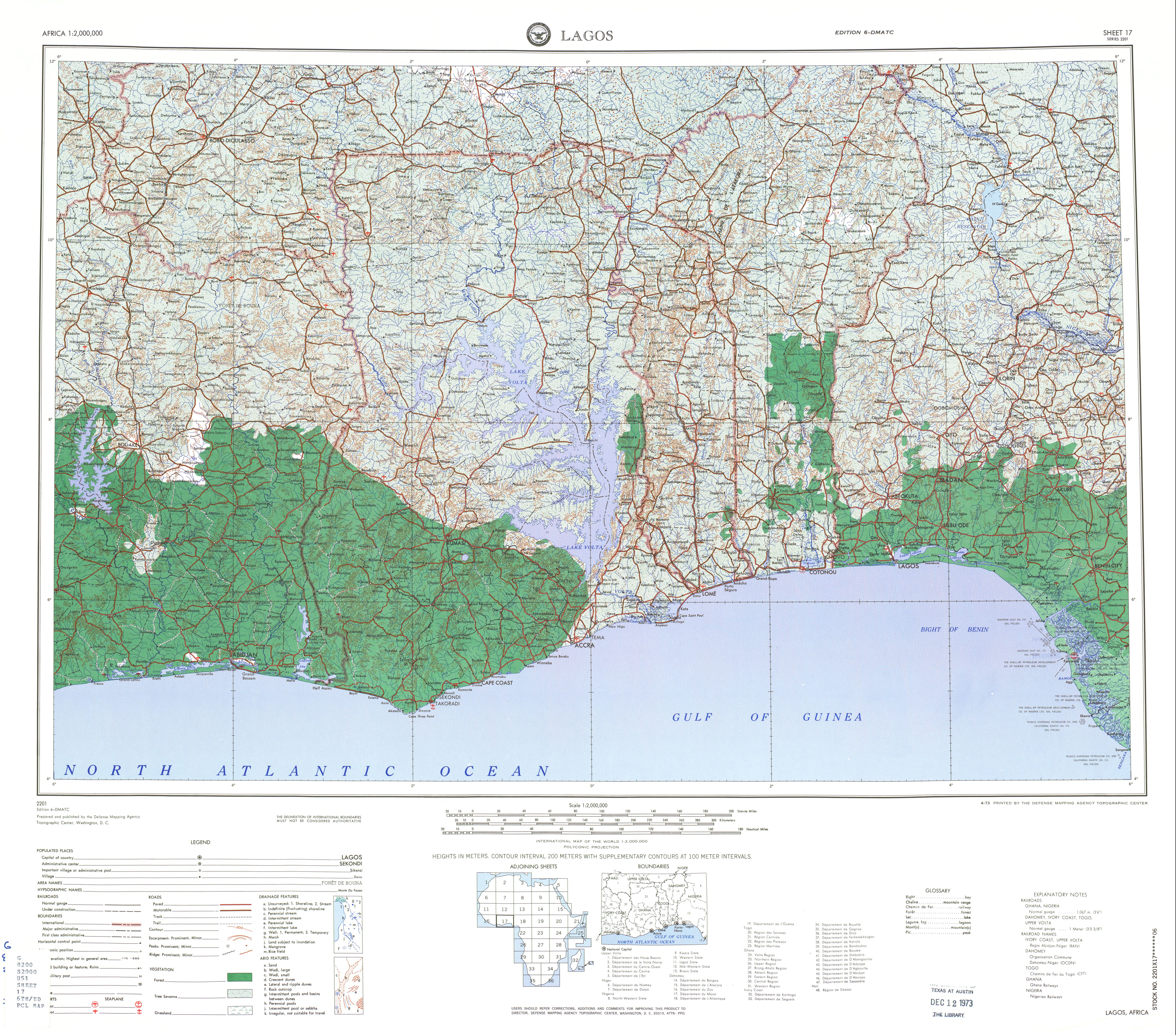
Benin, officially the Republic of Benin, and also known as Dahomey, is a country in West Africa. It is bordered by Togo to the west, Nigeria to the east, Burkina Faso to the north-west, and Niger to the north-east. The majority of its population lives on the southern coastline of the Bight of Benin, part of the Gulf of Guinea in the northernmost tropical portion of the Atlantic Ocean. The capital is Porto-Novo, and the seat of government is in Cotonou, the most populous city and economic capital. Benin covers an area of 114,763 km2 (44,310 sq mi), and its population in 2021 was estimated to be approximately 13 million. It is a small, tropical country. It is one of the least developed, with an economy heavily dependent on agriculture, and is an exporter of palm oil and cotton. Some employment and income arise from subsistence agriculture.

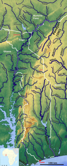
Togo is a small Sub-Saharan state, comprising a long strip of land in West Africa. Togo's geographic coordinates are a latitude of 8° north and a longitude of 1°10′ east. It is bordered by three countries: Benin to the east, with 644 km (400 mi) of border; Burkina Faso to the north, with 126 km (78 mi) of border; and Ghana, with 877 km (545 mi) of border. To the south Togo has 56 km (35 mi) of coastline along the Bight of Benin of the Gulf of Guinea in the North Atlantic Ocean. Togo stretches 579 km (360 mi) north from the Gulf and is only 160 km (99 mi) wide at the broadest point. In total, Togo has an area of 56,785 km2 (21,925 sq mi), of which 54,385 km2 (20,998 sq mi) is land and 2,400 km2 (927 sq mi) is water.

The Volta River is the main river system in the West African country of Ghana. It flows south into Ghana from the Bobo-Dioulasso highlands of Burkina Faso. The main parts of the river are the Black Volta, the White Volta, and the Red Volta. In the northwest, the Black Volta forms the international borders between the Ivory Coast, Ghana, and Burkina Faso. The Volta flows southward along the Akwapim-Togoland highlands, and empties into the Atlantic Ocean at the Gulf of Guinea at Ada Foah. One of its smaller tributaries, the Oti River, enters Ghana from Togo in the east. The Volta River has been dammed at Akosombo for generating hydroelectricity. The reservoir named Lake Volta stretches from Akosombo Dam in the south to the northern part of the country, and is the largest man-made reservoir by area in the world.

Benin, a narrow, key-shaped, north–south strip of land in West Africa, lies between the Equator and the Tropic of Cancer. Its latitude ranges from 6°30′ N to 12°30′ N and its longitude from 1° E to 3°40′ E. It is bounded by Togo to the west, Burkina Faso and Niger to the north, Nigeria to the east, and the Bight of Benin to the south.

The Oti River or Pendjari River is an international river in West Africa. It rises in Benin, forms the border between Benin and Burkina Faso, flows through Togo, and joins the Volta River in Ghana.

The Mono River is the major river of eastern Togo.

Savanes Region is the northernmost of the five Regions of Togo. Dapaong is the regional capital. Another major town in the region is Mango.

Centrale Region is one of Togo's five regions. Sokodé is the regional capital. Centrale is the least populated region in Togo with a total of 795,529 people according to a census done in 2022.
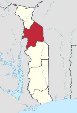
Kara Region is one of Togo's five regions. Kara is the regional capital.
Mango, formerly Sansanné-Mango , is a city in northern Togo. It is situated on the Oti River in the Savanes Region. The town is located near Kéran National Park and 26 kilometres (16 mi) from the border with Ghana. The population is about 41,464 people (2007).
Oti-Kéran National Park is located in the north of Togo, in the Kara area. There is only one road going through this area. Not many tourists visit Togo as the main national parks are more accessible in Ghana.

The Upper Guinean forests is a tropical seasonal forest region of West Africa. The Upper Guinean forests extend from Guinea and Sierra Leone in the west through Liberia, Côte d'Ivoire and Ghana to Togo in the east, and a few hundred kilometers inland from the Atlantic coast. A few enclaves of montane forest lie further inland in the mountains of central Guinea and central Togo and Benin.
Kabiye is an Eastern Gurunsi Gur language spoken primarily in northern Togo. Throughout the 20th century, there was extensive migration to the centre and south of Togo and also to Ghana and Benin. Kabiye speakers made up over 23% of the Togolese population in 1999.

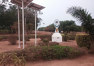
Kara is a city in northern Togo, situated in Kara Region, 413 km north of the capital Lomé. Kara is the capital of the Kara region and, according to the 2010 census, had a population of 94,878. The Kara River flows through the city and is its main resource of water. The city developed from the 1970s onwards from the village originally known as Lama-Kara. Its growth was largely due to the influence of the previous Togolese head of state Gnassingbé Eyadéma; he was born in the nearby village of Pya and understood Kara's strategic position at a crossroads of two trade routes.
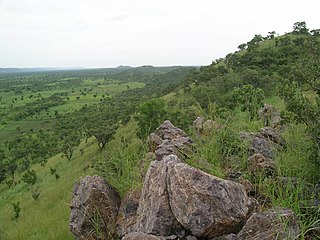
The Togo Mountains is a mountain range which stretches across the central region of the West African country of Togo and across the eastern and western borders of that country into Ghana and Benin. In Ghana, the range is also known as the Akwapim Hills, and in Benin it is also known as the Atakora Mountains. Part of the range is associated with the country of Niger, where the W National Park is found. The African wild dog, Lycaon pictus, was historically found in this region but may now be extirpated from this locale.
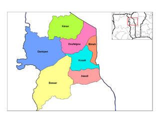
Dankpen is a prefecture located in the Kara Region of Togo. The prefecture covers 2 690 km2, with a population in 2022 of 185,662. The prefecture seat is located in Guérin-Kouka. It is split into 12 cantons, Guérin-Kouka, Bapuré, Nandouta, Kidjaboum, Namon, Nawaré, Katchamba, Nampoch, Natchiboré, Natchitikpi, Koulfièkou, and Koutchichéou.

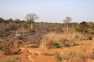
The wildlife of Togo is composed of the flora and fauna of Togo, a country in West Africa. Despite its small size the country has a diversity of habitats; there are only remnants of the once more extensive rain forests in the south, there is Sudanian savanna in the north-western part of the country and larger areas of Guinean forest–savanna mosaic in the centre and north-east. The climate is tropical with distinct wet and dry seasons. There are estimated to be over 3000 species of vascular plants in the country, and 196 species of mammals and 676 species of birds have been recorded there.
Mont Sokbaro is a hill that is mostly cited as the highest point of Benin, with an elevation of 658 metres (2,159 ft). This designation is contested, as SRTM readings at coordinates 10°17′22″N1°32′38″E give an elevation of 672 metres (2,205 ft). This is a location 2.5 kilometres (1.6 mi) southeast of Kotoponga.
The University of Lomé is the largest university in Togo. Located in the city of Lomé, it was founded in 1970 as University of Benin and changed its name to the University of Lomé in 2001.

The Oti Valley Faunal Reserve is a protected area in northeastern Togo, one of four Important Bird Areas (IBA) in the country. The site is mainly savanna and seasonally inundated floodplains on either side of the Oti River. It has a total area of 147,840 hectares and is located at 10°35'N and 0°40'E.