
Kandy is a major city in Sri Lanka located in the Central Province. It was the last capital of the ancient kings' era of Sri Lanka. The city lies in the midst of hills in the Kandy plateau, which crosses an area of tropical plantations, mainly tea. Kandy is both an administrative and religious city and is also the capital of the Central Province. Kandy is the home of the Temple of the Tooth Relic, one of the most sacred places of worship in the Buddhist world. It was declared a world heritage site by UNESCO in 1988. Historically the local Buddhist rulers resisted Portuguese, Dutch, and British colonial expansion and occupation.

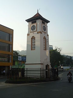
Hatton is a major town in the Nuwara Eliya District of Central Province, Sri Lanka governed by the Hatton-Dickoya Urban Council. Hatton is a major centre of the Sri Lankan tea industry.

Kegalle is a large town in Sabaragamuwa Province of Sri Lanka. It is located on the Colombo–Kandy road, approximately 78 km (48 mi) from Colombo and 40 km (25 mi) from Kandy. It is the main town in the Kegalle District, which is one of two districts which comprise Sabaragamuwa Province. The town is governed by an Urban Council.

Kurunegala is a major city in Sri Lanka. It is the capital city of the North Western Province and the Kurunegala District. Kurunegala was an ancient royal capital for 50 years, from the end of the 13th century to the start of the 14th century. It is at the junction of several main roads linking to other important parts of the country. It is about 94 kilometres (58 mi) from Colombo, 42 kilometres (26 mi) from Kandy and 51 kilometres (32 mi) from Matale.
Badulla is the capital and the largest city of Uva Province situated in the lower central hills of Sri Lanka. It is the capital city of Uva Province and the Badulla District.

Nawalapitiya is a town in Kandy District, Sri Lanka. It is governed by an Urban Council. It is 38 km (24 mi) away from Kandy and 112 km (70 mi) from Colombo, at a height of 589 m (1,932 ft) above sea level. It is located on the banks of the Mahaweli Ganga. The area was developed during the colonisation of the island by the British, as one of the colony's centres of Coffee Production.
Polgahawela is a town located in north western Sri Lanka. It is most notable for being a major railway junction.
Mirigama is a town in Gampaha District, Sri Lanka. It is located 57 km (35 mi) from Colombo, and 34 km (21 mi) from Negombo.

The Central Province is one of the nine provinces of Sri Lanka, the first level administrative division of the country. The Central Province is primarily in the central mountainous terrain of Sri Lanka. It is the 6th largest province by area and is home to 2.5 million people. It is bordered by North Central Province to the north, Uva Province to the east, North Western Province to the west and Sabaragamuwa Province to the south and west. The province's capital is Kandy.
Aladeniya is a village in Sri Lanka. It is located within Central Province. It is located approximately 12 km (7.5 mi) north-west of Kandy.
Balagolla is a small village in Sri Lanka about 10 km (6.2 mi) away from Kandy town. Balagolla belongs to Kandy administrative district in Central Province.
Dimbula is a village located in the Central Province, Sri Lanka. It is approximately 130 km (81 mi) east of Colombo, 60 km (37 mi) south of Kandy and 35 km (22 mi) west of Nuwara Eliya.
Hedeniya is a village in Sri Lanka. It is located within Central Province. Kurunegala Kandy main road is across hedeniya village. It is approximately 13 km (8.1 mi) from Kandy and 29 km (18 mi) from Kurunegala. In middle of the hedeniya town is faces to the hedeniya pujapitiya sub way which linked to Ankumbura, gallellagama, doranegama villages and ranawana to kandy road. Pallekotuwa road started from hedeniya town.
Kahatagaha is a village in the Kurunegala District, North Western Province, Sri Lanka. The village is located 14.5 km (9.0 mi) north-west of Matale and 32.5 km (20.2 mi) north north-west of Kandy.

Katugastota is a suburb of the city of Kandy in Kandy District, Central Province of Sri Lanka. It is located along the Kandy-Jaffna A9 highway approximately 4 km (2.5 mi) from the city center of Kandy. Katugastota is one of the three main entry points to the city of kandy. Two major Highways meet at the center of the city which makes Katugastota one of the busiest suburbs in Kandy district.
Kiribatkumbura is a suburb of the city of Kandy, Sri Lanka. It is in Central Province, on the A1 highway, 8 km (5.0 mi) from Kandy and 102 km (63 mi) from Colombo.

Rangala is a small village located in Kandy District, Central Province, Sri Lanka. It is situated approximately 35 km (22 mi) northwest of Kandy in the Knuckles Conservation forest, near Kotta Ganga.
Kaduwela is a suburb of Colombo in the Colombo District, Western Province, Sri Lanka. It is located about 16 km (9.9 mi) from Colombo city centre on the Colombo - Avissawella Old Road and about 18 km (11 mi) from Kollupitiya on the New Kandy Road from Ethulkotte to Kandy.
Hanguranketha is a town in the Nuwara Eliya District, Central Province of Sri Lanka.
Udadumbara is a small town in Sri Lanka, located within Kandy District, Central Province.
This page is based on this
Wikipedia article Text is available under the
CC BY-SA 4.0 license; additional terms may apply.
Images, videos and audio are available under their respective licenses.
