
Balczewo is a village in the administrative district of Gmina Inowrocław, within Inowrocław County, Kuyavian-Pomeranian Voivodeship, in north-central Poland. It lies approximately 8 kilometres (5 mi) east of Inowrocław and 33 km (21 mi) south-west of Toruń.
Borkowo is a village in the administrative district of Gmina Inowrocław, within Inowrocław County, Kuyavian-Pomeranian Voivodeship, in north-central Poland. It lies approximately 7 kilometres (4 mi) north-west of Inowrocław, 34 km (21 mi) south of Bydgoszcz, and 37 km (23 mi) south-west of Toruń.
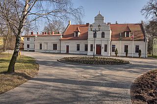
Cieślin is a village in the administrative district of Gmina Inowrocław, within Inowrocław County, Kuyavian-Pomeranian Voivodeship, in north-central Poland.
Gnojno is a village in the administrative district of Gmina Inowrocław, within Inowrocław County, Kuyavian-Pomeranian Voivodeship, in north-central Poland.
Jacewo is a village in the administrative district of Gmina Inowrocław, within Inowrocław County, Kuyavian-Pomeranian Voivodeship, in north-central Poland. It lies approximately 2 kilometres (1 mi) north-east of Inowrocław, 35 km (22 mi) south-west of Toruń, and 40 km (25 mi) south-east of Bydgoszcz.
Jaksice is a village in the administrative district of Gmina Inowrocław, within Inowrocław County, Kuyavian-Pomeranian Voivodeship, in north-central Poland. It lies approximately 10 kilometres (6 mi) north-west of Inowrocław, 31 km (19 mi) south-east of Bydgoszcz, and 34 km (21 mi) south-west of Toruń.

Łojewo is a village in the administrative district of Gmina Inowrocław, within Inowrocław County, Kuyavian-Pomeranian Voivodeship, in north-central Poland. It lies approximately 8 kilometres (5 mi) south-east of Inowrocław, 39 km (24 mi) south-west of Toruń, and 48 km (30 mi) south-east of Bydgoszcz.
Słońsko is a village in the administrative district of Gmina Inowrocław, within Inowrocław County, Kuyavian-Pomeranian Voivodeship, in north-central Poland. It lies approximately 7 kilometres (4 mi) north-east of Inowrocław, 30 km (19 mi) south-west of Toruń, and 41 km (25 mi) south-east of Bydgoszcz.
Stefanowo is a village in the administrative district of Gmina Inowrocław, within Inowrocław County, Kuyavian-Pomeranian Voivodeship, in north-central Poland. It lies approximately 10 kilometres (6 mi) north-west of Inowrocław, 31 km (19 mi) south-east of Bydgoszcz, and 35 km (22 mi) south-west of Toruń.
Tupadły is a village in the administrative district of Gmina Inowrocław, within Inowrocław County, Kuyavian-Pomeranian Voivodeship, in north-central Poland.
Góry is a village in the administrative district of Gmina Janikowo, within Inowrocław County, Kuyavian-Pomeranian Voivodeship, in north-central Poland. It lies approximately 6 kilometres (4 mi) south of Janikowo, 14 km (9 mi) south-west of Inowrocław, 48 km (30 mi) south of Bydgoszcz, and 50 km (31 mi) south-west of Toruń.
Kołuda Wielka is a village in the administrative district of Gmina Janikowo, within Inowrocław County, Kuyavian-Pomeranian Voivodeship, in north-central Poland. It lies approximately 4 kilometres (2 mi) south-east of Janikowo, 10 km (6 mi) south-west of Inowrocław, 44 km (27 mi) south of Bydgoszcz, and 46 km (29 mi) south-west of Toruń.
Karczyn is a village in the administrative district of Gmina Kruszwica, within Inowrocław County, Kuyavian-Pomeranian Voivodeship, in north-central Poland. It lies approximately 8 kilometres (5 mi) north-east of Kruszwica, 11 km (7 mi) south-east of Inowrocław, and 37 km (23 mi) south-west of Toruń.
Gniewkówiec is a village in the administrative district of Gmina Złotniki Kujawskie, within Inowrocław County, Kuyavian-Pomeranian Voivodeship, in north-central Poland.
Działy is a village in the administrative district of Gmina Glinojeck, within Ciechanów County, Masovian Voivodeship, in east-central Poland.
Zalas is a village in the administrative district of Gmina Długosiodło, within Wyszków County, Masovian Voivodeship, in east-central Poland. It lies approximately 5 kilometres (3 mi) south-east of Długosiodło, 20 km (12 mi) north-east of Wyszków, and 72 km (45 mi) north-east of Warsaw.
Jaworowo is a village in the administrative district of Gmina Witkowo, within Gniezno County, Greater Poland Voivodeship, in west-central Poland.
Małachowo-Złych Miejsc is a village in the administrative district of Gmina Witkowo, within Gniezno County, Greater Poland Voivodeship, in west-central Poland.
Giewartów-Holendry is a village in the administrative district of Gmina Ostrowite, within Słupca County, Greater Poland Voivodeship, in west-central Poland.
Tomaszewo is a village in the administrative district of Gmina Ostrowite, within Słupca County, Greater Poland Voivodeship, in west-central Poland.


