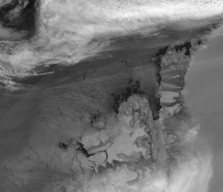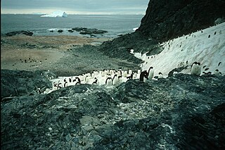
Joinville Island is the largest island of the Joinville Island group, about 40 nmi long in an east-west direction and 12 nmi wide, lying off the northeastern tip of the Antarctic Peninsula, from which it is separated by the Antarctic Sound. Joinville Island was discovered and charted roughly during 1838 by a French expedition commanded by Captain Jules Dumont d'Urville, who named it for Prince François, Prince of Joinville (1818–1900), the third son of Louis-Philippe, Duke of Orléans. It is within the Argentine, British and Chilean Antarctic claims.

Liège Island is an island, 17 kilometres (9 nmi) long and 5.6 kilometres (3 nmi) wide, lying immediately northeast of Brabant Island in the Palmer Archipelago, and separated from Hoseason Island and Christiania Islands to the northeast by Croker Passage. Its interior is occupied by Brugmann Mountains.

Bear Island or Isla Teniente González is a rocky island lying 1.9 kilometres (1 nmi) west of Stonington Island in Marguerite Bay, off the coast of Graham Land. Bear Island was presumably known to the British Graham Land Expedition (BGLE) (1934-1937) and the United States Antarctic Service (USAS) Expedition (1939-1941), both based in the Stonington Island area. Bear Island was surveyed in 1947 by the Falkland Islands Dependencies Survey (FIDS), who named it for the USS Bear, flagship of the United States Antarctic Service (USAS) Expedition which visited this area in 1940.

Charcot Island or Charcot Land is an island administered under the Antarctic Treaty System, 56 kilometres (30 nmi) long and 46 kilometres (25 nmi) wide, which is ice covered except for prominent mountains overlooking the north coast. Charcot Island lies within the Bellingshausen Sea, 102 kilometres (55 nmi) west of Alexander Island, and about 57 kilometres (31 nmi) north of Latady Island. A notable landmark of the island is its northernmost point, Cape Byrd.

Danco Island or Isla Dedo is an island off Antarctica, 2 kilometres (1 nmi) long lying in the southern part of Errera Channel, off the west coast of Graham Land. It was charted by the Belgian Antarctic Expedition under Adrien de Gerlache, 1897–1899. Danco Island was surveyed by the Falkland Islands Dependencies Survey from Norsel in 1955, and named by the UK Antarctic Place-names Committee for Emile Danco (1869–1898), a Belgian geophysicist and member of the Belgian Antarctic Expedition, who died on board Belgica in the Antarctic.

Masson Island or Mission Island is an ice-covered island about 31 kilometres (17 nmi) long and rising to 465 metres (1,526 ft), lying 17 kilometres (9 nmi) northwest of Henderson Island within the Shackleton Ice Shelf. Masson Island is located in the western part of Mawson Sea at 66°08′S96°35′E and has an elevation of 465 metres (1,526 ft). Masson Island was discovered in February 1912 by the Australian Antarctic Expedition under Sir Douglas Mawson, who named it for Professor Sir David Orme Masson of Melbourne, a member of the Australian Antarctic Expedition Advisory Committee.

Henderson Island is an ice-covered island 17 kilometres (9 nmi) long and rising to 240 m (787 ft), lying 17 kilometres (9 nmi) southeast of Masson Island within the Shackleton Ice Shelf. Henderson Island was discovered in August 1912 by the Western Base Party of the Australian Antarctic Expedition under Sir Douglas Mawson and named by him for Prof. G. C. Henderson of Adelaide, a member of the Australian Antarctic Expedition Advisory Committee.

The Windmill Islands are an Antarctic group of rocky islands and rocks about 11.1 kilometres (6 nmi) wide, paralleling the coast of Wilkes Land for 31.5 kilometres (17 nmi) immediately north of Vanderford Glacier along the east side of Vincennes Bay. Kirkby Shoal is a small shoal area with depths of less than 18 metres (59 ft) extending about 140 metres (459 ft) westwards and SSW, about 3.4 kilometres (2.1 mi) from the summit of Shirley Island, Windmill Islands, and 0.24 kilometres (0.15 mi) NW of Stonehocker Point, Clark Peninsula.

Liard Island is a mountainous island, 24 kilometres (13 nmi) long, 11 kilometres (6 nmi) wide and rising to 1,000 metres (3,300 ft), situated in the north-central portion of Hanusse Bay, off the west coast of Graham Land, Antarctica. It was discovered and named by the French Antarctic Expedition, 1908–10, under Jean-Baptiste Charcot.

Gouverneur Island is a low rocky island 2.2 kilometres (1.2 nmi) west-southwest of Petrel Island and 4.4 kilometres (2.4 nmi) east of Cape Géodésie in the southern part of the Géologie Archipelago, Antarctica. It was photographed from the air by Operation Highjump, 1946–47, and was charted and named by the French Antarctic Expedition under André F. Liotard, 1949–51. Liotard was the first man to encamp on the island and, as leader of the Expedition, also held the honorary post of governor.

Pascal Island in the Antarctic is a small rocky island 0.37 kilometres (0.2 nmi) east-southeast of Descartes Island and 1.9 kilometres (1 nmi) northeast of Cape Mousse. Charted in 1951 by the French Antarctic Expedition and named by them for Blaise Pascal (1623–1662), French physician and philosopher.

Kitney Island is a small island 2 kilometres (1 nmi) east-northeast of the Smith Rocks, 2 kilometres (1 nmi) southwest of the Wiltshire Rocks, and 5 kilometres (2.5 nmi) northwest of the Paterson Islands, off the coast of Mac. Robertson Land, Antarctica. The Lars Christensen Expedition (1936) first mapped this island which, though left unnamed, was included in a small group named by them "Spjotoyskjera". It was remapped by the Australian National Antarctic Research Expedition (ANARE) in 1956, and was named by the Antarctic Names Committee of Australia for V.J. Kitney, a supervising technician (radio) at Mawson Station in 1968.

Marguerite Island is a rocky island 1.3 kilometres (0.7 nmi) northwest of Empereur Island and 3.2 kilometres (1.75 nmi) north-northwest of Cape Margerie, Antarctica. It was charted in 1951 by the French Antarctic Expedition and named by them for Marguerite, a character in Goethe's Faust.

Somerville Island is a small island 7.4 kilometres (4 nmi) southwest of Berthelot Islands and 4.6 kilometres (2.5 nmi) northwest of Darboux Island, in the Wilhelm Archipelago, off the west coast of the Antarctic Peninsula in Antarctica. Discovered by the French Antarctic Expedition, 1908–1910, under Charcot, and named by him for Crichton Somerville, a resident of Oslo, Norway, who selected and supervised the making of much of the polar clothing and equipment used by the expedition.

Lagotellerie Island is an island 1.9 kilometres (1 nmi) long, lying 3.7 kilometres (2 nmi) west of Horseshoe Island in Marguerite Bay, off the west coast of Graham Land, Antarctica. It was discovered and named by the French Antarctic Expedition, 1908–10, under Jean-Baptiste Charcot.

Lagrange Island is a small rocky island 0.7 kilometres (0.4 nmi) northeast of Newton Island and 3 kilometres (1.5 nmi) north of Cape Mousse, Adélie Coast, Antarctica. It was charted in 1951 by the French Antarctic Expedition and named after Joseph-Louis Lagrange, the French mathematician.

Larrouy Island is an island 9 kilometres (5 nmi) long and 4 kilometres (2 nmi) wide which rises to 745 metres (2,440 ft), lying in Grandidier Channel off the northwest coast of Velingrad Peninsula 7 kilometres (4 nmi) north of Ferin Head, Antarctica. It was discovered by the French Antarctic Expedition, 1903–05, under Jean-Baptiste Charcot, who named it for Paul Augustin Jean Larrouy, at that time a French Minister Plenipotentiary.

Bluff Island is an island lying 1 kilometre (0.5 nmi) south of Magnetic Island and 4 kilometres (2 nmi) west of the Breidnes Peninsula, Vestfold Hills, in Prydz Bay, Antarctica. It was mapped from aerial photos taken by the Lars Christensen Expedition, 1936–37, re-emapped by the Australian National Antarctic Research Expeditions (1957–58) and so named because the south end of the island is marked by a steep cliff face.

Jagged Island is an island 4 kilometres (2 nmi) long, lying 2 kilometres (1 nmi) east of Dodman Island and 15 kilometres (8 nmi) west of Ferin Head, off the west coast of Graham Land, Antarctica. It was probably first sighted in January 1909 by the French Antarctic Expedition under Jean-Baptiste Charcot, and was charted and named by the British Graham Land Expedition, 1934–37, under John Rymill.

Newton Island is a rocky island 0.9 kilometres (0.5 nmi) northwest of Laplace Island and 2 kilometres (1.2 nmi) north-northwest of Cape Mousse, Adélie Coast, Antarctica. It was charted in 1951 by the French Antarctic Expedition and named after Sir Isaac Newton, English philosopher and mathematician.


