
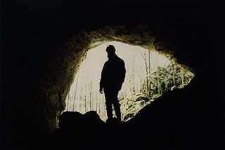
A cave or cavern is a natural void under the Earth's surface. Caves often form by the weathering of rock and often extend deep underground. Exogene caves are smaller openings that extend a relatively short distance underground. Caves which extend further underground than the opening is wide are called endogene caves.

Karst is a topography formed from the dissolution of soluble carbonate rocks such as limestone and dolomite. It is characterized by features like poljes above and drainage systems with sinkholes and caves underground. There is some evidence that karst may occur in more weathering-resistant rocks such as quartzite given the right conditions.
Speleology is the scientific study of caves and other karst features, as well as their composition, structure, physical properties, history, ecology, and the processes by which they form (speleogenesis) and change over time (speleomorphology). The term speleology is also sometimes applied to the recreational activity of exploring caves, but this is more properly known as caving, potholing, or spelunking. Speleology and caving are often connected, as the physical skills required for in situ study are the same.

A sinkhole is a depression or hole in the ground caused by some form of collapse of the surface layer. The term is sometimes used to refer to doline, enclosed depressions that are also known as shakeholes, and to openings where surface water enters into underground passages known as ponor, swallow hole or swallet. A cenote is a type of sinkhole that exposes groundwater underneath. Sink and stream sink are more general terms for sites that drain surface water, possibly by infiltration into sediment or crumbled rock.

A subterranean river is a river or watercourse that runs wholly or partly beneath the ground, one where the riverbed does not represent the surface of the Earth. It is distinct from an aquifer, which may flow like a river but is contained within a permeable layer of rock or other unconsolidated materials. A river flowing below ground level in an open gorge is not classed as subterranean.
Phreatic is a term used in hydrology to refer to aquifers, in speleology to refer to cave passages, and in volcanology to refer to a type of volcanic eruption.

Troglofauna are small cave-dwelling animals that have adapted to their dark surroundings. Troglofauna and stygofauna are the two types of subterranean fauna. Both are associated with subterranean environments – troglofauna are associated with caves and spaces above the water table and stygofauna with water. Troglofaunal species include spiders, insects, myriapods and others. Some troglofauna live permanently underground and cannot survive outside the cave environment. Troglofauna adaptations and characteristics include a heightened sense of hearing, touch and smell. Loss of under-used senses is apparent in the lack of pigmentation as well as eyesight in most troglofauna. Troglofauna insects may exhibit a lack of wings and longer appendages.
A losing stream, disappearing stream, influent stream or sinking river is a stream or river that loses water as it flows downstream. The water infiltrates into the ground recharging the local groundwater, because the water table is below the bottom of the stream channel. This is the opposite of a more common gaining stream which increases in water volume farther downstream as it gains water from the local aquifer.
Spook Cave is a flooded cave located about seven miles (11 km) west of McGregor in rural Clayton County, Iowa. It is privately owned and operated as a tourist attraction offering escorted boat rides into the cave. The cave was first discovered in 1953 and opened for business in 1955.

The Eramosa Karst is a provincially significant Earth Science Area of Natural and Scientific Interest in Ontario, Canada, located in Stoney Creek, a constituent community of the City of Hamilton, and immediately south of the Niagara Escarpment.

The Lost River is a river that rises in Vernon Township, Washington County, Indiana, and discharges into the East Fork of the White River in Lost River Township, Martin County, Indiana. The river's unusual hydrology has led to two of its features being named as National Natural Landmarks.

McConnell Springs is a twenty-six acre natural park located at the historic springs where the city of Lexington, Kentucky was named. The park is a non-profit organization in partnership with the Lexington-Fayette Urban County Government Division of Parks and Recreation. The mission statement of this organization is to restore and preserve McConnell Springs as a national historic site, an educational resource for culture and environment, and a passive recreational park.
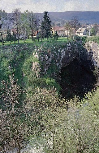
A ponor is a natural opening where surface water enters into underground passages; they may be found in karst landscapes where the geology and the geomorphology is typically dominated by porous limestone rock. Ponors can drain stream or lake water continuously or can at times work as springs, similar to estavelles. Morphologically, ponors come in forms of large pits and caves, large fissures and caverns, networks of smaller cracks, and sedimentary, alluvial drains.
An underground lake is a lake underneath the surface of the Earth. Most naturally occurring underground lakes are found in areas of karst topography, where limestone or other soluble rock has been weathered away, leaving a cave where water can flow and accumulate.
The Nambung River is a river in the Wheatbelt region of Western Australia, 170 kilometres (106 mi) north of Perth. The river drains an area between the towns of Cervantes and Badgingarra. In its lower reaches the Nambung River forms a chain of waterholes in the Nambung Wetlands where it disappears underground into a limestone karst system 5.5 kilometres (3 mi) from the Indian Ocean.

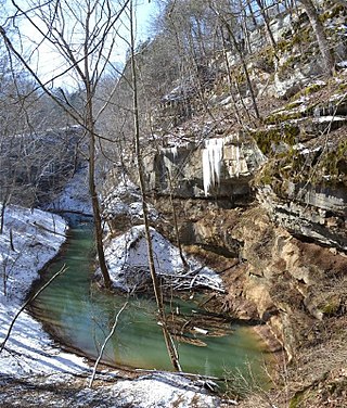
A solutional cave, solution cave, or karst cave is a cave usually formed in the soluble rock limestone. It is the most frequently occurring type of cave. It can also form in other rocks, including chalk, dolomite, marble, salt beds, and gypsum.
There are a number of terms that are used in connection with caves, caving and speleology. The following is an incomplete list.
Cedar Sink is a vertical-walled large depression or sinkhole in the ground, located in Edmonson County, Kentucky and contained within and managed by Mammoth Cave National Park. The sinkhole measures 300 feet (91.4 m) from the top sandstone plateau to the bottom of the sink and was caused by collapse of the surface soil. The landscape is karst topography, which means the region is influenced by the dissolution of soluble rocks. Sinkholes, caves, and dolines typically characterize these underground drainage systems. Cedar Sink has a bottom area of about 7 acres (2.8 ha) and has more fertile soil compared to the ridgetops.
Hongchiba National Forest Park is one of the 26 national parks in Chongqing, China.
