Kati Ward Kata ya Kati (Swahili) | |
|---|---|
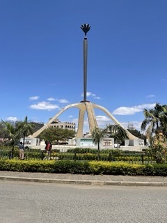 Arusha Declaration Monument, Kati Ward | |
| Etymology: Center | |
 Kati Ward | |
| Coordinates: 3°22′26″S36°41′18″E / 3.37389°S 36.68833°E | |
| Country | |
| Region | Arusha Region |
| District | Arusha District |
| Capital | Pangani Neighborhood |
| Area | |
• Total | 0.580 km2 (0.224 sq mi) |
| Elevation | 1,400 m (4,600 ft) |
| Population (2012) | |
• Total | 3,114 |
| • Density | 5,363/km2 (13,890/sq mi) |
| Demonym | Katian |
| Ethnic groups | |
| • Settler | Swahili |
| • Ancestral | Kinongo |
| Tanzanian Postal Code | 23102 |
Kati is an administrative ward in the Arusha City Council of the Arusha Region of Tanzania. Kati means "center" in Swahili language. Kati is one of 25 urban administrative wards in the City. [1] The ward is bordered by Levolosi ward to the west, Kaloleni ward to the north, Sekei ward to the northeast, Themi ward to the southeast, Daraja Mbili to the south and, Unga L.T.D ward to the southwest. The ward covers an area of 0.580 km2 (0.224 sq mi) and is the smallest ward in Arusha city. [2]
Contents
The ward is home to some of the oldest schools in the city and some of the most iconic monuments in the city.[ citation needed ]
Kati is home to the Arusha Ijumaa Mosque (Arusha Friday Mosque), one of the oldest in the city, located south of the Arusha Declaration Monument, which is also located in Kati Ward. According to the 2012 census, the ward has a total population of 5,363. [3]
