Enduleni is an administrative ward in the Ngorongoro District of the Arusha Region of Tanzania. The ward is home of the Laetoli prehistoric site. In 2016 the Tanzania National Bureau of Statistics report there were 13,537 people in the ward, from 13,537 in 2012.
Kakesio is an administrative ward in the Ngorongoro District of the Arusha Region of Tanzania. In 2016 the Tanzania National Bureau of Statistics report there were 6,179 people in the ward, from 5,537 in 2012.
Naiyobi is an administrative ward in the Ngorongoro District of the Arusha Region of Tanzania. In 2016 the Tanzania National Bureau of Statistics report there were 10,191 people in the ward, from 9,133 in 2012.
Olbalbal is an administrative ward in the Ngorongoro District of the Arusha Region of Tanzania. The ward is home to the famous Olduvai Gorge. The ward covers an area of 7.893 square kilometres (3.048 sq mi) with an average elevation of 1,405 metres (4,610 ft).
Oldonyosambu is an administrative ward in the Ngorongoro District of the Arusha Region of Tanzania. In 2016 the Tanzania National Bureau of Statistics report there were 8,657 people in the ward, from 5,233 in 2012.
Orgosorok is an administrative ward in the Ngorongoro District of the Arusha Region of Tanzania. In 2016 the Tanzania National Bureau of Statistics report there were 13,690 people in the ward, from 12,268 in 2012.
Sale is an administrative ward in the Ngorongoro District of the Arusha Region of Tanzania. In 2016 the Tanzania National Bureau of Statistics report there were 4,892 people in the ward, from 4,384 in 2012.
Makuyuni is an administrative ward in the Monduli district of the Arusha Region of Tanzania. In 2016 the Tanzania National Bureau of Statistics report there were 12,529 people in the ward, from 11,228 in 2012.
Moita is an administrative ward in the Monduli District of the Arusha Region of Tanzania. In 2016 the Tanzania National Bureau of Statistics report there were 12,654 people in the ward, from 11,340 in 2012.
Monduli Juu is an administrative ward in the Monduli District of the Arusha Region of Tanzania. In 2016 the Tanzania National Bureau of Statistics report there were 12,457 people in the ward, from 15,914 in 2012.
Endamarariek is an administrative ward in the Karatu district of the Arusha Region of Tanzania. In 2016 the Tanzania National Bureau of Statistics report there were 27,893 people in the ward, from 24,996 in 2012.

Kagera is an administrative ward in Kigoma-Ujiji District of Kigoma Region in Tanzania. The ward covers an area of 24.3 km2 (9.4 sq mi), and has an average elevation of 786 m (2,579 ft). In 2016 the Tanzania National Bureau of Statistics report there were 9,950 people in the ward, from 9,040 in 2012.

Kasingirima is an administrative ward in Kigoma-Ujiji District of Kigoma Region in Tanzania. The ward covers an area of 0.2 km2 (0.077 sq mi), and has an average elevation of 799 m (2,621 ft). In 2016 the Tanzania National Bureau of Statistics report there were 3,156 people in the ward, from 2,867 in 2012.
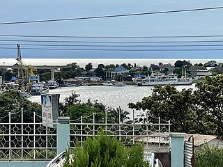
Kigoma is an administrative ward in Kigoma-Ujiji District of Kigoma Region in Tanzania. The ward covers an area of 4 km2 (1.5 sq mi), and has an average elevation of 789 m (2,589 ft). In 2016 the Tanzania National Bureau of Statistics report there were 7,604 people in the ward, from 6,908 in 2012.

Kitongoni is an administrative ward in Kigoma-Ujiji District of Kigoma Region in Tanzania. The ward covers an area of 1.2 km2 (0.46 sq mi), and has an average elevation of 773 m (2,536 ft). In 2016 the Tanzania National Bureau of Statistics report there were 7,675 people in the ward, from 6,973 in 2012.
Kasimbu is an administrative ward in Kigoma-Ujiji District of Kigoma Region in Tanzania. The ward covers an area of 1.9 km2 (0.73 sq mi), and has an average elevation of 783 m (2,569 ft). In 2016 the Tanzania National Bureau of Statistics report there were 5,405 people in the ward, from 4,910 in 2012.
Katubuka is an administrative ward in Kigoma-Ujiji District of Kigoma Region in Tanzania. The ward covers an area of 3 km2 (1.2 sq mi), and has an average elevation of 814 m (2,671 ft). In 2016 the Tanzania National Bureau of Statistics report there were 27,287 people in the ward, from 24,790 in 2012.
Kipampa is an administrative ward in Kigoma-Ujiji District of Kigoma Region in Tanzania. The ward covers an area of 1.8 km2 (0.69 sq mi), and has an average elevation of 777 m (2,549 ft). In 2016 the Tanzania National Bureau of Statistics report there were 8,714 people in the ward, from 7,917 in 2012.
Machinjioni is an administrative ward in Kigoma-Ujiji District of Kigoma Region in Tanzania. The ward covers an area of 1.1 km2 (0.42 sq mi), and has an average elevation of 839 m (2,753 ft). In 2016 the Tanzania National Bureau of Statistics report there were 3,814 people in the ward, from 3,465 in 2012.
Rubuga is an administrative ward in Kigoma-Ujiji District of Kigoma Region in Tanzania. The ward covers an area of 1.2 km2 (0.46 sq mi), and has an average elevation of 784 m (2,572 ft). In 2016 the Tanzania National Bureau of Statistics report there were 2,899 people in the ward, from 2,634 in 2012.
