
Swansea is a village in St. Clair County, Illinois. It is a part of the St. Louis metropolitan area and Metro East in southern Illinois. It is surrounded by the communities of Fairview Heights, Belleville, O’Fallon, and Shiloh. The population was 13,430 at the 2010 census, an increase from 10,579 in 2000.

Bloomfield is a city in Knox County, Nebraska, United States. The population was 1,028 at the 2010 census.

Kenton is a city in and the county seat of Hardin County, Ohio, United States, located in the west central part of Ohio approximately 57 mi (92 km) NW of Columbus and 70 mi (113 km) south of Toledo. The population was 8,262 at the 2010 census. The city was named for frontiersman Simon Kenton of Kentucky and Ohio.
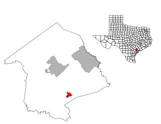
Bloomington is a census-designated place (CDP) in Victoria County, Texas, United States. The population was 2,459 at the 2010 census. It is included in the Victoria, Texas, Metropolitan Statistical Area.

Mahmudiye is a town and district of Eskişehir Province in the Central Anatolia region of Turkey. According to 2010 census, population of the district is 8,770 of which 4,707 live in the town of Mahmudiye. The district covers an area of 678 km2 (262 sq mi), and the town lies at an average elevation of 877 m (2,877 ft).
Amdanga is a community development block that forms an administrative division in North 24 Parganas district in the Indian state of West Bengal.
Deganga is a community development block that forms an administrative division in North 24 Parganas district in the Indian state of West Bengal.
Sandeshkhali I is a community development block that forms an administrative division in Basirhat subdivision of North 24 Parganas district in the Indian state of West Bengal.
Malwelwe is a village in Kweneng District of Botswana. It is located 70 km northwest of Molepolole. The population was 930 in 2001 census.
Dębno is a village in the administrative district of Gmina Nowa Słupia, within Kielce County, Świętokrzyskie Voivodeship, in south-central Poland. It lies approximately 8 kilometres (5 mi) north-west of Nowa Słupia and 27 km (17 mi) east of the regional capital Kielce.
Suti I is a community development block that forms an administrative division in the Jangipur subdivision of Murshidabad district in the Indian state of West Bengal.
Swarupnagar is a community development block that forms an administrative division in Basirhat subdivision of North 24 Parganas district in the Indian state of West Bengal.

Zlokućane is a village in the municipality of Leskovac, Serbia. According to the 2002 census, the village has a population of 217 people.
Bhagawangola I is a community development block that forms an administrative division in the Lalbag subdivision of Murshidabad district in the Indian state of West Bengal.
Habra II is a community development block that forms an administrative division in Barasat Sadar subdivision of North 24 Parganas district in the Indian state of West Bengal.
Baduria is a community development block that forms an administrative division in Basirhat subdivision of North 24 Parganas district in the Indian state of West Bengal.
Sandeshkhali-II is a community development block that forms an administrative division in Basirhat subdivision of North 24 Parganas district in the Indian state of West Bengal.
Raninagar II is a community development block that forms an administrative division in the Domkol subdivision of Murshidabad district in the Indian state of West Bengal.

Polovinsky District is an administrative and municipal district (raion), one of the twenty-four in Kurgan Oblast, Russia. It is located in the south of the oblast. The area of the district is 2,728 square kilometers (1,053 sq mi). Its administrative center is the rural locality (a selo of Polovinnoye. Population: 12,255 ; 16,295 ; 17,123 . The population of Polovinnoye accounts for 37.9% of the district's total population.
Lalgola is a community development block that forms an administrative division in the Lalbag subdivision of Murshidabad district in the Indian state of West Bengal.

