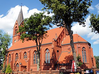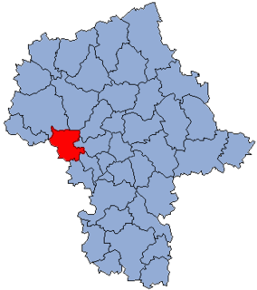
Równica is a village in the administrative district of Gmina Zbiczno, within Brodnica County, Kuyavian-Pomeranian Voivodeship, in north-central Poland. It lies 7 kilometres (4 mi) east of Zbiczno, 12 km (7 mi) north-east of Brodnica, and 67 km (42 mi) north-east of Toruń.
Zaleskie is a village in the administrative district of Gmina Juchnowiec Kościelny, within Białystok County, Podlaskie Voivodeship, in north-eastern Poland.

Zagadki is a village in the administrative district of Gmina Szczerców, within Bełchatów County, Łódź Voivodeship, in central Poland. It lies approximately 2 kilometres (1 mi) north-east of Szczerców, 17 km (11 mi) west of Bełchatów, and 54 km (34 mi) south-west of the regional capital Łódź.

Jackowice is a village in the administrative district of Gmina Zduny, within Łowicz County, Łódź Voivodeship, in central Poland. It lies approximately 3 kilometres (2 mi) north-west of Zduny, 13 km (8 mi) north-west of Łowicz, and 49 km (30 mi) north-east of the regional capital Łódź.

Werlas is a village in the administrative district of Gmina Solina, within Lesko County, Subcarpathian Voivodeship, in south-eastern Poland. It lies approximately 5 kilometres (3 mi) to the south of Solina, 18 km (11 mi) south-east of Lesko, and 84 km (52 mi) south-east of the regional capital Rzeszów.

Jeżów is a village in the administrative district of Gmina Końskie, within Końskie County, Świętokrzyskie Voivodeship, in south-central Poland. It lies approximately 7 kilometres (4 mi) north-west of Końskie and 45 km (28 mi) north-west of the regional capital Kielce.

Niekłań Mały is a village in the administrative district of Gmina Stąporków, within Końskie County, Świętokrzyskie Voivodeship, in south-central Poland. It lies approximately 6 kilometres (4 mi) north-east of Stąporków, 15 km (9 mi) east of Końskie, and 32 km (20 mi) north of the regional capital Kielce.
Anielew is a village in the administrative district of Gmina Mińsk Mazowiecki, within Mińsk County, Masovian Voivodeship, in east-central Poland.

Świerże-Panki is a village in the administrative district of Gmina Zaręby Kościelne, within Ostrów Mazowiecka County, Masovian Voivodeship, in east-central Poland. It lies approximately 5 kilometres (3 mi) north-east of Zaręby Kościelne, 19 km (12 mi) east of Ostrów Mazowiecka, and 102 km (63 mi) north-east of Warsaw.

Stare Lipiny B is a village in the administrative district of Gmina Wołomin, within Wołomin County, Masovian Voivodeship, in east-central Poland. It lies approximately 3 kilometres (2 mi) east of Wołomin and 24 km (15 mi) north-east of Warsaw.
Pieńki is a village in the administrative district of Gmina Szczytniki, within Kalisz County, Greater Poland Voivodeship, in west-central Poland.

Stefanowo is a village in the administrative district of Gmina Kazimierz Biskupi, within Konin County, Greater Poland Voivodeship, in west-central Poland. It lies approximately 6 kilometres (4 mi) north-west of Kazimierz Biskupi, 18 km (11 mi) north-west of Konin, and 83 km (52 mi) east of the regional capital Poznań.
Holendry Wąsowskie is a village in the administrative district of Gmina Ślesin, within Konin County, Greater Poland Voivodeship, in west-central Poland.
Leśna Grobla is a settlement in the administrative district of Gmina Kostrzyn, within Poznań County, Greater Poland Voivodeship, in west-central Poland.

Bytnica is a village in Krosno Odrzańskie County, Lubusz Voivodeship, in western Poland. It is the seat of the gmina called Gmina Bytnica. It lies approximately 14 kilometres (9 mi) north of Krosno Odrzańskie, 33 km (21 mi) north-west of Zielona Góra, and 65 km (40 mi) south of Gorzów Wielkopolski.

Stara Kiszewa is a village in Kościerzyna County, Pomeranian Voivodeship, in northern Poland. It is the seat of the gmina called Gmina Stara Kiszewa. It lies approximately 19 kilometres (12 mi) south-east of Kościerzyna and 52 km (32 mi) south-west of the regional capital Gdańsk.

Koleczkowski Młyn is a settlement in the administrative district of Gmina Szemud, within Wejherowo County, Pomeranian Voivodeship, in northern Poland. It lies approximately 8 kilometres (5 mi) east of Szemud, 13 km (8 mi) south-east of Wejherowo, and 24 km (15 mi) north-west of the regional capital Gdańsk.

Klekotki is a settlement in the administrative district of Gmina Bartoszyce, within Bartoszyce County, Warmian-Masurian Voivodeship, in northern Poland, close to the border with the Kaliningrad Oblast of Russia. It lies approximately 10 kilometres (6 mi) south of Bartoszyce and 47 km (29 mi) north-east of the regional capital Olsztyn.

Wormie is a village in the administrative district of Gmina Górowo Iławeckie, within Bartoszyce County, Warmian-Masurian Voivodeship, in northern Poland, close to the border with the Kaliningrad Oblast of Russia. It lies approximately 15 kilometres (9 mi) north-west of Górowo Iławeckie, 33 km (21 mi) north-west of Bartoszyce, and 66 km (41 mi) north of the regional capital Olsztyn.

Gnatowo-Kolonia is a settlement in the administrative district of Gmina Kętrzyn, within Kętrzyn County, Warmian-Masurian Voivodeship, in northern Poland. It lies approximately 3 kilometres (2 mi) west of Kętrzyn and 65 km (40 mi) north-east of the regional capital Olsztyn.


