Location
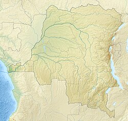
Kayuyu is in the Pangi Territory of Maniema province. Kayuyu is capital of the Wakabango 2 sector. It is 109 kilometres (68 mi) from Kindu. Pangi Territory is mostly occupied only by Lega people. In May 1999 a Mai-Mai resistance force including Lega groups from Kayuyu, Kampene and other towns threatened Kindu.
The Köppen climate classification is Aw : Tropical savanna, wet. Pangi territory has a subequatorial climate characterized by the alternation of two seasons. The rainy season lasts from the end of September to the end of July, and the dry season from the end of July to the end of September. Temperature varies between 25 and 30 °C (77 and 86 °F).
In March 2021 a citizens' group accused the head of Wakabango 2 of selling state land in Kayuyu to private citizens. He denied the charges.
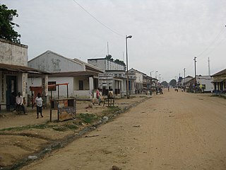
Maniema is one of 26 provinces of the Democratic Republic of the Congo. Its capital is Kindu.

The Ulindi River is a tributary of the Lualaba River in the Democratic Republic of the Congo (DRC). There is a proposal to build a hydroelectric power plant on the river to power a gold mining project.
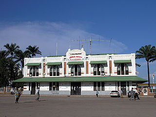
The Société Nationale des chemins de fer du Congo is the national railway company for the inland railways of the Democratic Republic of the Congo.

Kindu is a city in the Democratic Republic of Congo, the capital of Maniema province. It has a population of about 200,000 and is situated on the Lualaba River at an altitude of about 500 metres, and is about 400 km west of Bukavu.
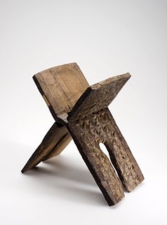
Islam is a minority religion within the Democratic Republic of the Congo where the large majority is affiliated to various Christian denominations and sects. It was first introduced to the Congo basin from the East African coast during the Arab slave trade in the 19th century and remains largely concentrated in parts of Eastern Congo, notably in Maniema Province. Most Congolese Muslims are Sunni and follow the Shafi‘i and Maliki school of jurisprudence (fiqh). Though estimates vary, it is generally believed that between one and 10 percent of the country's population identify as Muslim.

Kasongo, also known as Piani Kasongo, is a town and Territory, located in Maniema Province of the eastern Democratic Republic of the Congo.

Alexis Thambwe Mwamba is a Congolese politician who has assumed various political roles and offices since the early 1980s going from Minister of Public Works, Minister of State Portfolio, Minister of Transportation, Minister of Planning, Minister of Foreign Affairs and recently in December 2014, he was appointed Minister of Justice of the Democratic Republic of the Congo.
Daniel P. Biebuyck was an American scholar of Central African art.

Lokandu is a community in Maniema Province of the Democratic Republic of the Congo, on the Lualaba River downstream from Kindu.
The Elila River is a tributary of the Lualaba River in the Democratic Republic of the Congo. It rises in Mwenga Territory of Sud-Kivu Province and flows west through Shabunda Territory and then Pangi Territory in Maniema Province, entering the Lualaba just downstream of Kindu.

Pangi is a community in the Democratic Republic of the Congo. It is the administrative center of Pangi Territory in Maniema Province.

Pangi Territory is an administrative area in Maniema Province of the Democratic Republic of the Congo. The headquarters is the town of Pangi.

The Lega people are a Bantu ethnic group of the Democratic Republic of the Congo. In 1998 their population was about 250,000.
Madimba is a territory in the Kongo Central province of the Democratic Republic of the Congo. Its seat is the town of Madimba.
Inongo Territory is a second-level administrative area (territory) in Maï-Ndombe Province in the Democratic Republic of the Congo. Its headquarters is in the provincial capital of Inongo.
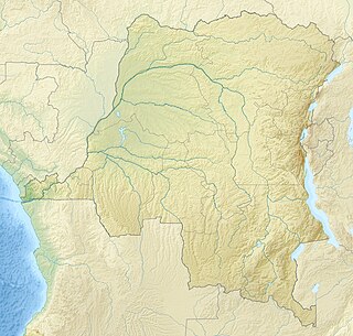
Lomami National Park is a national park located in the Democratic Republic of Congo in Central Africa. Situated within the middle basin of the Lomami River, it straddles the Provinces of Tshopo and Maniema with a slight overlap into the forests of the Tshuapa and Lualaba river basins. The National Park was formally declared on 7 July 2016. It is the 9th national park in the country and the first to be created since 1992.
Ingende Territory is a second-level administrative area (territory) in Équateur Province in the Democratic Republic of the Congo. Its headquarters is the town of Ingende.

The Twangiza-Namoya gold belt is a belt of gold deposits in the east of the Democratic Republic of the Congo. Artisanal working of alluvial deposits dates back to the 1920s. More systematic exploration and exploitation took place in the colonial era and continues up to the present, although civil war and militia attacks have periodically disrupted operations and have caused several changes of ownership of the concessions.

Kampene is town in Maniema province, Democratic Republic of the Congo (DRC). It is a center for informal artisanal gold mining.

Kafubu is a river in the Haut-Katanga Province, Democratic Republic of the Congo. It gives its name to a health zone.
This page is based on this
Wikipedia article Text is available under the
CC BY-SA 4.0 license; additional terms may apply.
Images, videos and audio are available under their respective licenses.
