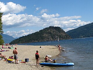
Keeley Lake is a hamlet in Saskatchewan.
Coordinates: 54°54′00″N108°08′00″W / 54.90000°N 108.13333°W
Keeley Lake is a hamlet in Saskatchewan.
Coordinates: 54°54′00″N108°08′00″W / 54.90000°N 108.13333°W

North Union Township is a township in Schuylkill County, Pennsylvania, United States. The population was 1,417 at the 2020 census.
Kluskoil Lake Provincial Park is a provincial park in British Columbia, Canada, located on the West Road River downstream from the Euchiniko Lakes.

Montague Harbour Marine Provincial Park is a provincial park in British Columbia, Canada, located on Galiano Island, one of the Gulf Islands off BC's South Coast in Canada. It is accessible by BC Ferries from Swartz Bay on Vancouver Island or Tsawwassen on the Mainland. The Island's ferry terminal is at Sturdies Bay, about 6 km (3.7 mi) from Montague.

The Yellow Dog Plains is an area north and west of Marquette, Michigan, in the Upper Peninsula of Michigan, United States. The Yellow Dog River flows through it, as does the Salmon Trout River. The Salmon Trout River is unique in that it has a breeding population of coasters, a potamodromous form of brook trout. Coasters are virtually extinct from their native range on the south coast of Lake Superior, except for the Salmon Trout River. The Yellow Dog Plains is a remote and virtually untouched wilderness, aside from large scale logging operations. There are extensive forests of Eastern white pine, with reports of some of the trees in the Yellow Dog Plains reaching heights of 31 meters.

Shuswap Lake Provincial Park is a provincial park in British Columbia, Canada.
Shuswap Lake Marine Provincial Park is a provincial park in British Columbia, Canada, comprising 894 ha. The Park has a variety of amenities including boat launch ramps, picnic areas, and 27 campsites around the perimeter of Shuswap Lake. The lake's name and that of the surrounding Shuswap Country is from the Shuswap people (Secwepemc), the most northern of the Salishan speaking people.
There are several lakes named Mud Lake within the Canadian province of Alberta.
The Lower Similkameen Indian Band or Lower Smelqmix, is a First Nations band government in the Canadian province of British Columbia. Their office is located in the village of Keremeos in the Similkameen region. They are a member of the Okanagan Nation Alliance.
The Stone First Nation or Yunesitʼin First Nation is a band government of the Yunesit'in subgroup of the Tsilhqot'in people, whose territory is the Chilcotin District in the western Central Interior region of the Canadian province of British Columbia. It is a member of the Tsilhqot'in Tribal Council. The people of the Stone First Nation are known as the Yunesit'in in the Chilcotin language.
Bridge Creek is a creek in the South Cariboo region of the Interior of British Columbia, Canada. Its meandering course across the Cariboo Plateau is approximately 85 kilometres in length, beginning at Bridge Lake and running roughly westwards to the town of 100 Mile House and from there turning and running northeast to Canim Lake. Below Canim Lake the Canim River connects to Mahood Lake and the short Mahood River to the Clearwater River, which meets the North Thompson at the town of Clearwater.

Lava Canyon is a canyon on the Chilko River in the Chilcotin District of the Interior of British Columbia, Canada, located about 35 kilometres below the Chilko's outflow from the foot of Chilko Lake.
Marie Canyon is a canyon on the Cowichan River, just below Skutz Falls, on southern Vancouver Island, British Columbia, Canada.
The Nazko First Nation is a First Nations government of the Dakelh people in the north-central Interior of British Columbia. Its reserves are located around the community of Nazko, British Columbia, which is 120 km west of Quesnel and southwest of Prince George.
The Nakina River is a river in northwestern British Columbia, Canada, rising southeast of Atlin Lake and flowing generally southeast to its confluence with the Inklin River at the locality of Inklin, where the two rivers combine to form the Taku River.
Wood Lake Township is a civil township in Benson County, North Dakota, United States. As of the 2000 census, its population was 440. Wood Lake Township is the second most populous township in Benson County, after Mission Township.
The Tahltan First Nation, also known as the Tahltan Indian Band, is a band government of the Tahltan people. Their main community and reserves are located at Telegraph Creek, British Columbia. Their language is the Tahltan language, which is an Athabaskan language also known as Nahanni, is closely related to Kaska and Dunneza. Their Indian and Northern Affairs Canada band number is 682. The Tahltan First Nation is joined with the Iskut First Nation in a combined tribal council-type organization known as the Tahltan Nation.
Tyoax Pass is a mountain pass in the Chilcotin Ranges of the Pacific Ranges, the southernmost main subdivision of the Coast Mountains of British Columbia, Canada. Located at the head of Tyaughton Creek, a north tributary of the Bridge River, it connects the basin of the Bridge River with that of Big Creek in the southern Chilcotin District, and is therefore at the boundary between the Spruce Lake Protected Area and Big Creek Provincial Park.
Matamec Ecological Reserve is an ecological reserve in Sept-Îles, in Sept-Rivières Regional County Municipality, in Quebec, Canada. It was established in 1995 and is located within the new boundaries of the recently amalgamated city of Sept-Îles.

HMS Vesper was a V-class destroyer of the British Royal Navy that saw service in World War I and World War II.
Drury inlet is an inlet in the Queen Charlotte Strait region of the Central Coast of British Columbia, Canada, extending west from Wells Passage to the northwest of North Broughton Island, northwest of the town of Port Hardy. Branching off to the northeast from the north side of the head of the inlet is Actaeon Sound.