The River Avon is in the south of England, rising in Wiltshire, flowing through that county's city of Salisbury and then west Hampshire, before reaching the English Channel through Christchurch Harbour in the Bournemouth, Christchurch and Poole conurbation of Dorset.

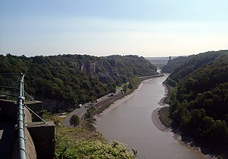
The River Avon is a river in the south west of England. To distinguish it from a number of other rivers of the same name, it is often called the Bristol Avon. The name 'Avon' is a cognate of the Welsh word afon, meaning 'river'.
Gripwood Quarry is a 2.9 hectare geological Site of Special Scientific Interest in Wiltshire, England, notified in 1951. The quarry is of Oolitic limestone and has a wall in the middle creating an upper and a lower quarry, last used for mushroom growing. The walls are whitewashed and there is a large wooden crane.
Polyne Quarry is a 0.1 hectare Site of Special Scientific Interest (SSSI) in Cornwall, England, UK. It is located to the north of Polperro civil parish, 2 miles (3.2 km) to the west of Looe.

Camp Down is a 7.3-hectare (18-acre) biological Site of Special Scientific Interest in Wiltshire in South West England. It was designated as such in 1965.
East Harnham Meadows is a 17.29 hectare biological Site of Special Scientific Interest in Wiltshire, England, in the floodplain of the Hampshire Avon and close to the southeast boundary of the city of Salisbury.
The River Till SSSI is a 32.07 hectares biological Site of Special Scientific Interest in Wiltshire, England, notified in 2000.

Mole Gap to Reigate Escarpment is a 1,016.4-hectare (2,512-acre) biological and geological Site of Special Scientific Interest west of Reigate in Surrey. It is a Geological Conservation Review site and a Special Area of Conservation. Part of it is a Nature Conservation Review site, Grade I. Two small private nature reserves in the site are managed by the Surrey Wildlife Trust, Dawcombe and Fraser Down.

Purton is a village on the east bank of the River Severn, 3 miles north of Berkeley, in Gloucestershire, England. The village is in the civil parish of Hinton. It lies opposite the hamlet of Purton on the west bank of the river.

West Hoathly SSSI is a 0.7-hectare (1.7-acre) geological Site of Special Scientific Interest in Sharpthorne in West Sussex. It is a Geological Conservation Review site.

Kellaways, also known as Tytherton Kellaways, is a village and former ecclesiastical parish in the present-day civil parish of Langley Burrell Without and ceremonial county of Wiltshire, England. Its nearest town is Chippenham, which lies 2.5 miles (4.0 km) southwest from the hamlet. Historically, the name was sometimes given as Gallows.

Frays Farm Meadows is a 28.2-hectare (70-acre) biological Site of Special Scientific Interest near Denham in the London Borough of Hillingdon. It was notified as an SSSI in 1981, and has been managed by the London Wildlife Trust on behalf of Hillingdon Council since 1999. It is part of the Colne Valley Regional Park.

Baulk Head to Mullion is a coastal Site of Special Scientific Interest (SSSI) in Cornwall, England, UK, noted for both its biological and geological characteristics.

Mid Colne Valley is a 132 hectare biological Site of Special Scientific Interest in Harefield in the London Borough of Hillingdon and Denham in South Buckinghamshire. Its main importance lies in its extensive diversity of birdlife in lakes in former gravel pits.

Meneage Coastal Section is a coastal Site of Special Scientific Interest (SSSI) in southern Cornwall, England, UK, noted for its geological characteristics.
Campden Tunnel Gravel Pit is a 0.2-hectare (0.49-acre) geological Site of Special Scientific Interest in Gloucestershire, notified in 1988. The site is listed in the 'Cotswold District' Local Plan 2001-2011.


