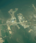
Kent Narrows

Last updated

The Kent Narrows, also known as Kent Island Narrows and to local residents simply as the Narrows, is a waterway that connects the Chester River with the Eastern Bay and also separates Kent Island from the Delmarva Peninsula. It runs through the community of Kent Narrows, Maryland. The Kent Narrows was originally shallow and surrounded by marsh. A causeway was built across it in 1826, but was removed in 1876 when the channel was dredged. [1] Today the Kent Narrows continues to be dredged regularly. The area has traditionally been a location for seafood packing and restaurants.

Chester River river in Maryland and Delaware, United States

The Chester River is a major tributary of the Chesapeake Bay on the Delmarva Peninsula. It is about 43 miles (69 km) long, and its watershed encompasses 368 sq mi (950 km2), which includes 295 sq mi (760 km2) of land. Thus the total watershed area is 20% water. It forms the border between Kent County and Queen Anne's County, Maryland, with its headwaters extending into New Castle County and Kent County, Delaware. Chestertown, the seat of Maryland's Kent County, is located on its north shore. It is located south of the Sassafras River and north of Eastern Bay, and is connected with Eastern Bay through Kent Narrows.

Eastern Bay tributary of Chesapeake Bay Maryland, USA

The Eastern Bay is a tributary of the Chesapeake Bay located between Queen Anne's County, Maryland and Talbot County, Maryland on the Eastern Shore. Its main tributaries include the Miles River and the Wye River. It is located south of the Chester River and north of the Choptank River and is connected to the Chester River via Kent Narrows.

Delmarva Peninsula peninsula

The Delmarva Peninsula, or simply Delmarva, is a large peninsula on the East Coast of the United States, occupied by Delaware and parts of the Eastern Shores of Maryland and Virginia. The peninsula is 170 miles (274 km) long. In width, it ranges from 70 miles (113 km) near its center, to 12 miles (19 km) at the isthmus on its northern edge, to less near its southern tip of Cape Charles. It is bordered by the Chesapeake Bay on the west, the Delaware River, Delaware Bay, and the Atlantic Ocean on the east, and the Elk River and its isthmus on the north.

Contents

Bridges

Several bridges, both part of roads and the Queen Anne's Railroad, have crossed the Kent Narrows in the past. Currently, two road bridges cross the Kent Narrows.

Queen Annes Railroad

The Queen Anne’s Railroad was a railroad that ran from Love Point, Maryland to Lewes, Delaware and was connected to Baltimore via ferry across the Chesapeake Bay. The Queen Anne's Railroad company was formed in Maryland in 1894, and received legislative authorization from Delaware in February 1895. The railroad's original western terminus was in Queenstown, Maryland, and was moved via a 13-mile (21 km) extension to Love Point in 1902, which shortened the ferry trip to Baltimore.

R. Clayton 'Clay' Mitchell Jr. was an American politician and the Speaker of the Maryland House of Delegates in the United States.

U.S. Route 50 in Maryland highway in Maryland

U.S. Route 50 is a major east–west route of the U.S. Highway system, stretching just over 3,000 miles (4,800 km) from Ocean City, Maryland on the Atlantic Ocean to West Sacramento, California. In the U.S. state of Maryland, US 50 exists in two sections. The longer of these serves as a major route connecting Washington, D.C. with Ocean City; the latter is the eastern terminus of the highway. The other section passes through the southern end of Garrett County for less than 10 miles (16 km) as part of the Northwestern Turnpike, entering West Virginia at both ends. One notable section of US 50 is the dual-span Chesapeake Bay Bridge across the Chesapeake Bay, which links the Baltimore–Washington metropolitan area with the Eastern Shore region, allowing motorists to reach Ocean City and the Delaware Beaches.

Bascule bridge moveable bridge using a counterweight to balance a span through its upward swing to let boats move underneath

A bascule bridge is a moveable bridge with a counterweight that continuously balances a span, or "leaf", throughout its upward swing to provide clearance for boat traffic. It may be single- or double-leafed.

Related Research Articles

U.S. Route 76 highway in the United States

U.S. Route 76 is an east–west U.S. highway that travels for approximately 548 miles (882 km) from Chattanooga, Tennessee, to Wrightsville Beach, North Carolina.

U.S. Route 301 highway in the United States

U.S. Route 301 (US 301) is a spur of U.S. Route 1 running through the South Atlantic States. It currently runs 1,099 miles (1,769 km) from Biddles Corner, Delaware at Delaware Route 1 to Sarasota, Florida at U.S. Route 41. It passes through the states of Delaware, Maryland, Virginia, North Carolina, South Carolina, Georgia, and Florida. It goes through the cities of Annapolis, Maryland; Richmond and Petersburg, Virginia; Rocky Mount, Wilson, and Fayetteville, North Carolina; Florence, South Carolina; Statesboro and Jesup, Georgia; and Ocala, Zephyrhills, Brandon, and Sarasota, Florida.

Chesapeake Bay Bridge major dual-span bridge in the U.S. state of Maryland, spanning the Chesapeake Bay

The Chesapeake Bay Bridge is a major dual-span bridge in the U.S. state of Maryland. Spanning the Chesapeake Bay, it connects the state's rural Eastern Shore region with the urban Western Shore. The original span, opened in 1952 and with a length of 4.3 miles (6.9 km), was the world's longest continuous over-water steel structure. The parallel span was added in 1973. The bridge is officially named the "Gov. William Preston Lane Jr. Memorial Bridge" after William Preston Lane Jr. who, as the 52nd Governor of Maryland, initiated its construction in the late 1940s finally after decades of political indecision and public controversy.

Severn River (Maryland) river in Maryland, United States

The Severn River is a tidal estuary 14 miles (23 km) long, located in Anne Arundel County in the U.S. state of Maryland, south of the Magothy River and north of the South River.

Maryland Route 450 highway in Maryland

Maryland Route 450 is a state highway in the U.S. state of Maryland. The state highway runs 30.19 miles (48.59 km) from U.S. Route 1 Alternate in Bladensburg east to US 50, US 301, and MD 2 near Arnold. MD 450 forms a local complement to US 50 from near Washington through Annapolis. In Prince George's County, the highway is a four- to six-lane divided highway that serves Bladensburg, Landover Hills, New Carrollton, Lanham, and Bowie. In Anne Arundel County, MD 450 connects Crofton with Parole and Annapolis with the portion of the county east of the Severn River. The highway serves as one of the main streets of Annapolis, including the state capital's historic core, and is the primary vehicular access to the U.S. Naval Academy.

Kent Island (Maryland) island in the United States of America

Kent Island is the largest island in the Chesapeake Bay and an historic place in Maryland. To the east, a narrow channel known as the Kent Narrows barely separates the island from the Delmarva Peninsula, and on the other side, the island is separated from Sandy Point, an area near Annapolis, by roughly four miles (6.4 km) of water. At only four miles wide, the main waterway of the bay is at its narrowest at this point and is spanned here by the Chesapeake Bay Bridge. The Chester River runs to the north of the island and empties into the Chesapeake Bay at Kent Island's Love Point. To the south of the island lies Eastern Bay. The United States Census Bureau reports that the island has 31.62 square miles (81.90 km2) of land area.

Maryland Route 18 highway in Maryland

Maryland Route 18 (MD 18) is a state highway in the U.S. state of Maryland. The state highway runs 20.37 miles (32.78 km) from the beginning of state maintenance at Love Point east to MD 213 in Centreville. MD 18 is the main east–west local highway on Kent Island and east to Centreville, serving the centers of Stevensville, Chester, Kent Narrows, Grasonville, and Queenstown that are bypassed by U.S. Route 50 (US 50) and US 301. What is signed as MD 18 is actually a set of four suffixed highways: MD 18A, MD 18B, MD 18S, and MD 18C. There are also several unsigned segments of MD 18 scattered along the length of the signed portions.

Maryland Route 8 highway in Maryland

Maryland Route 8 is a state highway in the U.S. state of Maryland. Known for most of its length as Romancoke Road, the state highway runs 8.37 miles (13.47 km) from Romancoke Pier in Romancoke north to MD 18 in Stevensville. MD 8 is the main north–south highway of Kent Island in western Queen Anne's County. The state highway is also the first highway encountered on U.S. Route 50 and US 301 east of the Chesapeake Bay Bridge. South of Matapeake, MD 8 is paralleled by the Kent Island South Trail.

Maryland Route 3 highway in Maryland

Maryland Route 3, part of the Robert Crain Highway, is the designation given to the former alignment of U.S. Route 301 from Bowie, Maryland, USA, to Baltimore. It is named for Robert Crain of Baltimore. It is unique in Maryland in that it has a business route and a truck route which do not connect to their parent; however, the business route is also a part of the Robert Crain Highway. MD 3's current orientation is vestigial from the construction of Maryland's freeway system.

Skipjack (boat) type of fishing boat

The skipjack is a traditional fishing boat used on the Chesapeake Bay for oyster dredging. It is a sailboat which succeeded the bugeye as the chief oystering boat on the bay, and it remains in service due to laws restricting the use of powerboats in the Maryland state oyster fishery.

Maryland Route 304 highway in Maryland

Maryland Route 304 is a state highway in the U.S. state of Maryland. The highway runs 15.23 miles (24.51 km) from Spider Web Road near Centreville east to MD 312 in Bridgetown. MD 304 connects Centreville with U.S. Route 301 and several small settlements in central Queen Anne's County and northern Caroline County, including Ruthsburg and Bridgetown. The first sections of modern MD 304 were improved in the 1910s, but much of the highway from Centreville to Ruthsburg was constructed from the mid-1930s to the early 1940s. The part of the highway west of Centreville was constructed as Maryland Route 606 and became part of MD 304 in 1950. Since the 1950s, the highway through Centreville has been municipally maintained. MD 304 was extended east to MD 405 and replaced that route to Bridgetown in the 1960s. The US 301 junction became a superstreet intersection in 2011 and a dumbbell interchange in 2017.

The South River is a 10-mile-long (16 km) tributary of the Chesapeake Bay in Anne Arundel County, Maryland in the United States. It lies south of the Severn River, east of the Patuxent River, and north of the West River and Rhode River, and drains to the Chesapeake Bay.

U.S. Route 301 (US 301) in the state of Maryland is a major highway that runs from Delaware to the Governor Harry W. Nice Memorial Bridge into Virginia. It passes through three of Maryland's four main regions: the Eastern Shore, the Baltimore-Washington Metropolitan Area, and Southern Maryland. US 301 serves mainly as a bypass of Baltimore and Washington from Delaware to Virginia.

The Severn River Bridge, officially known as the Pearl Harbor Memorial Bridge, is a bridge that crosses the Severn River northwest of the city limits of Annapolis, Maryland. The bridge serves as part of the John Hanson Highway, which is signed as U.S. Route 50 and U.S. Route 301. Maryland Route 2 also traverses the bridge, but no MD 2 signs exist along the section of highway the route traverses. MD 2 separates from US 50/301 east of the bridge and becomes Governor Ritchie Highway, and to the west of the bridge it leaves the highway along Solomons Island Road. The bridge serves as the main connection between Annapolis and points east, including the Eastern Shore via the Chesapeake Bay Bridge; however, unlike the rest of US 50/301 in the area, the bridge lacks shoulders and is often a point of traffic congestion and numerous accidents.

Maryland Route 290 highway in Maryland

Maryland Route 290 is a state highway in the U.S. state of Maryland. The highway runs 17.20 miles (27.68 km) from MD 300 at Dudley Corners north to MD 299 near Sassafras. MD 290 roughly parallels U.S. Route 301, which it intersects twice, as it connects the communities of Crumpton in northern Queen Anne's County and Chesterville and Galena in eastern Kent County. The portion of the route in Queen Anne's County was constructed as Maryland Route 301 in the early to mid-1920s. In Kent County, a portion south of Galena was built in the late 1910s and extended south to the Chester River in the late 1920s. MD 290 assumed the course of MD 301 in 1940 to avoid a number conflict with US 301. The Galena–Sassafras section of the highway was built in the late 1940s. MD 290 was reconstructed in Queen Anne's County and from south of Galena to Sassafras in the mid- to late 1950s. The highway's interchanges with US 301 were built when the U.S. Highway's course was constructed in the mid-1950s.

Maryland Route 291 highway in Maryland

Maryland Route 291 (MD 291) is a state highway in the U.S. state of Maryland. The highway runs 18.34 miles (29.52 km) from MD 20 in Chestertown east to the Delaware state line east of Millington, where the highway continues east as Delaware Route 6 (DE 6). MD 291 parallels the Chester River along the southern edge of Kent County and connects Chestertown with U.S. Route 301 (US 301). The highway follows much of what was originally MD 447, which was constructed between US 213 in Chestertown and MD 290 at Chesterville around 1930. MD 291 itself was built east of Millington around 1930. The highway was extended west toward Chesterville in the early 1930s, but it was not complete to MD 290 until the late 1940s. MD 291 was extended west to US 213 along a partially new alignment in the early 1960s, superseding MD 447. MD 291 was reconstructed along its entire length between the mid-1960s and mid-1970s, and it reached its present western terminus at MD 20 in 1969.

Cross Island Trail

The Cross Island Trail is a rail trail in Queen Anne's County, Maryland occupying a section of the abandoned Queen Anne's Railroad corridor that traverses the width of Kent Island. It was completed in 2001 and is part of the American Discovery Trail.

Matapeake is an unincorporated community located south of Stevensville on Kent Island, Maryland.

References

  1. Ruffner, Jennifer Gayman. "History of Kent Island". The Complete Guide to Kent Island. Retrieved 27 September 2016.
  2. Combs, Hannah (May 24, 2018). "Kent Narrows Bridge dedicated to R. Clayton Mitchell Jr". Kent County News . Retrieved June 14, 2019.

Coordinates: 38°58′19″N76°14′50″W / 38.97194°N 76.24722°W / 38.97194; -76.24722

Geographic coordinate system Coordinate system

A geographic coordinate system is a coordinate system that enables every location on Earth to be specified by a set of numbers, letters or symbols. The coordinates are often chosen such that one of the numbers represents a vertical position and two or three of the numbers represent a horizontal position; alternatively, a geographic position may be expressed in a combined three-dimensional Cartesian vector. A common choice of coordinates is latitude, longitude and elevation. To specify a location on a plane requires a map projection.