U.S. Route 641 (US 641) is a U.S. Route in Tennessee and Kentucky. It runs for 165.45 miles (266.27 km) from US 64 south of Clifton, Tennessee to an intersection with US 60 in Marion, Kentucky. While it is considered a spur route of U.S. Route 41, the two routes no longer connect.
U.S. Route 31E (US 31E) is the easternmost of two parallel routes for U.S. Highway 31 from Nashville, Tennessee, to Louisville, Kentucky.
Interstate 65 (I-65) runs from Ardmore north in Tennessee to just south of Franklin, Kentucky, forming part of the national Interstate 65, which goes from Mobile, Alabama, to Gary, Indiana. In Tennessee the highway's official name is the Albert Arnold Gore Sr. Memorial Highway.
U.S. Route 51 in Kentucky runs 42 miles (68 km) through the western portion of the state from the Tennessee state line at Fulton to the Illinois state line at Cairo, Illinois. It is a mostly rural route, also serving the towns of Clinton, Arlington, Bardwell and Wickliffe. It also carries part of the Great River Road near the northern end of its route in Kentucky.
U.S. Route 79 enters Kentucky from Tennessee in Todd County west of Guthrie and runs northeast into Logan County, terminating at a junction with US 68, US 68 Business, and Kentucky Route 80 in Russellville. US 79 remains a two-lane road throughout Kentucky.
Kentucky Route 35 is a 12.833-mile-long state highway in Kentucky that runs from US 127 in Owen County south of Sparta and heads north and goes through Sparta and meets KY 467 before meeting Interstate 71. KY 35 then passes by the Kentucky Speedway and comes to an end at US 42 in Warsaw.
Kentucky Route 73 is a 30.031-mile-long (48.330 km) state highway in Kentucky that runs from White Road at the Kentucky-Tennessee state line southeast of Franklin to Kentucky Route 1038 northwest of South Union in rural Logan County via Franklin.
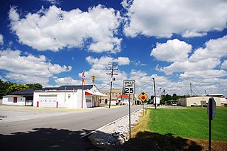
Kentucky Route 94 is a 79.816-mile-long (128.451 km) state highway in Kentucky that runs from Tennessee State Route 78 at the Tennessee state line to KY 80 southwest of the unincorporated community of Aurora via Hickman, Water Valley, and Murray.
Kentucky Route 96 is a 15.009-mile-long state highway in Logan County, Kentucky that runs from KY 102 in Keysburg to US 431 in southern Russellville.
Kentucky Route 97 is a 18.262-mile-long (29.390 km) state highway in Graves County, Kentucky that runs from Tennessee State Route 69 and State Line Road West on the Kentucky-Tennessee state border southeast of Sedalia to KY 80, KY 121, and KY 121 Business just southeast of Mayfield.
Kentucky Route 453 (KY 453) is a 16.040-mile-long (25.814 km) state highway in Kentucky that runs from The Trace at the northern entrance of Land Between the Lakes National Recreation Area south of Grand Rivers to U.S. Route 60 and North Court Street in Smithland.
Kentucky Route 99 is a 5.667-mile-long (9.120 km) state highway in Allen County, Kentucky, that runs from Tennessee State Route 10 and Kentucky Route 1578 at the Tennessee state line south of Amos to Kentucky Route 100 at Holland via Amos.
Kentucky Route 139 (KY 139) is a 55.797-mile-long (89.797 km) state highway in Kentucky that runs from Tennessee State Route 120 at the Tennessee state line south of Cadiz to Kentucky Route 120 in rural Crittenden County north of Princeton via Cadiz and Princeton.
Kentucky Route 116 (KY 116) is a 13.726-mile-long (22.090 km) state highway in Fulton County, Kentucky. It runs from KY 166 southeast of Hickman to KY 307 and Commercial Avenue in Fulton. All of KY 116 except for the first 2 miles (3.2 km) and final 0.100 miles (0.161 km) is on the Kentucky–Tennessee border.
Kentucky Route 121 (KY 121) is a 69.383-mile-long (111.661 km) state highway in Kentucky. It runs from State Route 119 (SR 119) at the Kentucky–Tennessee state line southeast of New Concord to U.S. Route 51 (US 51) and US 62 in Wickliffe via Murray and Mayfield.
Kentucky Route 125 (KY 125) is a 6.296-mile-long (10.132 km) state highway in Fulton County. It runs from Tennessee State Route 5 (SR 5) at the Kentucky–Tennessee state line north of Woodland Mills, Tennessee, to KY 94 in Hickman.
Kentucky Route 239 (KY 239) is a 10.3-mile-long (16.6 km) state highway in the U.S. state of Kentucky. The highway connects mostly rural areas of Fulton and Hickman counties with the Tennessee state line.
Kentucky Route 303 (KY 303) is a 16.9-mile-long (27.2 km) state highway in the U.S. state of Kentucky. The highway connects mostly rural areas of Graves County with the Tennessee state line and Mayfield.
Kentucky Route 307 (KY 307) is a 28.3-mile-long (45.5 km) state highway in the U.S. state of Kentucky. The highway connects mostly rural areas of Fulton, Hickman, and Carlisle counties with Fulton.
Kentucky Route 381 (KY 381) is a 10.472-mile-long (16.853 km) state highway in the U.S. state of Kentucky. The highway connects mostly rural areas of Graves County with Lynnville and Sedalia.