Kesath is a village and corresponding community development block in Buxar district of Bihar, India. It is the least populous of Buxar's 11 blocks, with a population of 33,820, in 5,304 households. The population of Kesath itself is 14,843, in 2,351 households.[2]
Kesath is an entirely rural block, with no large urban centres. Its sex ratio as of 2011 was 942 females to every 1000 males, which was higher than the overall district ratio of 922. The sex ratio was lower in the 0-6 age bracket, with 921 females for every 1000 males. Members of scheduled castes made up 17.61% of the block population and members of scheduled tribes made up 0.45%. The block literacy rate was 71.1%, which was slightly higher than the overall district rate of 70.14%. There was a 21.72% literacy gender gap between men (81.67%) and women (59.95%), compared to the district-wide gap of 22.09%.[2]
Employment
Most of Kesath block's workforce was engaged in agriculture in 2011, with 28.33% being cultivators who owned their own land and another 40.30% being agricultural labourers who worked someone else's land for wages. Another 4.36% were household industry workers, and the remaining 27.01% were other workers.[2]
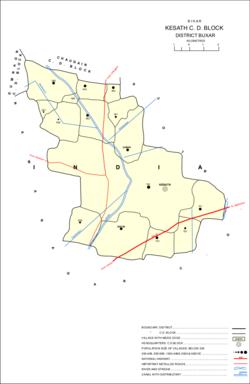
Villages
Kesath block comprises 15 villages, all of which are inhabited:[2]
This page is based on this Wikipedia article Text is available under the CC BY-SA 4.0 license; additional terms may apply. Images, videos and audio are available under their respective licenses.