Related Research Articles

Abbottabad is the capital city of Abbottabad District in the Hazara region of eastern Khyber Pakhtunkhwa, Pakistan. It is the 40th largest city in Pakistan and fourth largest in the province of Khyber Pakhtunkhwa by population. It is about 120 km (75 mi) north of Islamabad-Rawalpindi and 150 km (95 mi) east of Peshawar, at an elevation of 1,256 m (4,121 ft). Kashmir lies a short distance to the east.

Nathia Gali or Nathiagali is a hill station and mountain resort town located in the Abbottabad District of Khyber Pakhtunkhwa, Pakistan. It is located at the centre of the Galyat range, where several hill stations are situated. Nathia Gali is known for its scenic beauty, hiking tracks and pleasant weather, which is much cooler than the rest of the Galyat range due to it being at a higher altitude. It is situated approximately 32 kilometres (20 mi) away from both Murree and Abbottabad.
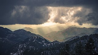
Galyat region, or hill tract, is a narrow strip or area roughly 50–80 km north-east of Islamabad, Pakistan, extending on both sides of the Khyber Pakhtunkhwa-Punjab border, between Abbottabad and Murree. The word itself is derived from the plural of the Urdu word gali, which means an alley between two mountains on both sides of which there are valleys and it is not the highest point in the range. Many of the towns in the area have the word gali as part of their names, and are popular tourist resorts. Being on linguistic and geographical continuum this area has challenged social scientists in terms of anomalous classification.

Murree is a mountain resort city, located in the Galyat region of the Pir Panjal Range, within the Murree District of Punjab, Pakistan. It forms the outskirts of the Islamabad-Rawalpindi metropolitan area, and is about 30 km (19 mi) northeast of Islamabad. It has average altitude of 2,291 metres (7,516 ft). The British built this town during their rule to escape the scorching heat in the plains of Punjab during the summer.

Namli Mera is a mountainous rural area located in Abbottabad District, Khyber Pakhtunkhwa province, Pakistan. It is one of the 51 union councils of Abbottabad District, and takes its name from the two largest hamlets in the Union Council, Namli and Mera. Its capital is New kalwan city. These settlements are nestled on mountain ridges about 20 kilometres from the city of Abbottabad, in the foothills of Miranjani, the highest peak in the district. A metalled road connects Namli Mera to the main Abbottabad—Nathia Gali road and is an alternate route to reach Nathia Gali from Abbottabad. Namli Mera is around 3 kilometres away Bagnotar on the main road.the main population area starts from chanat Al Noor masjid and along there is a famous Gull super store owned by sardar Nafees gul onward to this there is a main market named as pull market of maira kalan

Ayubia National Park, also known as Ayubia, is a protected area of 3,312 hectares (33 km2) located in Abbottabad District, Khyber Pakhtunkhwa province, Pakistan. It was declared a national park in 1984. Ayubia was named after Muhammad Ayub Khan (1958–1969), second President of Pakistan. The area supports temperate coniferous forest and temperate broadleaf and mixed forest ecoregion habitats, with an average elevation of 8,000 feet (2,400 m) above sea level. Ayubia National Park is surrounded by seven major villages and three small towns of Thandiani, Nathiagali and Khanspur. The park has been developed as a resort complex from a combination of four mini resorts of Khaira Gali, Changla Gali, Khanspur and Ghora Dhaka in Galyat. Currently, it is managed by the Wildlife and Parks Department of Government of Khyber Pakhtunkhwa.
Nawan Shehr is a town in Abbottabad District in Khyber Pakthunkhwa of Pakistan. Nawan Shehr's most famous place is Ilyasi Masjid which is the oldest and largest mosque of Abbottabad, there is also a small hill with walking tracks just behind the masjid. The weather is pleasant in summer, so people from other parts of country come to visit Abbottabad and Nawan Shehr. Board of Intermediate and Secondary Education of Abbottabad is also in Nawan Shehr. Nawan Shehr has its own old bazaar which is famous for its Chapli Kebab. The language spoken in Nawanshehr is Hindko. Gojri is also spoken in different parts.

Miranjani is the highest peak in Galyat Region which is located at the elevation of 2,992 metres (9,816 ft), in Abbottabad District of Khyber Pakhtunkhwa the Province of Pakistan. It is located in the Namli Maira area, in Ayubia National Park, 80 kilometres (50 mi) north of Islamabad in the western Himalayan range.

Changla Gali is one of the tourist mountain resort towns of the Galyat area of Pakistan. It has an elevation of 2804m. During British rule it was the headquarters of the Northern Command School of Musketry.

Dewal Manal is one of the 51 union councils of Abbottabad District in the Khyber-Pakhtunkhwa province of Pakistan.

Dalola is one of the 51 union councils (sub-divisions) of Abbottabad District in Khyber-Pakhtunkhwa province of Pakistan.
Malkot is a village of Abbottabad District in Khyber-Pakhtunkhwa province of Pakistan. Until the local government reforms of 2000 it was a Union Councils of the district.
Ghora Gali is one of the tourist mountain resort towns of the Galyat area of northern Pakistan. It has an elevation of 1691m and is located in the northeastern tip of the Punjab province of Pakistan. Ghora Gali is also a Union council, an administrative subdivision, of Murree Tehsil in Murree District and is located at 33.83°N 73.35°E. According to the 1998 census of Pakistan it had a population of 14410.
Bara Gali is one of the mountain resort towns of the Galyat and Ayubia National Park, at an altitude of 2,350 metres (7,710 ft). It is located in the Abbottabad District of Khyber Pakhtunkhwa province in northern Pakistan.

Dunga Gali is one of the towns of the Galyat area of Ayubia National Park, at an altitude of 2,500 metres (8,200 ft) in northern Pakistan. Dunga Gali is located in Nathia Gali Union Council (subdivision) of Abbottabad District in the Khyber Pakhtunkhwa Province. It is 3 kilometres (1.9 mi) from Nathia Gali.
This is about a mountain resort town in Pakistan. For the Capital of Bangladesh, see Dhaka

Abbottabad Tehsil is an administrative subdivision (tehsil) of Abbottabad District in Khyber Pakhtunkhwa province of Pakistan.
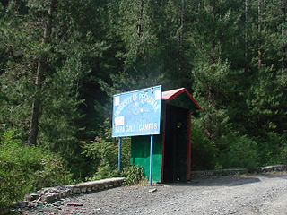
Barian is a town in Punjab (Pakistan). It is located at 33°57'0N 73°23'0E. The town is linked to the city of Abbottabad by a 71 km road via Nathia Gali, the area is often cut off during bad winter weather, in 2005 heavy snowfall had cut the roads to Khanspur and Changla Gali, and in January 2008 snow and heavy landslides cut off roads.
Beeran Gali is a Union Council of Abbottabad District, in Khyber-Pakhtunkhwa province of Pakistan. located approximately 20 km from Abbottabad city.

St Luke's Church, Abbottabad is an Anglican church dedicated to Saint Luke, now under the jurisdiction of the Peshawar Diocese of the Church of Pakistan. It was founded in the town of Abbottabad, British India, in 1864.
References
33°58′N73°24′E / 33.967°N 73.400°E
| | This Abbottabad District location article is a stub. You can help Wikipedia by expanding it. |