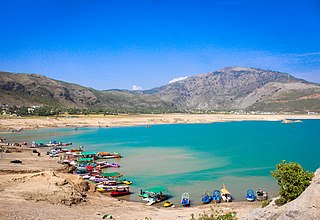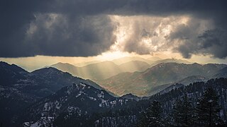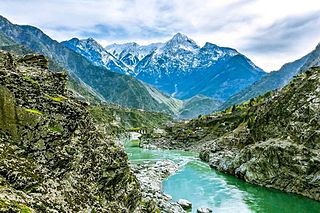
Abbottabad is a city in the Hazara Division of Khyber Pakhtunkhwa province, Pakistan. It is the 40th largest city in the country and 6th largest in the province by population, and serves as the headquarter of its namesake tehsil and district. It is about 120 km (75 mi) north of Islamabad-Rawalpindi and 150 km (95 mi) east of Peshawar, at an elevation of 1,256 m (4,121 ft). Kashmir lies a short distance to the east.

Hindko is a cover term for a diverse group of Lahnda dialects spoken by several million people of various ethnic backgrounds in several areas in northwestern Pakistan, primarily in the provinces of Khyber Pakhtunkhwa and northwestern regions of Punjab.

Haripur District is a district in the Hazara Division of Khyber Pakhtunkhwa, Pakistan. Before obtaining the status of a district in 1991, Haripur was a tehsil of Abbottabad District Its headquarters are the city of Haripur. According to 2023 Pakistani census population of Haripur District is 1,173,056.

Mansehra District is a district in the Hazara Division, Khyber Pakhtunkhwa, northern Pakistan. Mansehra city serves as the headquarters of the district. The district has a Hindkowan majority, with a significant Pashtun and Kohistani population.

Galyat region, or hill tract, is a narrow strip or area roughly 50–80 km north-east of Islamabad, Pakistan, extending on both sides of the Khyber Pakhtunkhwa-Punjab border, between Abbottabad and Murree. The word itself is derived from the plural of the Urdu word gali, which means an alley between two mountains on both sides of which there are valleys and it is not the highest point in the range. Many of the towns in the area have the word gali as part of their names, and are popular tourist resorts. Being on linguistic and geographical continuum this area has challenged social scientists in terms of anomalous classification.

Hazara Division is an administrative division of the Khyber Pakhtunkhwa province of Pakistan. It is located along the Indus River and comprises eight districts: Abbottabad, Mansehra, Haripur, Battagram, Upper Kohistan, Kolai-Palas, Lower Kohistan, Torghar and most recently created Allai District.

The Muzaffarabad District is a district of Pakistan-administered Azad Kashmir in the disputed Kashmir region. It is one of the 10 districts of this dependent territory. The district is located on the banks of the Jhelum and Neelum rivers and is very hilly. The total area of the Muzaffarabad District is 1,642 square kilometres (634 sq mi). The district is part of the Muzaffarabad Division, and the city of Muzaffarabad serves as the capital of Azad Kashmir. The district is bounded on the north-east by the Neelum District and the Kupwara district of Indian-administered Jammu and Kashmir region, on the south-east by the Hattian Bala District, on the south by the Bagh District, and on the west by the Mansehra and Abbottabad districts of Pakistan's Khyber Pakhtunkhwa Province.

Haripur is a city in the Hazara Division of Khyber Pakhtunkhwa province, Pakistan. It is the 14th largest city by population in the province, and serves as the headquarter of its namesake tehsil and district. Located some 65 km (40 mi) north of Islamabad Capital Territory and 35 km (22 mi) south of Abbottabad, Haripur is in a hilly plain area at an altitude of 520 m (1,706 ft).

Kohistan District, also known as Indus Kohistan and Hazara Kohistan, was a District within the Hazara Division of Khyber Pakhtunkhwa, Pakistan. Consisting of eastern portion of the larger Kohistan region, it was bifurcated into two districts in 2014: Upper Kohistan and Lower Kohistan. In 2017, the Lower Kohistan District was further bifurcated and a district Kolai-Palas was established. It has an area of 7,492 square kilometres (2,893 sq mi) and a population of 472,570 according to the 1998 Census.

Dhamtore is situated about 6 km east of Abbottabad, Hazara, Khyber Pakhtunkhwa, Pakistan, and is the largest village and union council of Abbottabad. Their language is Hindko which is the traditional mother tongue of the Hazara Division but in some villages especially Nagakki village, Gojri is also the mother tongue. Dhamtour village is the gateway to places like Murree, Nathiagali, Dunga Gali, Bara Gali, Ayubia National Park, Miranjani, Mukeshpuri and the most famous picnic spot of Abbottabad, Harnoi. The Union council is located in Abbottabad District in the Khyber-Pakhtunkhwa province of Pakistan.

Mansehra is a city in the Hazara Division of Khyber Pakhtunkhwa province, Pakistan. By population, it is the 71st largest city in the country and the 7th largest in the province, and serves as the headquarter of its namesake tehsil and district.

Hazara, historically known as Pakhli, is a region in northern Pakistan, falling administratively within the Hazara Division of the Khyber Pakhtunkhwa province. It forms the northernmost portion of Sindh Sagar Doab, and is mainly populated by the indigenous Hindko-speaking Hindkowans and Kohistani people, with a significant Pashto-speaking population. The inhabitants of Hazara are collectively called the Hazarewal.

Torghar District formerly known as Kala Dhaka is a district in the Hazara Division of the Khyber Pakhtunkhwa province of Pakistan. It was officially separated from Mansehra District in 2011 under Article 246 of the Constitution of the Islamic Republic of Pakistan.

Battagram is a tribal district in Hazara Division of Khyber Pakhtunkhwa province in Pakistan. The headquarter is Battagram, which is about 75 km from Mansehra city. It was part of historic Yaghistan before 1955. Later in 1955, It was merged into Pakistan and made part of neighboring Mansehra District with the status of Tehsil. It was officially separated from Mansehra District in July 1993 and was given the status of district. Battagram District was ruled by many different Khans, all belonging to the Swati tribe.
Lassan Nawab is a town situated in a long and narrow valley about 32 kilometers from Mansehra city. Lassan Nawab town is also a union council of Mansehra District in Khyber-Pakhtunkhwa province of Pakistan.

Havelian Tehsil is an administrative subdivision (tehsil) of Abbottabad District in the Khyber Pakhtunkhwa province of Pakistan.
Hazarewal or Hazarawals refer to the multi-ethnic community inhabitants of the Hazara region in Northern Pakistan. This region is known for its multi-ethnic population, comprising various ethnic groups with diverse origins.
Dhund Abbasi is a tribe found in the Abbottabad and Rawalpindi District, as well as Mansehra, Haripur, Bagh, Peshawar, Buner and Muzaffarabad districts of Khyber Pakhtunkhwa and Azad Kashmir in Pakistan. They mainly speak Punjabi or Pahari dialects, as well as Hindko.

The M-15 Motorway, also known as the Hazara Motorway, is a 180-kilometer controlled-access motorway in Pakistan. It links the Burhan Interchange near Hasan Abdal in the Punjab province with Haripur, Havelian, Abbottabad, Mansehra, Shinkiari, Battagram, and Thakot in the Hazara Division of the Khyber Pakhtunkhwa province.


