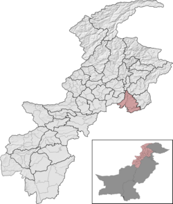
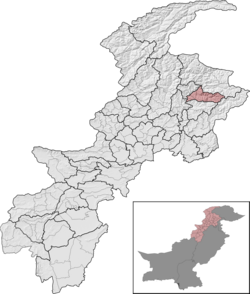
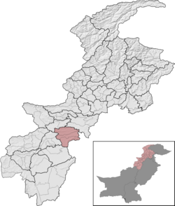
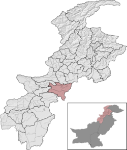
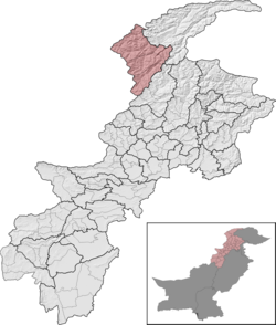
Districts of Khyber Pakhtunkhwa | |
---|---|
Location | Khyber Pakhtunkhwa, Pakistan |
Number | 38 (as of Feb 2024) |
Populations | 169,240 (Upper Chitral District) – 4,333,770 (Peshawar District) |
Areas | 454 square kilometres (175 sq mi) (Torghar District) – 9,334 square kilometres (3,604 sq mi) (Dera Ismail Khan District) |
Government | |
Subdivisions |
The province of Khyber Pakhtunkhwa, the third-largest province of Pakistan by population and the smallest province by area, is divided into 38 districts and seven divisions.
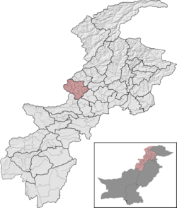
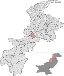
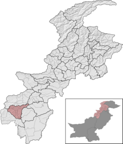
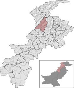
Below, you will find a detailed overview of the history of Khyber Pakhtunkhwa's districts and divisions, a map showing each district, the divisions of Khyber Pakhtunkhwa and their districts, and a list showing each district's name, the division the district belongs to, the district's area, the location of the district's headquarters, the district's population and population density (in 2017), the average annual population growth rate of each district (between 1998 and 2017), and a map showing each district's location.
Districts have formed an integral part of civil administration in the subcontinent since colonial times. When the North-West Frontier Province (the former name of Khyber Pakhtunkhwa) formed in November 1901, it was divided into five "settled districts": Bannu, Dera Ismail Khan, Hazara, Kohat, and Peshawar, and a "trans-border tract" of land which encompassed five "Political Agencies": Khyber, Kurram, Malakand, Tochi, and Wano. [1] The four districts Bannu, Dera Ismail Khan, Kohat, and Peshawar were considered "Trans-Indus" districts.
By the time of the 1941 census of British India, Tochi Agency had been renamed "North Waziristan Agency", Wana Agency had been renamed "South Waziristan Agency", and two tehsils of Peshawar District (Mardan and Swabi) were split off to form Mardan District, which became the fifth "Trans-Indus" district. [2] The six districts of the North-West Frontier Province had also all been given their own "Frontier Regions", which were tribal areas that were under the control of the deputy commissioner of an adjacent district. [2]
Upon the independence of Pakistan, the six districts of the North-West Frontier Province retained their borders and status within the province, but the five tribal agencies and six frontier regions all split off from the province, creating the Federally Administered Tribal Areas. The Federally Administered Tribal Areas was an administrative unit of Pakistan governed from Islamabad which had an area larger than the province itself. [3] [4]
In 1951, parts of Malakand Agency were split off to create the Mohmand Agency in the Federally Administered Tribal Areas. [5]
In 1954, the One Unit policy that consolidated all of West Pakistan into one province began. From 1954 to 1970, the North-West Frontier Province ceased to exist. The death of the province brought the rise of the area's first divisions (divisions had already existed in Punjab and East Bengal, but none of the other provinces had any divisions until One Unit). The area that once covered the North-West Frontier Province and Federally Administered Tribal Areas was split among two divisions: Dera Ismail Khan Division and Peshawar Division. Dera Ismail Khan Division covered Bannu District, Dera Ismail Khan District, North Waziristan Agency, and South Waziristan Agency, and Peshawar Division covered Hazara District, Kohat District, Mardan District, Peshawar District, Kurram Agency, Khyber Agency, Malakand Agency, and Mohmand Agency. [5] The frontier regions which had previously existed were absorbed into their respective districts at this time. [5]
The One Unit policy ended in 1970 and the provinces returned with their original forms (which also meant that the Federally Administered Tribal Areas and the North-West Frontier Province were separate once more, and that the Frontier Regions regained their status as administrative units). The divisions that had been created as a result of the policy stayed in the North-West Frontier Province, but were abolished entirely in the Federally Administered Tribal Areas.
By the time of the 1972 Census of Pakistan, many changes had been made to the administrative map: [6]
This meant that at the North-West Frontier Province was divided into three divisions and ten districts, while the Federally Administered Tribal Areas were divided into six Political Agencies and four Frontier Regions. The administrative divisions of the region were as follows (districts and divisions which do not exist anymore are in italic): [6]
Province/territory | Divisions | Districts |
---|---|---|
North-West Frontier Province | Dera Ismail Khan Division | |
Malakand Division | ||
Peshawar Division | ||
Federally Administered Tribal Areas | Political Agencies | |
Frontier Regions |
Throughout the years between 1972 and 1981, new divisions and districts kept on being divided and created and changes kept on being made to the administrative map: [6] [7]
Hazara Division was created out of the area that covered the now-defunct Hazara District and parts of Swat District, in Malakand Division. Hazara Division was split up into three districts, which were Abbottabad District (formed out of Abbottabad, Amb, and Haripur Tehsils of Hazara District), Kohistan District (formed out of six tehsils of Swat District and eight union councils of Batagram Tehsil (in Hazara District), and Mansehra District (formed out of Batagram Tehsil (exc. eight union councils which were given to Kohistan District) and Mansehra Tehsil in Hazara District). [6] [7]
The agency of Orakzai was created out of parts of the Frontier Region Kohat (which still existed, but was smaller) in the Federally Administered Tribal Areas. [6] [7]
This meant that by the time of the 1981 Census of Pakistan, the North-West Frontier Province had 12 districts (two more than in 1972) organized into four divisions (one more than in 1972) and the Federally Administered Tribal Areas had seven Political Agencies (one more than in 1972) and four Frontier Regions. You can find a list of them below (districts and divisions which do not exist anymore are in italic): [6] [7]
Province/territory | Divisions | Districts |
---|---|---|
North-West Frontier Province | Dera Ismail Khan Division | |
Hazara Division | ||
Malakand Division | ||
Peshawar Division | ||
Federally Administered Tribal Areas | Political Agencies | |
Frontier Regions |
Between the 1981 and 1998 censuses of Pakistan, many changes to the administrative map of the North-West Frontier Province: [7]
Dir District was split up into Lower Dir District (formed out of the sub-divisions of Dir and Wari) and Upper Dir District (formed out of the sub-divisions of Timergara and Jandool); the sub-divisions of Daggar/Buner and Alpuri were split off of Swat District to form the districts of Buner and Shangla respectively; [7]
Batagram Tehsil was separated from Mansehra District to form the new Batagram District and many union councils which were once part of Abbottabad District (most of which were part of Amb Tehsil before 1981) were absorbed into Mansehra District; what was left of Abbottabad District was divided into Haripur District (formed of Haripur Tehsil and portions of Abbottabad Tehsil) and Abbottabad District (formed of Abbottabad Tehsil excluding the portions taken by Haripur District); [7]
Mardan Division was formed out of Mardan District (formerly in Peshawar Division) and was split into the districts of Mardan (covering the area of Mardan Tehsil, part of Mardan District) and Swabi (covering the area of Swabi Tehsil, part of Mardan District); [7]
Kohat Division was formed out of Kohat District (formerly in Peshawar Division) and was split into the districts of Karak (covering the areas of Karak Tehsil and parts of Hangu and Kohat Tehsils, all of which were formerly part of Kohat District), Kohat (covering the areas of Kohat Tehsil, minus the parts of the tehsil that were absorbed into Karak District), and Hangu (covering the areas of Hangu Tehsil minus the parts of the tehsil that were absorbed into Karak District); [7]
Peshawar District was split into three districts, Charsadda (upgraded from Charsadda Tehsil), Nowshera (made from most of the area of Nowshera Tehsil), and Peshawar (made from Peshawar Tehsil and parts of the area of Nowshera Tehsil); [7]
Bannu Division was formed out of Bannu District (formerly in Dera Ismail Khan Division), and was split into the districts of Bannu (covering most of the areas of Bannu Tehsil) and Lakki Marwat (covering the area of Lakki Marwat Tehsil, along with parts of Bannu Tehsil); [7]
Dera Ismail Khan District was bifurcated into Dera Ismail Khan District (created from Dera Ismail Khan Tehsil) and Tank District (created from Tank Tehsil). [7]
As for the Federally Administered Tribal Areas, the agencies remained the same and retained the exact same borders they had in 1981, but two more frontier regions were created: Frontier Region Lakki Marwat and Frontier Region Tank. These two frontier regions were created from parts of Frontier Region Dera Ismail Khan, which was, in 1981, split up into two non-contiguous sections. The northern section was divided into Frontier Region Lakki Marwat and Frontier Region Tank upon the creation of Lakki Marwat and Tank Districts, but Frontier Region Dera Ismail Khan retained the southern section. [6] [7]
This meant that by the time of the 1998 Census of Pakistan, the North-West Frontier Province had 24 districts (twelve more than in 1981) organized into seven divisions (three more than in 1981) and the Federally Administered Tribal Areas had seven Political Agencies and six Frontier Regions (two more than in 1981). You can find a list of them below (districts and divisions which do not exist anymore are in italic): [7]
Province/territory | Divisions | Districts |
---|---|---|
North-West Frontier Province | Bannu Division | |
Dera Ismail Khan Division | ||
Hazara Division | ||
Kohat Division | ||
Malakand Division | ||
Mardan Division | ||
Peshawar Division | ||
Federally Administered Tribal Areas | Political Agencies | |
Frontier Regions |
In August 2000, all of the divisions throughout Pakistan were abolished, but were reinstated in their exact previous forms eight years later after the elections of 2008.
On the other hand, no changes occurred to the 1998 district setup for over a decade, until 2010, when the North-West Frontier Province was renamed Khyber Pakhtunkhwa. One year later, in 2011, Kala Dhaka Tehsil was separated from Mansehra District to become Torghar District, [8] the 25th district of Khyber Pakhtunkhwa. These 25 districts (the 24 districts dating to 1998 and Torghar) were the only districts recorded as a part of Khyber Pakhtunkhwa during the 2017 Census. [9]
This meant that by the time of the 2017 Census of Pakistan, Khyber Pakhtunkhwa had 25 districts (one more than in 1998) organized into seven divisions and the Federally Administered Tribal Areas had seven Political Agencies and six Frontier Regions. You can find a list of them below (districts and divisions which do not exist anymore are in italic): [9] [10]
Province/territory | Divisions | Districts |
---|---|---|
North-West Frontier Province (renamed to Khyber Pakhtunkhwa in 2010) | Bannu Division | |
Dera Ismail Khan Division | ||
Hazara Division | ||
Kohat Division | ||
Malakand Division | ||
Mardan Division | ||
Peshawar Division | ||
Federally Administered Tribal Areas | Political Agencies | |
Frontier Regions |
In 2014, Kohistan District was bifurcated into Upper Kohistan District and Lower Kohistan District, [11] but tensions on the bifurcation [12] did not resolve until late 2017 (after the 2017 census), when Kolai-Palas District was formed as well. [13] This meant that Kohistan District was still legally one administrative unit until after the time of the 2017 census (the bifurcation was delayed in light of the political tensions, and did not go through until late 2017, when Kohistan district was split into three districts).
On 31 May 2018, the Twenty-fifth Amendment to the Constitution of Pakistan was put into force. This amendment merged the Federally Administered Tribal Areas with the province of Khyber Pakhtunkhwa and changes the province's borders and layout drastically. Each of the seven agencies in the Federally Administered Tribal Areas (Bajaur, Kurram, Khyber, Mohmand, North Waziristan, Orakzai, and South Waziristan) was made into its own district and added into an adjacent division (Bajaur District became a part of Malakand Division, Khyber and Mohmand Districts joined Peshawar Division, Kurram and Orakzai Districts joined Kohat Division, North Waziristan District joined Bannu Division, and South Waziristan District joined Dera Ismail Khan Division). The six Frontier Regions joined the districts they were adjacent to (Frontier Region Bannu was incorporated into Bannu District, Frontier Region Kohat was incorporated into Kohat District etc.).
In late 2018, Chitral District, formerly the largest district in the province by area, was bifurcated into Upper Chitral District, from Mastuj Tehsil, and Lower Chitral District, from Chitral Tehsil. [14] In 2022, South Waziristan district was bifurcated into Upper South Waziristan headquarter Spinkai Karzai and Lower South Waziristan headquarter Wana.This raised the number of districts in the province to 37, where it stands to this day. You can observe the current setup in the maps and lists below.
Below you will find a list of all 38 districts in the province of Khyber Pakhtunkhwa, along with the division it belongs to, the area of the district, the population and population density of the district, the average annual population growth rate of each district (between 1998 and 2017), and a map showing its location. The districts are initially listed in alphabetical order, but they can be sorted in different ways by clicking the headers of the table.
Name | Division [10] [15] | Population (2017) [10] [16] | Total Area [7] | Population Density (2017) | Average Annual Population Growth Rate (1998 - 2017) [10] | Map |
---|---|---|---|---|---|---|
Abbottabad District | Hazara Division | 1,332,912 | 1,967 km2 (759 sq mi) | 677.64/km2 (1,755.1/sq mi) | 2.20% | |
Allai District | Hazara Division | 180,414 | 521 km2 (201 sq mi) | 350/km2 (900/sq mi) | ||
Bajaur District | Malakand Division | 1,093,684 A | 1,290 km2 (500 sq mi) | 847.82/km2 (2,195.8/sq mi) | 3.25% | |
Bannu District | Bannu Division | 1,211,006 B | 1,972 km2 (761 sq mi) | 614.10/km2 (1,590.5/sq mi) | 2.96% | |
Battagram District | Hazara Division | 476,612 | 1,301 km2 (502 sq mi) | 366.34/km2 (948.8/sq mi) | 2.33% | |
Buner District | Malakand Division | 897,319 | 1,865 km2 (720 sq mi) | 481.14/km2 (1,246.1/sq mi) | 3.05% | |
Central Dir District | Malakand Division | 595,227 | 1,483 km2 (573 sq mi) | 400/km2 (1,000/sq mi) | ||
Charsadda District | Peshawar Division | 1,616,198 | 996 km2 (385 sq mi) | 1,622.69/km2 (4,202.7/sq mi) | 2.43% | |
Dera Ismail Khan District | Dera Ismail Khan Division | 1,695,688 C | 9,334 km2 (3,604 sq mi) | 181.67/km2 (470.5/sq mi) | 3.43% | |
Hangu District | Kohat Division | 518,798 | 1,097 km2 (424 sq mi) | 472.92/km2 (1,224.9/sq mi) | 2.66% | |
Haripur District | Hazara Division | 1,003,031 | 1,725 km2 (666 sq mi) | 581.47/km2 (1,506.0/sq mi) | 1.97% | |
Karak District | Kohat Division | 706,299 | 3,371 km2 (1,302 sq mi) | 209.52/km2 (542.7/sq mi) | 2.63% | |
Khyber District | Peshawar Division | 986,973 D | 2,576 km2 (995 sq mi) | 383.14/km2 (992.3/sq mi) | 3.15% | |
Kohat District | Kohat Division | 1,112,452 E | 2,991 km2 (1,155 sq mi) | 371.93/km2 (963.3/sq mi) | 2.85% | |
Kolai-Palas District | Hazara Division | 275,461 F S [16] | 1,238 km2 (478 sq mi) | N/A | 2.71% | |
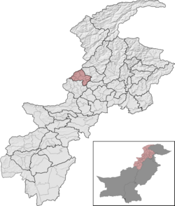
Kurram District | Kohat Division | 619,553 G | 3,380 km2 (1,310 sq mi) | 183.30/km2 (474.7/sq mi) | 1.71% | |
Lakki Marwat District | Bannu Division | 902,541 H | 3,296 km2 (1,273 sq mi) | 273.83/km2 (709.2/sq mi) | 3.18% | |
Lower Chitral District | Malakand Division | 278,122 I | 6,458 km2 (2,493 sq mi) | 43.06/km2 (111.5/sq mi) | 2.17% | |
Lower Dir District | Malakand Division | 1,435,917 | 1,583 km2 (611 sq mi) | 907.09/km2 (2,349.4/sq mi) | 3.71% | |
Lower Kohistan District | Hazara Division | 202,913 J S [16] | 850 km2 (330 sq mi) | N/A | 2.70% | |
Lower South Waziristan District | Dera Ismail Khan Division | |||||
Malakand District | Malakand Division | 720,295 | 952 km2 (368 sq mi) | 756.61/km2 (1,959.6/sq mi) | 2.47% | |
Mansehra District | Hazara Division | 1,556,460 | 4,125 km2 (1,593 sq mi) | 377.32/km2 (977.3/sq mi) | 2.47% | |
Mardan District | Mardan Division | 2,373,061 | 1,632 km2 (630 sq mi) | 1,454.08/km2 (3,766.0/sq mi) | 2.58% | |
Mohmand District | Peshawar Division | 466,984 K | 2,296 km2 (886 sq mi) | 203.39/km2 (526.8/sq mi) | 1.77% | |
North Waziristan District | Bannu Division | 543,254 L | 4,707 km2 (1,817 sq mi) | 115.41/km2 (298.9/sq mi) | 2.17% | |
Nowshera District | Peshawar Division | 1,518,540 | 1,748 km2 (675 sq mi) | 868.73/km2 (2,250.0/sq mi) | 2.94% | |
Orakzai District | Kohat Division | 254,356 M | 1,538 km2 (594 sq mi) | 165.38/km2 (428.3/sq mi) | 0.64% | |
Peshawar District | Peshawar Division | 4,333,770 N | 1,518 km2 (586 sq mi) | 2,854.92/km2 (7,394.2/sq mi) | 3.93% | |
Shangla District | Malakand Division | 757,810 | 1,586 km2 (612 sq mi) | 477.81/km2 (1,237.5/sq mi) | 2.96% | |
Swabi District | Mardan Division | 1,624,616 | 1,543 km2 (596 sq mi) | 1,052.89/km2 (2,727.0/sq mi) | 2.44% | |
Swat District | Malakand Division | 2,309,570 | 5,337 km2 (2,061 sq mi) | 432.75/km2 (1,120.8/sq mi) | 3.24% | |
Tank District | Dera Ismail Khan Division | 428,274 P | 2,900 km2 (1,100 sq mi) | 147.68/km2 (382.5/sq mi) | 2.54% | |
Torghar District | Hazara Division | 171,395 | 454 km2 (175 sq mi) | 377.52/km2 (977.8/sq mi) | -0.10% | |
Upper Chitral District | Malakand Division | 169,240 Q | 8,392 km2 (3,240 sq mi) | 20.17/km2 (52.2/sq mi) | 1.24% | |
Upper Dir District | Malakand Division | 946,421 | 3,699 km2 (1,428 sq mi) | 255.86/km2 (662.7/sq mi) | 2.64% | |
Upper Kohistan District | Hazara Division | 306,337 R [16] | 4,158 km2 (1,605 sq mi) | 73.67/km2 (190.8/sq mi) | 2.69% | |
Upper South Waziristan District | Dera Ismail Khan Division | |||||
Khyber Pakhtunkhwa, formerly known as North West Frontier Province (NWFP), is a province of Pakistan. Located in the northwestern region of the country, Khyber Pakhtunkhwa is the fourth largest province of Pakistan by land area and the third-largest province by population. It is bordered by the Pakistani provinces of Balochistan to the south, Punjab to the south-east, the territory of Gilgit-Baltistan to the north and north-east, Islamabad Capital Territory to the east and Azad Kashmir to the north-east. It shares an international border with Afghanistan to the west. Khyber Pakhtunkhwa has a varied landscape ranging from rugged mountain ranges, valleys, plains surrounded by hills, undulating submontane areas and dense agricultural farms.
The North-West Frontier Province was a province of British India from 1901 to 1947, of the Dominion of Pakistan from 1947 to 1955, and of the Islamic Republic of Pakistan from 1970 to 2010. It was established on 9 November 1901 from the north-western districts of the British Punjab, during the British Raj. Following the referendum in 1947 to join either Pakistan or India, the province voted hugely in favour of joining Pakistan and it acceded accordingly on 14 August 1947. It was dissolved to form a unified province of West Pakistan in 1955 upon promulgation of One Unit Scheme and was reestablished in 1970. It was known by this name until 19 April 2010, when it was dissolved and redesignated as the province of Khyber Pakhtunkhwa following the passing of the Eighteenth Amendment to the Constitution of Pakistan, by President Asif Ali Zardari.
North Waziristan District is a district of Khyber Pakhtunkhwa province in Pakistan. It is the northern part of Waziristan, a mountainous region of northwest Pakistan, bordering Afghanistan and covering 4,707 square kilometres (1,817 sq mi). The capital city of North Waziristan is Miranshah.
The Provincially Administered Tribal Area (PATA) was the former administrative subdivision of Pakistan designated in the Article 246(b) of the Constitution of Pakistan. No Act of Provincial Assembly can be applied to PATA whereas the Governor of the respective province has a mandate parallel to the authority President of Pakistan has over Federally Administered Tribal Areas. In 2018, a Twenty-fifth Amendment to the Constitution of Pakistan merged PATA, as well as FATA into full control of the Khyber-Paktunkhwa government, thus the PATA designation has no legal standing in the future of Khyber-Paktunkhwa.
The four provinces, capital territory, and two autonomous territories of Pakistan are subdivided into 39 administrative "divisions", which are further subdivided into districts, tehsils, and finally union councils. These divisions were abolished in 2000, but restored in 2008.
South Waziristan District was a district in the Dera Ismail Khan Division of the Khyber Pakhtunkhwa province of Pakistan, before splitting into the Lower South Waziristan District and the Upper South Waziristan District on 13 April 2022. It covers around 11,585 km2 (4,473 mi2). Waziristan is located in the southwest of Khyber Pakhtunkhwa. It is situated between two rivers, the Tochi River to the north and the Gomal River to the south. The region was an independent tribal territory from 1893, separated from both Afghanistan and the British-ruled empire in the subcontinent. Raiding the tribal areas was a constant problem for the British, requiring frequent punitive expeditions between 1860 and 1945. Troops of the British Raj coined a name for this region "Hell's Door Knocker" in recognition of the fearsome reputation of the local fighters and inhospitable terrain. The district headquarter of the South Waziristan district is Wanna. South Waziristan is divided into three administrative subdivisions of Ladha, Sarwakai, and Wanna. These three subdivisions are further divided into eight Tehsils: Ladha, Makin, Sararogha, Sarwakai, Tiarza, Wanna, Barmal, and Toi Khula.
Kohat Division is one of the seven divisions in the Khyber Pakhtunkhwa province of Pakistan. It consists of five districts: Hangu, Karak, Kohat, Kurram, and Orakzai. According to the 2017 Census of Pakistan, the division had a population of 3,211,458, making it the third-least populous division in the province. Its area is 12,377 km2 (4,779 sq mi). Thus, it is also the fourth-largest division by area in the province. Kohat is the division's largest city and its namesake. Kohat city has a population of 220,000. The division borders Bannu Division to the south and west, Peshawar Division to the north and east, the province of Punjab to the east, and Afghanistan to the northwest. CNIC code of Kohat Division is 14.
Mardan Division is one of the seven divisions in the Khyber Pakhtunkhwa province of Pakistan. It consists of two districts: Mardan and Swabi. According to the 2017 Pakistani Census, the division had a population of 3,997,667, making it the fourth-most populous division in the province. However, it only spans 3,175 km2 (1,226 sq mi) of area, which makes it the smallest division by area in the province as well. Mardan, with over 350,000 people, is the division's namesake and most populous city. The division borders Hazara Division, Malakand Division, and Peshawar Division. CNIC code of Mardan Division is 16.
Bannu Division is one of seven divisions in Pakistan's Khyber Pakhtunkhwa province. It consists of three districts: Bannu, Lakki Marwat, and North Waziristan. According to the 2017 Pakistani Census, the division had a population of 2,656,801, making it the least populous division in the province, but it spans 9,975 km2 (3,851 sq mi) of area, and this makes it the third-smallest division by area in the province. Lakki Marwat is the largest city of Bannu Division, with around 60,000 people, while the division's namesake and second-largest city is Bannu, with just under 50,000 people. The division borders Dera Ismail Khan Division to the south and west, Kohat Division to the north and east, and the province of Punjab, Pakistan to its east. CNIC code of Bannu Division is 11.
Peshawar Division is an administrative division of Khyber Pakhtunkhwa Province, Pakistan. It was abolished in the reforms of 2000, like all divisions, but reinstated in 2008. At independence in 1947, the Khyber Pakhtunkhwa was split into two divisions, Dera Ismail Khan and Peshawar. Until 1976, Peshawar Division contained the districts of Hazara and Kohat, when they both became divisions themselves. Later in the mid-1990s, the district of Mardan also became a division itself. CNIC code of Peshawar Division is 17.
Dera Ismail Khan Division is an administrative division of Khyber Pakhtunkhwa Province, Pakistan. It is the southernmost division of Khyber Pakhtunkhwa. CNIC code of Dera Ismail Khan Division is 12.
The Frontier Regions of Pakistan were a group of small administrative units in the Federally Administered Tribal Areas (FATA), lying immediately to the east of the seven main tribal agencies and west of the settled districts of Khyber Pakhtunkhwa. Each of the Frontier Regions was named after an adjoining settled district and was administered by the district coordination officer (DCO) of that adjacent district. The overall administration of the Frontier Regions was carried out by the FATA Secretariat based in Peshawar, the capital of Khyber Pakhtunkhwa. The six Frontier Regions were:
Wazir Tehsil is an administrative subdivision (tehsil) of Bannu District, Bannu Division, Khyber Pakhtunkhwa Province, Pakistan. The total population, according to the 1998 census, was 19,600, 98.1% of which have Pashto as a first language, and the remaining 1.9% speak Punjabi. Most of the population belong to the Wazir tribe of Pashtuns.
Drazanda Tehsil is an administrative subdivision (tehsil) of Dera Ismail Khan District in Khyber Pakhtunkhwa province of Pakistan. The subdivision borders South Waziristan to the north, Dera Ghazi Khan and Musa Khel to the south and Zhob to the west.
The Federally Administered Tribal Areas, commonly known as FATA, was a semi-autonomous tribal region in north-western Pakistan that existed from 1947 until being merged with the neighbouring province of Khyber Pakhtunkhwa in 2018 through the Twenty-fifth amendment to the constitution of Pakistan. It consisted of seven tribal agencies (districts) and six frontier regions, and were directly governed by the federal government through a special set of laws called the Frontier Crimes Regulations.
Jandola Tehsil is an administrative subdivision (tehsil) of Tank District in Khyber Pakhtunkhwa province of Pakistan. The subdivision borders South Waziristan to the north, south and west and Lakki Marwat District to the north-east.
On 31 May 2018, with the application of 25th Amendment, Federally Administrated Tribal Areas ceased to exist, and stood merged into neighbouring province of Khyber Pakhtunkhwa.
Hinduism is a minority religion in the Khyber Pakhtunkhwa province followed by 0.02% of the population of the province as per 2023 Census.
General elections were held in Khyber Pakhtunkhwa on Wednesday, 25 July 2018 to elect the 51 members of 15th National Assembly from Khyber Pakhtunkhwa. The Pakistan Tehreek-e-Insaf (PTI) obtained a landslide victory in the province by winning 37 general seats and increased their margin of victory from 2013. The PTI also won 8 out of 10 reserved seats while the Pakistan Muslim League (N) (PML-N) and Muttahida Majlis-e-Amal (MMA) won 1 reserved seat each.