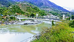
List of bridges in Pakistan

Last updated

This is a list of bridges in Pakistan.

Bridges of historical and architectural interest

ImageNameUrduDistinctionLengthTypeCarries
Crosses
OpenedLocationProvinceRef.
Chuha Gujar Bridge 91 m (299 ft) Masonry
12 arches
Chowa Gujar Lar
Bara River
1629 Peshawar
33°59′45.5″N71°37′33.4″E / 33.995972°N 71.625944°E / 33.995972; 71.625944 (Chuha Gujar Bridge)
Khyber Pakhtunkhwa [1] [2]
Pul Shah Daula (33658380704).jpg Pul Shah Daula Masonry
5 arches
Grand Trunk Road
Degh Nala
Pul Shahdaula
31°54′11.3″N74°20′23.3″E / 31.903139°N 74.339806°E / 31.903139; 74.339806 (Pul Shah Daula)
Punjab [3]
Bridge in Peshawar at Inqilab Road..jpg Bridge (Sabzi Mandi Road) Masonry
1 arch
Peshawar
34°00′56.2″N71°38′48.1″E / 34.015611°N 71.646694°E / 34.015611; 71.646694 (Bridge (Sabzi Mandi Road))
Khyber Pakhtunkhwa
Kohala Bridge2.JPG Kohala Bridge Popular for picnics organized under its arch (Kohala Picnic Point) Masonry
1 arch
Kohala
34°05′48.1″N73°29′50.6″E / 34.096694°N 73.497389°E / 34.096694; 73.497389 (Kohala Bridge)
Punjab [4]
Bridge over the Indus, built 1880.jpg Attock Bridge اٹک پل425 m (1,394 ft) Truss
2 levels, steel
1883
1929
Attock
33°52′20.8″N72°14′13.0″E / 33.872444°N 72.236944°E / 33.872444; 72.236944 (Attock Bridge)
Punjab [S 1]
[5]
Bridge Danyor2.jpg Danyor Suspension Bridge 155 m (509 ft) Suspension
Wooden deck
KKH - Gilgit Road
Hunza River
Gilgit - Danyor
35°55′30.4″N74°22′20.5″E / 35.925111°N 74.372361°E / 35.925111; 74.372361 (Danyor Suspension Bridge)
Gilgit-Baltistan [S 2]
[6]
Hussaini Bridge - Gojal HUNZA.jpg Hussaini Suspension Bridge Renowned as one of the most dangerous bridges in the world194 m (636 ft) Simple suspension bridge
Wooden deck
Footbridge
Hunza River
1968 Hussaini
36°25′25.7″N74°52′57.1″E / 36.423806°N 74.882528°E / 36.423806; 74.882528 (Hussaini Suspension Bridge)
Gilgit-Baltistan [7]
Bunji Bridge (55).jpg Bunji Bridge Simple suspension bridge 1893
2012
Bunji
35°43′47″N74°37′24″E / 35.729781°N 74.623359°E / 35.729781; 74.623359 (Bunji Bridge)
Gilgit-Baltistan
Raikot Bridge.jpg Raikot Bridge Arch bridge 2013 Diamer
35°29′35.03″N74°35′31.09″E / 35.4930639°N 74.5919694°E / 35.4930639; 74.5919694 (Raikot Bridge)
Gilgit-Baltistan

Major bridges

Image#NameUrduSpanLengthTypeCarries
Crosses
OpenedLocationProvinceRef.
SukkurBridge.jpg 1 Lansdowne Bridge (Pakistan) لینسڈائون پل250 m (820 ft)250 m (820 ft) Cantilever
Steel
Saleh Pat Road–Royal Road
Indus River
1889 SukkurRohri
27°41′37.9″N68°53′18.5″E / 27.693861°N 68.888472°E / 27.693861; 68.888472 (Lansdowne Bridge (Pakistan))
Sindh [Note 1]
[S 3]
[8]
[9]
Ayub.jpg 2 Ayub Bridge ایوب پل246 m (807 ft)310 m (1,020 ft) Arch
Steel through arch
Sukkur Railway–Rohri Railway
Indus River
1962 SukkurRohri
27°41′38.0″N68°53′17.7″E / 27.693889°N 68.888250°E / 27.693889; 68.888250 (Ayub Bridge)
Sindh [Note 1]
[S 4]
[10]
3 New Khairabad Bridge 200 m (660 ft) (x2)701 m (2,300 ft) Box girder
Prestressed concrete
111+2x200+111
2004 Attock
33°53′53.3″N72°14′04.5″E / 33.898139°N 72.234583°E / 33.898139; 72.234583 (New Khairabad Bridge)
Punjab [11] [12]
4 Karot Bridge کروٹ پل150 m (490 ft)330 m (1,080 ft) Box girder
Prestressed concrete
Kotli Road
Jhelum River
2019 KahutaHollar
33°35′26.0″N73°36′17.1″E / 33.590556°N 73.604750°E / 33.590556; 73.604750 (Karot Bridge)
Punjab
Azad Kashmir
[13]
Bridge (view from NWFP side).jpg 5 Khushal Garh Bridge خوشحال گڑھ ریلوے پل144 m (472 ft)236 m (774 ft) Truss
2 levels, steel
144+92
1907 KushalgarhBhandarbara
33°28′50.2″N71°54′34.3″E / 33.480611°N 71.909528°E / 33.480611; 71.909528 (Khushal Garh Bridge)
Khyber Pakhtunkhwa
Punjab
[14]
[15]
Under construction Bridge on Neelum River - panoramio.jpg 6 Earthquake Memorial Bridge زلزلہ یادگاری پل122 m (400 ft) (x2)473 m (1,552 ft) Extradosed
Concrete box girder deck, concrete pylon
2x122
2014 Muzaffarabad
34°20′53.3″N73°27′49.6″E / 34.348139°N 73.463778°E / 34.348139; 73.463778 (Earthquake Memorial Bridge)
Azad Kashmir [S 5]
[16]
[17]
[18]
7 Kund Bridge Besham 120 m (390 ft)188 m (617 ft) Box girder
Prestressed concrete
34+120+34
Road bridge
Indus River
Besham
34°54′22.8″N72°51′58.5″E / 34.906333°N 72.866250°E / 34.906333; 72.866250 (Kund Bridge Besham)
Khyber Pakhtunkhwa [19]
8 New Khushal Garh Bridge خوشحال گڑھ پل373 m (1,224 ft) Box girder
Prestressed concrete
2016 KushalgarhBhandarbara
33°28′54.3″N71°54′34.0″E / 33.481750°N 71.909444°E / 33.481750; 71.909444 (New Khushal Garh Bridge)
Khyber Pakhtunkhwa
Punjab
[20]
New bridge over Mangla dam.jpg 9 New Dhangali Bridge دھان گلی پل340 m (1,120 ft) Box girder
Prestressed concrete
Sahara Kashmir Road
Jhelum River
2011 Pallal Mallahan
33°21′37.7″N73°34′04.7″E / 33.360472°N 73.567972°E / 33.360472; 73.567972 (New Dhangali Bridge)
Punjab
Azad Kashmir
[21]
Thakot 2019.jpg 10 New Thakot Bridge 234 m (768 ft) Box girder
Prestressed concrete
ThakotDandai
34°48′13.4″N72°56′08.0″E / 34.803722°N 72.935556°E / 34.803722; 72.935556 (New Thakot Bridge)
Khyber Pakhtunkhwa [22]
Kowardo Suspension bridge.jpg 11 Kowardo Suspension Bridge Suspension
Wooden deck, concrete pylons
Single lane
Indus River
Skardu
35°21′37.7″N75°33′35.7″E / 35.360472°N 75.559917°E / 35.360472; 75.559917 (Kowardo Suspension Bridge)
Gilgit-Baltistan
Dhan Gali Bridge.jpg 12 Dhan Galli Bridge
dismantled
دھان گلی پل Suspension
Wooden deck, concrete pylons
Sahara Kashmir Road
Single lane
Jhelum River
Pallal Mallahan
33°21′40.6″N73°34′04.1″E / 33.361278°N 73.567806°E / 33.361278; 73.567806 (Dhangali Bridge)
Punjab
Azad Kashmir
KarakoramHighway2-2.jpg 13 Suspension Bridge (Sazin) Suspension
Steel truss deck, steel pylons
Tangir River Valley Road
Indus River
Sazin
35°31′55.7″N73°30′35.4″E / 35.532139°N 73.509833°E / 35.532139; 73.509833 (Suspension Bridge (Sazin))
Gilgit-Baltistan
Khyber Pakhtunkhwa
A fresh stream joins the might Indus River..JPG 14 Suspension Bridge (Kandia) Suspension
Steel truss deck, steel pylons
Kandia River Road
Indus River
Kandia
35°25′57.1″N73°12′16.4″E / 35.432528°N 73.204556°E / 35.432528; 73.204556 (Suspension Bridge (Kandia))
Khyber Pakhtunkhwa
Noshera, Khyber Pakhtun Khuwa, Pakistan2.jpg 15 Khairabad Bridge Box girder
Prestressed concrete
Attock
33°53′48.8″N72°14′02.3″E / 33.896889°N 72.233972°E / 33.896889; 72.233972 (Khairabad Bridge)
Punjab
16 Palak Bridge Truss
Steel
Dadyal–Mirpur Road (Kotli Road)
Poonch River
Khadamabad
33°20′27.2″N73°45′12.7″E / 33.340889°N 73.753528°E / 33.340889; 73.753528 (Palak Bridge)
Azad Kashmir
Kohala1.JPG 17 New Kohala Bridge کوہالہ پل Box girder
Prestressed concrete
KohalaBakot
34°05′46.7″N73°29′56.5″E / 34.096306°N 73.499028°E / 34.096306; 73.499028 (New Kohala Bridge)
Punjab
Khyber Pakhtunkhwa
2007 08 25 Pakistan Karakoram Highway IMG 8604.jpg 18 Youyi Bridge دوستی کا پل Suspension
Steel truss deck, concrete pylons
ThakotDandai
34°48′14.5″N72°56′11.5″E / 34.804028°N 72.936528°E / 34.804028; 72.936528 (Youyi Bridge)
Khyber Pakhtunkhwa [23]
Ghizer Ghahkoch.jpg 19 Kanchey Bridge Suspension
Steel truss deck
Gahkuch
36°10′21.8″N73°48′51.9″E / 36.172722°N 73.814417°E / 36.172722; 73.814417 (Kanchey Bridge)
Gilgit-Baltistan

Alphabetical list

This is a list of road flyovers, road overpasses, road and railway bridges in Pakistan.

Contents

See also

Notes and references

  1. 1 2 Originally, the Lansdowne Bridge was railway, the Ayub bridge took over after its entry into service in 1962 and the old bridge was then used for road traffic
  1. "Heritage site: Mughal bridge still stands tall over Bara River". The Express Tribune . 29 November 2013.
  2. Shinwari, Sher Alam (23 January 2019). "Mughal-era bridge still stands intact with past glory". Dawn Newspaper . Retrieved 22 January 2025.
  3. "Pul Shah Daula". meemainseen.com. 18 May 2017.
  4. "Muree, A City in Clouds - River Neelam". eatntravel.pk. Archived from the original on 2009-09-21.
  5. "Railway Bridge on Indus at Attock". pakistaniat.com. 4 February 2009.
  6. "Declared unsafe: Danyore bridge closed to traffic". The Express Tribune. July 2012.
  7. Nagri, Jamil (5 July 2022). "PM orders FWO to restore traffic on Skardu-Juglot road". Dawn.
  8. Waddell, John Alexander Low (1916). "Fig.25m. Landsdowne Bridge over the Indus River at Sukkur. India". In John Wiley & Sons (ed.). Bridge engineering. Vol. 1 (1st ed.). p. 595. OL   23282798M.
  9. Unwin, William Cawthorne (1911). "Bridges/History 2"  . In Chisholm, Hugh (ed.). Encyclopædia Britannica . Vol. 4 (11th ed.). Cambridge University Press. pp. 541 & 542. (3) The Lansdowne bridge (completed 1889) at Sukkur, over the Indus.
  10. "Ayub Bridge Replaces the Old Lansdowne Bridge on the Indus" (PDF). Engineering News. 7 (3). West Pakistan Engineering Congress: 5–6. September 1962.
  11. "Khairabad Bridge Over River Indus (Cantilver Box Girder) from Chablat Nowshera (N-5) for NHA". Aa-associates.com - A.A. Associates. Retrieved May 7, 2023.
  12. "New Khairabad bridge over River Indus; a masterpiece of unique technology". Brecorder . 20 May 2004.
  13. "Pakistan Karot Bridge built by ACEG is open to traffic". Aceg.com.cn - Anhui Construction Engineering Group. Retrieved May 7, 2023.
  14. Hamid, Syed Ali (June 9, 2022). "Bridging the mighty Indus - Part II". The Nation (Pakistan) . Retrieved May 7, 2023.
  15. "Railway Bridges in Pakistan". Pakistanrail.tripod.com. Retrieved May 7, 2023.
  16. "The Project for Construction of Naluchi Bridge, Muzaffarabad (2007, Islamic Republic of Pakistan)". Aec-inc.jp - Asia Engineering Consultant Co., Ltd. Archived from the original on December 18, 2013.
  17. Urgent Rehabilitation Project: West Bank Bypass Design Under the Urgent Development Study on Rehabilitation and Reconstruction in Muzaffarabad City in the Islamic Republic of Pakistan (PDF) (Report). Japan International Cooperation Agency (JICA). March 2008. p. 15.
  18. "Naluchi Earthquake Memorial Extradosed West Bank Bypass Jehlum River, Pakistan" (PDF). Wiecon Project Reference Catalogue - Bridge Design Services. p. 71.
  19. "Projects photographs". Loyaassociates.com - Loya Associates. Retrieved May 7, 2023.
  20. "Khushal Garh Bridge inaugurated at Indus River". The News International . Retrieved May 7, 2023.
  21. "Bridging the distance: Dhangali bridge over Jhelum River completed". The Express Tribune . May 10, 2011. Retrieved May 7, 2023.
  22. "Design Review and Construction Supervision of Thakot Bridge over River Indus (KKH) for NHA". Aa-associates.com - A.A. Associates. Retrieved May 7, 2023.
  23. "Sino-Pakistan Youyi Bridge Inaugurated". China Internet Information Center . Retrieved May 7, 2023.

Further reading

Related Research Articles

<span class="mw-page-title-main">Transport in Pakistan</span>

Transport in Pakistan is extensive and varied. In recent years, new national highways have been built, with the addition of motorways which have improved trade and logistics within the country. Pakistan's rail network is also undergoing expansion in recent years. Airports and seaports have been built with the addition of foreign and domestic funding. Transportation challenges in Pakistan are escalating due to poor planning, inadequate governance, and corrupt practices.

<span class="mw-page-title-main">Punjab, Pakistan</span> Province of Pakistan

Punjab is a province of Pakistan. With a population of over 127 million, it is the most populous province in Pakistan and second most populous subnational polity in the world. Located in the central-eastern region of the country, it has the largest economy, contributing the most to national GDP, in Pakistan. Lahore is the capital and largest city. Other major cities include Faisalabad, Rawalpindi, Gujranwala and Multan.

<span class="mw-page-title-main">Sukkur</span> Metropolis in Sindh, Pakistan

Sukkur is a city in the Pakistani province of Sindh along the western bank of the Indus River, directly across from the historic city of Rohri. Sukkur is the third largest city in Sindh after Karachi and Hyderabad, and 14th largest city of Pakistan by population. The city was originally founded by the Rai dynasty of Sindh. The modern city was built in the 1840s. New Sukkur was established during the British era alongside the village of Sukkur. Sukkur's hill, along with the hill on the river island of Bukkur, form what is sometimes considered the "Gate of Sindh".

<span class="mw-page-title-main">Gujranwala District</span> District in Punjab, Pakistan

Gujranwala District, is a district that is a part of the Majha region in Punjab, Pakistan. Gujranwala District is bordered by the districts of Wazirabad, Sialkot, Hafizabad and Sheikhupura. Gujranwala district has 5 National Assembly and 12 Punjab Assembly constituencies. Gujranwala is known as the city of wrestlers and famous for its food.

<span class="mw-page-title-main">N-5 National Highway</span> National highway in Pakistan

The N-5 or National Highway 5 is a 1819 km national highway in Pakistan, which extends from Karachi in Sindh to Torkham in Khyber Pakhtunkhwa.

<span class="mw-page-title-main">Lansdowne Bridge (Pakistan)</span> Indus-Bridge in Sukker, Pakistan

The Lansdowne Bridge over the Indus at Sukkur was one of the great engineering feats of the 19th century. The longest cantilever bridge ever built, it had to support the load of heavy steam locomotives. The bridge was inaugurated on 25 March 1889. The Ayub Bridge was built immediately adjacent to the bridge in 1962, to separate the road and Railway traffic. Hence the photographs of the Landsdown Bridge usually also show the Ayub Bridge.

Rail transport in Pakistan began in 1855 during the British Raj, when several railway companies began laying track and operating in present-day Pakistan. The country's rail system has been nationalised as Pakistan Railways. The system was originally a patchwork of local rail lines operated by small private companies, including the Scinde, Punjab and Delhi Railways and the Indus Steam Flotilla. In 1870, the four companies were amalgamated as the Scinde, Punjab & Delhi Railway. Several other rail lines were built shortly thereafter, including the Sind–Sagar and Trans–Baluchistan Railways and the Sind–Pishin, Indus Valley, Punjab Northern and Kandahar State Railways. These six companies and the Scinde, Punjab & Delhi Railway merged to form the North Western State Railway in 1880. Following the independence of Pakistan in 1947, the North Western Railway became Pakistan Western Railway and the rail system was reorganised in the dominion of Pakistan; some of the reorganisation was controversial. Rail use increased in early 1948, and the network became profitable. Declining passenger numbers and financial losses in the late 1980s and early 1990s prompted the closure of many branch lines and small stations. The 1990s saw corporate mismanagement and severe cuts in rail subsidies. Due to falling passenger numbers, government subsidies are necessary to keep the railways financially viable.

The city of Karachi is a major transport hub of Pakistan. The Karachi port and airport are major gateways to Pakistan. The Karachi Railway stations transports the major part of Pakistan's trade with other countries.

<span class="mw-page-title-main">Board of Intermediate and Secondary Education, Gujranwala</span> Examination board in Gujranwala, Punjab

The Board of Intermediate and Secondary Education, Gujranwala is an examination board for secondary and intermediate education in Gujranwala Division.

<i>Tezrao</i> Pakistani passenger train

Tezrao was a daily express train (5-Up/6-Down) service in Pakistan. The train ran between Karachi and Peshawar. Its name was changed to Zulfiqar Express during the Peoples Party government. After the Peoples Party government its name changed again to Tezrao. The train had economy and first-class sleeper accommodation. In 2008, its route was changed to Mardan to Karachi by the then railway minister Ghulam Ahmed Bilour .It was suspended on 20 July 2010 due to lack of locomotives.

Yousuf Raza Gillani Flyover is located in Multan city of Pakistan. Ground breaking of this flyover was done by former prime minister of Pakistan Yousuf Raza Gillani on the new year ceremony on Saturday, 31 December 2011. It was built at a cost of around Rs.1.6 billion rupees. It is the part of Inner Ring Road Multan project. It is a four lane flyover with partitions. Two one ways of two lanes each. Length of the flyover is 1.6 km. There are three extra ramps connecting to the main flyover.

The Provincial Highways of Punjab consists of all public highways maintained by the Pakistani province of Punjab. The Punjab Highway Department under the Department of Transportation maintains over 38,000 kilometres (24,000 mi) of roadways organised into various classifications which crisscross the province and provide access to major population centres. These are not to be confused with national highways which are federal roads maintained by the Government of Pakistan and the National Highway Authority.

<span class="mw-page-title-main">Karachi–Peshawar Line</span> Main railway line in Pakistan

Karachi–Peshawar Railway Line is one of four main railway lines in Pakistan, operated and maintained by Pakistan Railways. The line starts from Kiamari station in the province of Sindh and ends at Peshawar Cantonment Station in Khyber Pakhtunkhwa province. The railway track is dual between Keamari and Shahdara Bagh, Chaklala and Golra Sharif. The total length of the line is 1,687 kilometers (1,048 mi), with 176 railway stations in between. The line serves as the country's main passenger and freight line with 75% of the country's cargo and passenger traffic.

<span class="mw-page-title-main">Hinduism in Punjab, Pakistan</span> Overview of the role and impact of Hinduism in the Pakistani province of Punjab

Hinduism is a minority religion in Punjab province of Pakistan followed by about 0.19% of its population. Punjab has the second largest number of Hindus in Pakistan after Sindh. Hinduism is followed mainly in the Southern Punjab districts of Rahim Yar Khan and Bahawalpur.