
The economy of Afghanistan is listed as 103rd in the world in terms of gross domestic product (GDP) based on purchasing power parity (PPP). With a population of nearly 40 million people, Afghanistan's GDP (PPP) stands at around $70 billion with an exchange rate of $20 billion (2017), and the GDP (PPP) per capita is about $2,000. Its total external debt is 1.4 billion as of 2022. The Afghan economy has been steadily increasing in the last two decades mainly due to the influx of millions of expats, improvement of national infrastructure, establishment of more trade routes with neighboring and regional countries, and expansion of the nation's agriculture and mining.

Transport in Afghanistan is done mostly by road, rail and air. Much of the nation's road network was built in the mid-20th century but left to ruin during the last two decades of that century due to war and political turmoil. Officials of the current Islamic Emirate have continued to improve the national highways, roads, and bridges. In 2008, there were about 700,000 vehicles registered in Kabul.

Nangarhār also called Nangrahar or Ningrahar, is one of the 34 provinces of Afghanistan, located in the eastern part of the country and bordering Logar, Kabul, Laghman and Kunar provinces as well as having an international border with Pakistan. It is divided into 22 districts and has a population of about 1,735,531, the third highest of the country's 34 provinces. The city of Jalalabad is the capital of Nangarhar province. Nangarhar province is famous for fish and karaye, and the popular tourist locations Daroonta and Pul-e- Sayad.

The Panj, traditionally known as the Ochus River and also known as Pyandzh, is a tributary of the Amu Darya. The river is 921 kilometres (572 mi) long and has a basin area of 114,000 square kilometres (44,000 sq mi). It forms a considerable part of the Afghanistan–Tajikistan border.

The Afghanistan–Uzbekistan Friendship Bridge is a road and rail bridge across the river Amu Darya, connecting the town of Hairatan in the northern Balkh province of Afghanistan with Termez in the Surxondaryo Region of Uzbekistan. The bridge was built by the Soviet Union and opened in 1982 to supply its forces who were based in Afghanistan at the time. It is used today for trade and travel purposes between the two countries.

The Tajikistan–Afghanistan Friendship Bridge connects the two banks of Darvaz region across the Panj River separating Tajikistan and Afghanistan, at the town of Qal'ai Khumb. It was opened on 6 July 2004.

Jalalabad Airport, also known as Nangarhar Airport, is located next to the Kabul–Jalalabad Road, about 3 miles (4.8 km) southeast of Jalalabad, which is the capital of Nangarhar Province in Afghanistan. It is a domestic airport under the country's Ministry of Transport and Civil Aviation (MoTCA), and serves the population of not only Nangarhar but also neighboring Kunar, Nuristan and Laghman provinces. It is also used by the Ministry of Defense for military purposes. Security in and around the airport is provided by the Afghan National Security Forces.
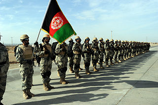
The following lists events that happened during 2004 in Afghanistan.

Afghanistan has three railway lines in the north of the country. The first is between Mazar-i-Sharif and the border town of Hairatan in Balkh province, which then connects with Uzbek Railways of Uzbekistan. The second links Torghundi in Herat province with Turkmen Railways of Turkmenistan. The third is between Turkmenistan and Aqina in Faryab province of Afghanistan, which extends south to the city of Andkhoy. The country currently lacks a passenger rail service, but a new rail link from Herat to Khaf in Iran for both cargo and passengers was recently completed. Passenger service is also proposed in Hairatan – Mazar-i-Sharif section and Mazar-i-Sharif – Aqina section.

Sher Khan or Shir Khan is a border town in the northern Kunduz Province of Afghanistan, next to the Panj River. The town's main attraction is the Sher Khan Bandar, which is a dry port and border checkpoint that officially connects by road Afghanistan with Tajikistan. It is located about 8 kilometres (5.0 mi) northwest from the center of the town. The city of Kunduz is about 60 kilometres (37 mi) of driving distance south from Sher Khan Bandar. The historical name of the town was Qizil Qalah. It was given the current name in honor of Sher Khan Nashir, Khan of the Nashers.

The following outline is provided as an overview of and topical guide to Afghanistan:

Hairatan is a border town in northern Balkh Province of Afghanistan. The Hairatan dry port and border checkpoint is located in the eastern section of the town. It sits along the Amu Darya river in the Kaldar District of Balkh province. The river forms the border with neighboring Uzbekistan, and the two nations are connected by the Afghanistan–Uzbekistan Friendship Bridge. The city of Termez in Uzbekistan is a short distance away to the northwest of Hairatan, on the other side of the Amu Darya river.
The Afghan Border Force (ABF) was responsible for security of Afghanistan's border area with neighboring countries extending up to 30 miles (48 km) into the interior and formed part of the Afghan National Army. In December 2017, most of the Afghan Border Police (ABP) personnel of the Afghan National Police were transferred to the Afghan National Army to form the Afghan Border Force. The ABP retained 4,000 personnel for customs operations at border crossings and international airports such as checking documents of foreigners entering the country or deporting them.
Ludin are progenited by Syed Muhammad Masood (Mashwani) from his grand son Hassan Allauddin. and settled among the area of Ghurghasht tribe of Pashtuns. They are scattered all over Afghanistan and can be found in most of the major cities.
Eastern Afghanistan Operations was when Uzbek Khan and Muhammad Shaybani surrounded Kandahar, Babur found his developing Kingdom of Kabul in danger. He feared that Kabul would be the next target of the Uzbeks. Having consulted with his men, he decided the only way out was to leave to India. Babur's second Indian expedition, became an operation monitoring Kabul, traveling around eastern provinces of Afghanistan to subdue rebellious Afghans and plunder towns and villages for supplies for his army's survival.
The Islamic State–Taliban conflict is an ongoing armed conflict between the Islamic State and the Taliban in Afghanistan. The conflict escalated when militants who were affiliated with Islamic State – Khorasan Province killed Abdul Ghani, a senior Taliban commander in Logar province on 2 February 2015. Since then, Taliban and IS-KP have engaged in clashes over the control of territory, mostly in eastern Afghanistan, but clashes have also occurred between the Taliban and IS-KP cells which are located in the north-west and south-west.
This article documents the timeline of the COVID-19 pandemic in Afghanistan.
2021 (MMXXI) was a common year starting on Friday of the Gregorian calendar, the 2021st year of the Common Era (CE) and Anno Domini (AD) designations, the 21st year of the 3rd millennium and the 21st century, and the 2nd year of the 2020s decade.


