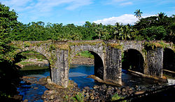
This is a list of bridges in the Philippines. This list includes notable viaducts or landbridges built over land mass, on coastal areas, riverbanks and on diversion roads.
Name | Distinction | Length | Type | Carries Crosses | Opened | Location | Region | Ref. | ||
---|---|---|---|---|---|---|---|---|---|---|
1 | Malagonlong Bridge | National Cultural Treasure National Historical Landmark | 136 m (446 ft) | Masonry 5 semi-circular arches | Dumaca River | 1850 | Tayabas 14°00′46.6″N121°37′00.6″E / 14.012944°N 121.616833°E | Calabarzon | [1] [2] | |
2 | Puente Colgante (Manila) dismantled in 1939 | 110 m (360 ft) | Suspension Wooden deck, masonry pylons | 1852 | Manila 14°35′43.6″N120°58′55.9″E / 14.595444°N 120.982194°E | Metro Manila | [3] [4] |
This table presents a non-exhaustive list of the road and railway bridges with spans greater than 100 metres (328 ft) or total lengths longer than 5,000 metres (16,404 ft).
This table presents a non-exhaustive list of the road and railway bridges with spans greater than 100 metres (328 ft) or total lengths longer than 1,000 metres (3,281 ft).
Transportation in the Philippines covers the transportation methods within this archipelagic nation of over 7,500 islands. From a previously underdeveloped state of transportation, the government of the Philippines has been improving transportation through various direct infrastructure projects, and these include an increase in air, sea, road, and rail transportation and transport hubs.
Cebu City, officially the City of Cebu, is a 1st class highly urbanized city in the Central Visayas region of the Philippines. It is the capital of the province of Cebu, where it is geographically located but is one of three cities that are administratively independent of the provincial government. According to the 2020 census, it has a population of 964,169 people, making it the sixth-most populated city in the nation and the most populous in the Visayas.
Lapu-Lapu City, officially the City of Lapu-Lapu, is a 1st class highly urbanized city in the Central Visayas region of the Philippines. According to the 2020 census, it has a population of 497,604.
Mandaue, officially the City of Mandaue, is a 1st class highly urbanized city in the Central Visayas region of the Philippines. According to the 2020 census, it has a population of 364,116 people.
The San Juanico Bridge is part of the Pan-Philippine Highway and stretches from Samar to Leyte across the San Juanico Strait in the Philippines. Its longest length is a steel girder viaduct built on reinforced concrete piers, and its main span is of an arch-shaped truss design. Constructed during the administration of President Ferdinand Marcos through Japanese Official Development Assistance loans, it has a total length of 2.16 kilometers (1.34 mi)—the second longest bridge spanning a body of seawater in the Philippines after the Cebu-Cordova Bridge. It was also the longest bridge in the Philippines upon its opening in 1973, surpassed in 1976 by Candaba Viaduct of North Luzon Expressway (NLEX), another bridge that connects from one province to another, connecting the provinces of Pampanga and Bulacan.
Marcelo Fernan Bridge, also known as Second Cebu–Mactan Bridge and the Second Bridge locally, is an extradosed cable-stayed bridge located in Metro Cebu in the Philippines. It crosses Mactan Channel connecting Mandaue in mainland Cebu to Lapu-Lapu City in Mactan Island. It is currently the second-longest cable-stayed bridge in the Philippines after Cebu–Cordova Link Expressway which also crosses the Mactan Channel. Before it was named the Marcelo Fernan Bridge, it was also called the Consolacion Bridge, owing to its proximity to the municipality of Consolacion, which is 1.6 miles (2.6 km) from the north end of the bridge. It is one of three bridges crossing Mactan Channel, the others being Mactan–Mandaue Bridge and the aforementioned Cebu–Cordova Link Expressway.
Rail transportation in the Philippines is currently used mostly to transport passengers within Metro Manila and provinces of Laguna and Quezon, as well as a commuter service in the Bicol Region. Freight transport services once operated in the country, but these services were halted. However, there are plans to restore old freight services and build new lines. From a peak of 1,100 kilometers (680 mi), the country currently has a railway footprint of 533.14 kilometers (331.28 mi), of which only 129.85 kilometers (80.69 mi) are operational as of 2024, including all the urban rail lines. World War II, natural calamities, underspending, and neglect have all contributed to the decline of the Philippine railway network. In the 2019 Global Competitiveness Report, the Philippines has the lowest efficiency score among other Asian countries in terms of efficiency of train services, receiving a score of 2.4, and ranking 86th out of 101 countries globally. The government is currently expanding the railway network up to 1,900 kilometers (1,200 mi) by 2022 through numerous projects.
Metropolitan Cebu, or simply Metro Cebu,, is the main urban center of the province of Cebu in the Philippines. Metro Cebu is located along the central eastern portion of the island including the nearby island of Mactan. It accounts for 19.9 percent of the land area and 61.5 percent of the population of the entire province of Cebu.
The Mactan–Mandaue Bridge, officially known as Serging Veloso Osmeña Jr. Bridge, also known as the First Cebu–Mactan Bridge and First Bridge locally, is a truss bridge that crosses the Mactan Channel and connects the cities of Mandaue and Lapu-Lapu City in Metro Cebu, Philippines. It is one of three bridges that span across the Mactan Channel, the other being the Marcelo Fernan Bridge and the Cebu–Cordova Link Expressway, and connects the islands of Cebu and Mactan.
Alabang–Zapote Road is a four-lane national road which travels east–west through the southern limits of Metro Manila, Philippines. It runs parallel to Dr. Santos Avenue in the north and is named for the two barangays that it links: Alabang in the city of Muntinlupa and Zapote in both the cities of Bacoor and Las Piñas.
The Marcos Bridge is a road bridge that connects the Barangays of Calumpang and Barangka in Marikina in Metro Manila, Philippines
The Philippine highway network is a network of national roads owned and maintained by the Department of Public Works and Highways (DPWH) and organized into three classifications according to their function or purpose: national primary, secondary, and tertiary roads. The national roads connecting major cities are numbered from N1 to N83. They are mostly single and dual carriageways linking two or more cities.
The Cebu–Cordova Link Expressway (CCLEX), also known as the Cebu–Cordova Bridge and the Third Cebu–Mactan Bridge, is an 8.9-kilometer (5.5 mi) toll bridge expressway in Metro Cebu, Philippines. The bridge connects the South Road Properties in Cebu City in mainland Cebu, and Cordova, on Mactan island. Crossing the Mactan Channel, it is the third road link between Cebu and Mactan islands, and the first between Cebu City and Cordova. It is the longest sea-crossing bridge in the Philippines, surpassing the 2-kilometer (1.2 mi) San Juanico Bridge between Samar and Leyte, as well as Marcelo Fernan Bridge as the longest cable-stayed bridge in the Philippines. It also surpassed the 5-kilometer (3.1 mi) Candaba Viaduct of North Luzon Expressway (NLEX) connecting the provinces of Pampanga and Bulacan for being the longest bridge in the Philippines overall upon its inauguration on April 27, 2022.
The Metro Manila Subway, formerly known as the Mega Manila Subway (MMS), is an under-construction underground rapid transit line in Metro Manila, Philippines. The 36-kilometer (22 mi) line, which will run north–south between Valenzuela, Quezon City, Pasig, Taguig, Parañaque and Pasay, consists of 15 stations between the East Valenzuela and Bicutan stations. It will become the country's second direct airport rail link after the North–South Commuter Railway, with a branch line to Ninoy Aquino International Airport.
The Philippine expressway network, also known as the High Standard Highway Network, is a controlled-access highway network managed by the Department of Public Works and Highways (DPWH) which consists of all expressways and regional high standard highways in the Philippines.
The Guadalupe Bridge is a road bridge that connects the cities of Makati and Mandaluyong in Metro Manila, Philippines
The LRTA 1100 class is the second-generation class of high-floor light rail vehicles of the Light Rail Transit Authority (LRTA) in Manila, Philippines, which began operation in 1999.
The North–South Commuter Railway (NSCR), also known as the Clark–Calamba Railway, is a 147-kilometer (91-mile) urban rail transit system under construction in the island of Luzon in the Philippines. Running from New Clark City in Capas to Calamba, Laguna with 36 stations and four services, the railway is designed to improve connectivity within the Greater Manila Area, and it will be integrated with the railway network in the region.
The Historic Bridges of Romblon are a group of bridges that were built during the Spanish and American colonial era over the Casalogan River in the town of Romblon, Romblon in the Philippines. In March 2013, these bridges were declared an Important Cultural Property by the Philippine government and was placed under the protection and conservation of the National Museum of the Philippines.
The Build! Build! Build! Infrastructure Program (BBB) was the infrastructure program of the administration of Rodrigo Duterte, the 16th president of the Philippines. A key component of his socioeconomic policy, the program aimed to reduce poverty, encourage economic growth and reduce congestion in Metro Manila, and address the country's infrastructure gap. Launched on April 18, 2017, the program also included the continuation of 44 infrastructure projects under previous administrations.