Agusan River

Last updated

Agusan River
Rio Grande de Agusan
Mighty Agusan.jpg
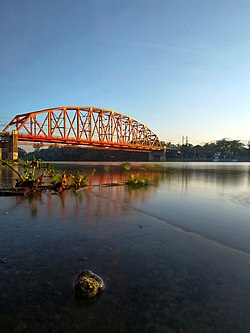
The Agusan River and Magsaysay Bridge in 2019
Agusan river watershed.png
Agusan River drainage basin
Philippines relief location map (Mindanao).svg
Red pog.svg
Agusan River mouth
Philippines relief location map (square).svg
Red pog.svg
Agusan River (Philippines)
Location
Country Philippines
Region
Province Agusan del Sur
Cities/municipalities
Physical characteristics
Source Mount Tagubud, Pantukan, Davao de Oro
  location Davao del Norte
  coordinates 7°26′35″N126°13′16″E / 7.443°N 126.221°E / 7.443; 126.221
  elevation1,022 m (3,353 ft)
Mouth Butuan Bay
  location
Butuan
  coordinates
9°01′00″N125°30′40″E / 9.01667°N 125.51111°E / 9.01667; 125.51111
  elevation
0 m (0 ft)
Length349 km (217 mi) [1]
Basin size11,937 km2 (4,609 sq mi) [2]
Basin features
Tributaries 
  left
  right

The Agusan River is third longest river in the Philippines, located in the north-eastern part of Mindanao island, draining majority of the Caraga region and some parts of Davao de Oro. It is the country's third largest river (after the Cagayan River and Rio Grande de Mindanao) with a total drainage area of 11,937 square kilometres (4,609 sq mi) [2] and an estimated length of 349 kilometres (217 mi) from its origin. [1] [3] [4]

Contents

Geography

The headwaters of the river are found in the mountains of Davao de Oro, near its border with Davao Oriental and east of Tagum. It flows through the wide Agusan River valley which measures 177 kilometers (110 mi) from south to north and varies from 32–48 kilometers (20–30 miles) in width. [5] It finally drains into Butuan Bay at its mouth in Butuan.

One of the prominent features in the Agusan River basin is the presence of the Agusan Marsh covering a total area of 19,197 hectares (47,440 acres). The marsh serves a flood retention basin for the Agusan River, cutting the high discharge of water causing flash floods in the lower reaches of the river. Aside from that, the marsh harbors unique and pristine habitats like the sago and peat swamps forest and is a home to endangered and endemic flora and fauna. As a consequence, it was designated a wildlife sanctuary by then-President Fidel V. Ramos in 1996. [4]

Watershed

The Agusan River basin is divided into three sub-basins on the basis of topographic features: the upper Agusan River basin, the middle Agusan River basin, and the lower Agusan River basin. The upper Agusan River basin is the section from its headwaters in the mountains of Davao de Oro to Santa Josefa, Agusan del Sur to Veruela, Agusan del Sur, the middle Agusan River basin is the section of the river from Santa Josefa to Amparo, Agusan del Sur while the lower Agusan River basin is from Amparo to its mouth at Butuan.

See also

Related Research Articles

<span class="mw-page-title-main">Mindanao</span> Island in the Philippines

Mindanao is the second-largest island in the Philippines, after Luzon, and seventh-most populous island in the world. Located in the southern region of the archipelago, the island is part of an island group of the same name that also includes its adjacent islands, notably the Sulu Archipelago. According to the 2020 census, Mindanao has a population of 26,252,442 people, while the entire island group has an estimated population of 27,021,036 according to the 2021 census.

<span class="mw-page-title-main">Geography of the Philippines</span>

The Philippines is an archipelago that comprises 7,641 islands with a total land area of 300,000 square kilometers (115,831 sq mi). It is the world's fifth largest island country. The eleven largest islands contain 95% of the total land area. The largest of these islands is Luzon at about 105,000 square kilometers (40,541 sq mi). The next largest island is Mindanao at about 95,000 square kilometers (36,680 sq mi). The archipelago is around 800 kilometers (500 mi) from the Asian mainland and is located between Taiwan and Borneo.

<span class="mw-page-title-main">Bukidnon</span> Province in Northern Mindanao, Philippines

Bukidnon, officially the Province of Bukidnon, is a landlocked province in the Philippines located in the Northern Mindanao region. Its capital is the city of Malaybalay. The province borders, clockwise from the north, Misamis Oriental, Agusan del Sur, Davao del Norte, Cotabato, Lanao del Sur, and Lanao del Norte. According to the 2020 census, the province is inhabited by 1,541,308 residents. The province is composed of 2 component cities and 20 municipalities. It is the third largest province in the country in terms of total area of jurisdiction behind Palawan and Isabela respectively.

<span class="mw-page-title-main">Agusan del Norte</span> Province in Caraga, Philippines

Agusan del Norte, officially the Province of Agusan del Norte, is a province in the Caraga region of the Philippines. Its capital is the city of Cabadbaran with several government offices located in the city of Butuan. It is bordered on the northwest by Butuan Bay; northeast by Surigao del Norte; mid-east by Surigao del Sur; southeast by Agusan del Sur, and southwest by Misamis Oriental.

<span class="mw-page-title-main">Agusan del Sur</span> Province in Caraga, Philippines

Agusan del Sur, officially the Province of Agusan del Sur, is a province in Caraga region, Mindanao, Philippines. Its capital is the municipality of Prosperidad. It is bordered on the northwest by Agusan del Norte and Misamis Oriental; east by Surigao del Sur; southeast by Davao Oriental; mid-south by Davao de Oro; southwest by Davao del Norte and, mid-west by Bukidnon. It is the fourth largest province in the country in terms of area.

<span class="mw-page-title-main">Surigao del Norte</span> Province in Caraga, Philippines

Surigao del Norte, officially the Province of Surigao del Norte, is a province in the Philippines located in the Caraga region of Mindanao. The province was formerly under the jurisdiction of Region 10 until 1995. Its capital is Surigao City. The province comprises two major islands—Siargao and Bucas Grande—in the Philippine Sea, plus a small area at the northeastern tip of mainland Mindanao and other surrounding minor islands and islets. This mainland portion borders Agusan del Norte – between the Municipality of Alegria in Surigao del Norte and the Municipality of Kitcharao in Agusan del Norte; and the province of Surigao del Sur, to the south.

<span class="mw-page-title-main">Surigao del Sur</span> Province in Caraga, Philippines

Surigao del Sur, officially the Province of Surigao del Sur, is a province in the Philippines located in the Caraga region in Mindanao. Its capital is Tandag City. Surigao del Sur is situated at the eastern coast of Mindanao and faces the Philippine Sea to the east.

<span class="mw-page-title-main">Caraga</span> Administrative region of the Philippines

Caraga, officially the Caraga Administrative Region and designated as Region XIII, is an administrative region in the Philippines occupying the northeastern section of Mindanao. The region was created through Republic Act No. 7901 on February 23, 1995. The region comprises five provinces: Agusan del Norte, Agusan del Sur, Dinagat Islands, Surigao del Norte, and Surigao del Sur; six cities: Bayugan, Bislig, Butuan, Cabadbaran, Surigao and Tandag; 67 municipalities and 1,311 barangays. Butuan, the most urbanized city in Caraga, serves as the regional administrative center.

<span class="mw-page-title-main">Sibagat</span> Municipality in Agusan del Sur, Philippines

Sibagat, officially the Municipality of Sibagat, is a 1st class municipality in the province of Agusan del Sur, Philippines. According to the 2020 census, it has a population of 33,957 people.

<span class="mw-page-title-main">Butuan</span> Highly urbanized city in Agusan del Norte, Philippines

Butuan, officially the City of Butuan, is a 1st class highly urbanized city in the region of Caraga, Philippines. It is the de facto capital of the province of Agusan del Norte where it is geographically situated but has an administratively independent government. According to the 2020 census, it has a population of 372,910 people.

<span class="mw-page-title-main">Magallanes, Agusan del Norte</span> Municipality in Agusan del Norte, Philippines

Magallanes, officially the Municipality of Magallanes, is a 4th class municipality in the province of Agusan del Norte, Philippines. According to the 2020 census, it has a population of 22,293 people.

The legislative district of Agusan was the representation of the historical province of Agusan in the various national legislatures of the Philippines until 1969. Butuan also remained part of the province's representation even after becoming a chartered city in 1950.

The Wawa River is a river located in Caraga, in northeastern Mindanao, in the southern Philippine island. Its headwaters traverse the municipality of Sibagat, Bayugan, and Esperanza. The Wawa River is a tributary of the larger Agusan River.

<span class="mw-page-title-main">Surigao (province)</span> Former province of the Philippines

Surigao was a province of the Philippines. Originally a Spanish-era district, became a chartered province on May 15, 1901. The province was dissolved on 1960.

<span class="mw-page-title-main">Butuan–Cagayan de Oro–Iligan Road</span>

The Butuan–Cagayan de Oro–Iligan Road, or Butuan–Cagayan de Oro–Iligan–Tukuran Road, is a 416-kilometer (258 mi), two-to-six lane major thoroughfare, connecting the provinces of Agusan del Norte, Misamis Oriental, Lanao del Norte, and Zamboanga del Sur.

Mount Diwata, colloquially nicknamed as Diwalwal, is a remote 1,261-metre (4,137 ft) high range of volcanic mountain and biodiversity area in Davao Region in the eastern part of Mindanao island of Philippines. Rich in gold and copper ores and mines, it is spread across the 3 municipalities: (a) Monkayo in the province of Davao de Oro; as well as (b) Cateel and (c) Boston in the province of Davao Oriental. Laguna Copperplate Inscription, the oldest written document in Philippines dated to 900 CE, refers to Mount Diwata.

<span class="mw-page-title-main">Mindanao Railway</span> Proposed inter-city rail system in Philippines

The Mindanao Railway, previously known as the Trans-Mindanao High Speed Railway, is a proposed inter-city rail system in Mindanao, the southernmost major island of the Philippines. Originally proposed in 1936 as part of Manuel L. Quezon's efforts to strengthen the presence of Commonwealth government in Mindanao against the rising influence of Imperial Japan before World War II, the line was shelved. Other proposals and studies were made in the 1950s, 1990s, and the 2000s, but never materialized. The current line began development in 2018, with construction set to begin in late 2021. It will be initially built as a single-track standard gauge system to be operated by diesel-powered rolling stock, but will have provisions for upgrading to double-track and electrification through overhead lines.

The Andanan River is a stream located in Sibagat, Agusan del Sur and Bayugan, Caraga Region, Philippines. It is a tributary of the larger Wawa River.

The Boguko River is a stream located in Sibagat, Agusan del Sur, Caraga Region, Philippines. It is a tributary of the larger Wawa River with headwaters located in the mountain boundaries of Sibagat and the Province of Surigao del Sur.

The Tago River is a stream located in Sibagat, Agusan del Sur, and the municipalities of San Miguel and Tago, Surigao del Sur, Caraga Region, in northeastern Mindanao, in southern Philippines.

References

  1. 1 2 Kenneth Kimutai too (July 24, 2018). "Longest Rivers In The Philippines". worldatlas.com. WorldAtlas. Retrieved September 9, 2019.
  2. 1 2 Vicente B. Tuddao Jr. (September 21, 2011). "Water Quality Management in the Context of Basin Management: Water Quality, River Basin Management and Governance Dynamics in the Philippines" (PDF). www.wepa-db.net. Department of Environment and Natural Resources. Retrieved April 10, 2017.
  3. Kundel, Jim (June 7, 2007). "Water profile of Philippines". Encyclopedia of Earth. Archived from the original on September 21, 2008. Retrieved September 30, 2008.
  4. 1 2 "Technical Assistance To The Republic of the Philippines For A Master Plan For the Agusan River Basin" (PDF). Asian Development Bank. December 2004. Archived from the original (PDF) on July 13, 2007. Retrieved August 9, 2008.
  5. Plains of Mindanao

Commons-logo.svg Media related to Agusan River at Wikimedia Commons