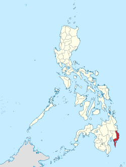
Davao Oriental

Last updated

Davao Oriental
Province of Davao Oriental
Sleeping Dinosaur.JPG
Mount Hamiguitan peak.JPG
Aliwagwag falls serenity.jpg
Dahican Beach, Mati City 2.jpg
Subangan Museum.jpg
Capitol Hill Mati.JPG
Flag of Davao Oriental.svg
Official Seal of Davao Oriental.svg
Etymology: Davao Oriental (i.e., "Eastern Davao")
Nickname(s): 
Sunrise and Coconut Capital of the Philippines [1] [2]
Anthem: Banwa na Madayaw
Davao Oriental in Philippines.svg
Location in the Philippines
OpenStreetMap
Davao Oriental
Coordinates: 7°10′N126°20′E / 7.17°N 126.33°E / 7.17; 126.33
Country Philippines
Region Davao Region
Founded May 8, 1967
Capital
and largest city
Mati
Government
   Governor Niño Sotero L. Uy Jr. (Nacionalista Party)
   Vice Governor Nelson L. Dayanghirang Jr. (Nacionalista Party)
   Legislature Davao Oriental Provincial Board
Area
[3]
  Total5,679.64 km2 (2,192.92 sq mi)
  Rank14th out of 81
Highest elevation1,728 m (5,669 ft)
Population
 (2020 census) [4]
  Total576,343
  Rank54th out of 81
  Density100/km2 (260/sq mi)
   Rank70th out of 81
Demonym Eastern Davaoeño
Divisions
   Independent cities 0
   Component cities
1
   Municipalities
   Barangays 183
   Districts Legislative districts of Davao Oriental
Time zone UTC+8 (PHT)
ZIP code
8200–8210
IDD : area code +63(0)87
ISO 3166 code PH-DAO
Spoken languages
Income classification1st class
Website www.davaooriental.gov.ph OOjs UI icon edit-ltr-progressive.svg

Davao Oriental (Cebuano : Sidlakang Dabaw; Filipino : Silangang Davao), officially the Province of Davao Oriental (Cebuano : Lalawigan sa Sidlakang Dabaw, Lalawigan sa Davao Oriental; Filipino : Lalawigan ng Silangang Davao, Lalawigan ng Davao Oriental), is a province in the Philippines located in the Davao Region in Mindanao. Its capital is the city of Mati, and it borders the province of Davao de Oro to the west, and Agusan del Sur and Surigao del Sur to the north. The province is the traditional homeland of the Mandaya and Kalagan/Kaagan.

Contents

Davao Oriental is the easternmost province in the country with Pusan Point in the municipality of Caraga as the easternmost location. The Philippine Sea, part of the Pacific Ocean, faces Davao Oriental to the east. Part of the province lies on an unnamed peninsula that encloses Davao Gulf to the west.

The province is the top producer of coconut and copra in the country, earning the province the title Coconut Capital of the Philippines. [1] [2] It is also home to Mount Hamiguitan Wildlife Sanctuary, a UNESCO World Heritage Site.

Etymology

The name of the province was derived from the word, Dabaw, of which the center was west of the province.

History

Early history

The present territory of Davao Oriental was covered by the historical region of Caraga, which was under the Sultanate of Maguindanao.

Spanish colonial era

The Spaniards established a permanent settlement in the region in 1591, and in 1844, the area was ceded by the Sultanate to Spain. An expedition was sent by the colonial government in Manila in 1847 to control the region, led by the Spaniard Jose Oyanguren, who settled in the town of Davao and organized the surrounding areas into the province of Nueva Guipozcoa in 1849. The province existed until 1858, when the politico-military commandancias of Davao and Bislig were created in its place. Bislig was incorporated into the District of Davao two years later. [5]

American colonial era

Davao province in 1918 encompassing the current provinces of Davao Region Davao province 1918 map.JPG
Davao province in 1918 encompassing the current provinces of Davao Region

In 1903, the colonial American government created the Moro Province comprising several districts, one of which was Davao. The Moro province was converted in 1914 into the Department of Mindanao and Sulu, and its component districts were made into independent provinces. [5]

Japanese occupation

In 1942, the territory of what is now Davao Oriental was occupied by the Japanese Imperial forces.[ further explanation needed ]

In 1945, the Battle of Davao began with the combined forces of the British, Australian, Dutch and the Filipino troops of the 6th, 101st, 102nd, 103rd, 104th, 106th, 107th and 110th Infantry Division of the Philippine Commonwealth Army and 10th Infantry Regiment of the Philippine Constabulary being supported by Davaoeño guerrilla fighter units in attacking Japanese Imperial forces during the liberation in Eastern Davao or Eastern Davao Campaign until the end of the Second World War.[ further explanation needed ]

Philippine independence

Foundation

On May 8, 1967, through Republic Act No. 4867, the province of Davao was divided into three independent provinces, one of which was Davao Oriental. [6] [5]

Geography

Eastern coast showing Pujada Bay Sleeping Dinosaur.JPG
Eastern coast showing Pujada Bay

Davao Oriental covers a total area of 5,679.64 square kilometres (2,192.92 sq mi) [7] occupying the eastern tip of the Davao Region in Mindanao. The province is bordered by Davao de Oro to the west, Agusan del Sur and Surigao del Sur to the north, Davao Gulf to the southwest, and the Philippine Sea to the east and southeast.

The Eastern Pacific Cordillera mountain range encompasses the province. To the east of the range lie narrow strips of coastal areas, which feature several inlets and bays. [8] [9] The province encloses Davao Gulf to the southwest.

Climate

Davao Oriental has a pronounced rainy season and a short dry season, with maximum rainfall occurring from November to January especially at coastal areas. [5]

Climate data for Davao Oriental
MonthJanFebMarAprMayJunJulAugSepOctNovDecYear
Mean daily maximum °C (°F)30.5
(86.9)
31.0
(87.8)
32.0
(89.6)
32.8
(91.0)
32.2
(90.0)
31.8
(89.2)
31.3
(88.3)
31.5
(88.7)
31.8
(89.2)
32.3
(90.1)
31.8
(89.2)
31.3
(88.3)
31.7
(89.0)
Mean daily minimum °C (°F)23.7
(74.7)
23.9
(75.0)
24.1
(75.4)
24.7
(76.5)
24.8
(76.6)
24.6
(76.3)
24.4
(75.9)
24.5
(76.1)
24.4
(75.9)
24.4
(75.9)
24.4
(75.9)
24.2
(75.6)
24.3
(75.8)
Average rainy days151113111517151413151513167
Source: Storm247 [10]

Administrative divisions

Davao Oriental comprises 10 municipalities and 1 city, all organized into 2 legislative districts. There are 183 barangays in the province.

Political map of Davao Oriental Ph fil davao oriental.png
Political map of Davao Oriental

Demographics

Population census of Davao Oriental
YearPop.±% p.a.
1903 25,971    
1918 38,315+2.63%
1939 60,744+2.22%
1948 68,365+1.32%
1960 132,593+5.67%
1970 247,995+6.45%
1975 299,426+3.85%
1980 339,931+2.57%
1990 394,697+1.51%
1995 413,472+0.87%
2000 446,191+1.65%
2007 486,104+1.19%
2010 517,618+2.31%
2015 558,958+1.47%
2020 576,343+0.60%
Source: Philippine Statistics Authority [11] [12] [12]

The population of Davao Oriental in the 2020 census was 576,343 people, [4] with a density of 100 inhabitants per square kilometre or 260 inhabitants per square mile.

The province is mostly inhabited by Cebuanos, who settled the province in the early 20th century from Visayas. Other ethnic groups include the Mandayas, Mansakas, Manobos and the Kalagan. [5]

While the native languages spoken in the province are Kalagan, Mandaya, and Davaoeño. Cebuano is the dominant first language. Chavacano is spoken by a minority, while Tagalog and English are widely used in business, education, and government.

Even some of the natives adhere to Christian faith (mostly Catholics), they are syncretic[ clarification needed ] in some of their beliefs. Muslim Kagans traditionally inhabited the plains and coastal areas of the Municipalities of Banaybanay, Lupon, San Isidro, Governor Generoso, Mati and Tarragona.

Economy

Aliwagwag Protected Landscape Aliwagwag Falls, 2018 01.jpg
Aliwagwag Protected Landscape

Davao Oriental is the top coconut and copra (dried coconut meat) producer in the Philippines. [1] It also is a major producer of abacá, and exports crude oil and copra pellets. [2]

On March 20, 2018, Davao Oriental signed a memorandum of understanding (MOU) with Pionaire Finance Limited, a Hong Kong-based foreign firm for a $27-billion industrial park. [20] [21] [22] [23]

Related Research Articles

<span class="mw-page-title-main">Northern Mindanao</span> Administrative region of the Philippines

Northern Mindanao is an administrative region in the Philippines, designated as Region X. It comprises five provinces: Bukidnon, Camiguin, Misamis Occidental, Misamis Oriental, and Lanao del Norte, and two cities classified as highly urbanized, all occupying the north-central part of Mindanao island, and the island-province of Camiguin. The regional center is Cagayan de Oro. Lanao del Norte was transferred to Northern Mindanao from Region XII by virtue of Executive Order No. 36 in September 2001.

<span class="mw-page-title-main">Misamis Occidental</span> Province in Northern Mindanao, Philippines

Misamis Occidental, officially the Province of Misamis Occidental, is a province located in the region of Northern Mindanao in the Philippines. Its capital is the city of Oroquieta. The province borders Zamboanga del Norte and Zamboanga del Sur to the west and is separated from Lanao del Norte by Panguil Bay to the south and Iligan Bay to the east. The province of Misamis was originally inhabited by Subanens who were an easy target by the sea pirates from Lanao.

<span class="mw-page-title-main">Davao del Sur</span> Province in Davao Region, Philippines

Davao del Sur, officially the Province of Davao del Sur, is a province in the Philippines located in the Davao Region in Mindanao. Its capital is Digos. Davao City is the largest city in terms of area and population within the province's jurisdiction, yet it is administratively independent from the province; as such, Davao City is only grouped for geographical and statistical purposes.

<span class="mw-page-title-main">Davao del Norte</span> Province in Davao Region, Philippines

Davao del Norte, officially the Province of Davao del Norte, is a province in the Philippines located in the Davao Region in Mindanao. Its capital and largest city is Tagum. The province also includes Samal Island to the south in Davao Gulf.

<span class="mw-page-title-main">Davao Region</span> Administrative region of the Philippines

Davao Region, formerly called Southern Mindanao, is an administrative region in the Philippines, designated as Region XI. It is situated at the southeastern portion of Mindanao and comprises five provinces: Davao de Oro, Davao del Norte, Davao del Sur, Davao Oriental and Davao Occidental.

<span class="mw-page-title-main">Davao de Oro</span> Province in Davao Region, Philippines

Davao de Oro, officially the Province of Davao de Oro, is a province in the Philippines located in the Davao Region in Mindanao. Its capital is Nabunturan. It used to be part of the province of Davao del Norte until it was made a separate province in 1998.

<span class="mw-page-title-main">Sarangani</span> Province in Soccsksargen, Philippines

Sarangani, officially the Province of Sarangani, is a province in the Philippines located in the Soccsksargen region. Its capital is Alabel. With a 230-kilometre (140 mi) coastline along the Sarangani Bay and Celebes Sea, the province is at the southernmost tip of Mindanao island, and borders South Cotabato and Davao del Sur to the north, Davao Occidental to the east, and the Celebes Sea to the south.

<span class="mw-page-title-main">San Isidro, Davao Oriental</span> Municipality in Davao Oriental, Philippines

San Isidro, officially the Municipality of San Isidro, is a 3rd class municipality in the province of Davao Oriental, Philippines. According to the 2020 census, it has a population of 33,664 people.

<span class="mw-page-title-main">Caraga, Davao Oriental</span> Municipality in Davao Oriental, Philippines

Caraga, officially the Municipality of Caraga, is a 1st class municipality in the province of Davao Oriental, Philippines. According to the 2020 census, it has a population of 39,704 people. It is one of the oldest settlements in the island of Mindanao.

<span class="mw-page-title-main">Tagum</span> Capital of Davao del Norte, Philippines

Tagum, officially the City of Tagum, is a 1st class component city and capital of the Davao del Norte, Philippines. According to the 2020 census, it has a population of 296,202 people making it the most populous component city in Mindanao.

<span class="mw-page-title-main">Mawab</span> Municipality in Davao de Oro, Philippines

Mawab, officially the Municipality of Mawab, is a 3rd class municipality in the province of Davao de Oro, Philippines. According to the 2020 census, it has a population of 39,631 people.

<span class="mw-page-title-main">Santa Maria, Davao Occidental</span> Municipality in Davao Occidental, Philippines

Santa Maria, officially the Municipality of Santa Maria, is a 2nd class municipality in the province of Davao Occidental, Philippines. According to the 2020 census, it has a population of 57,526 people. Postal code 8011.

<span class="mw-page-title-main">Baganga</span> Municipality in Davao Oriental, Philippines

Baganga, officially the Municipality of Baganga, is a 1st class municipality in the province of Davao Oriental, Philippines. According to the 2020 census, it has a population of 58,714 people, making it the third largest town in province.

<span class="mw-page-title-main">Banaybanay</span> Municipality in Davao Oriental, Philippines

Banaybanay, officially the Municipality of Banaybanay, is a 2nd class municipality in the province of Davao Oriental, Philippines. According to the 2020 census, it has a population of 44,451 people.

<span class="mw-page-title-main">Lupon</span> Municipality in Davao Oriental, Philippines

Lupon, officially the Municipality of Lupon, is a 1st class municipality in the province of Davao Oriental, Philippines. According to the 2020 census, it has a population of 66,979 people.

<span class="mw-page-title-main">Mati, Davao Oriental</span> Capital of Davao Oriental, Philippines

Mati, officially the City of Mati, is a 5th class component city and capital of the province of Davao Oriental, Philippines located on the southeasternmost side of Mindanao and is part of Metropolitan Davao, the second-most populous metropolitan area in the Philippines, and its managing entity, the MDDA. According to the 2020 census, it has a population of 147,547 people.

<span class="mw-page-title-main">Metro Davao</span> Metropolitan area in the Philippines

Metro Davao, officially Metropolitan Davao, is a metropolitan area in Mindanao, Philippines. It includes the cities of Davao, Digos, Mati, Panabo, Samal and Tagum and spanned parts of all five provinces of the Davao Region. Metro Davao is one of three metropolitan areas in the Philippines. It is administered by the Metropolitan Davao Development Authority. It is the largest metropolitan region by land area and the second most populous in the Philippines.

Mandaya is an Austronesian language of Mindanao in the Philippines. It may be intelligible with Mansaka.

<span class="mw-page-title-main">Kalagan people</span> Austronesian ethnic group of the southern Philippines

The Kalagan are a subgroup of the Mandaya-Mansaka people who speak the Kalagan language. The Kalagan comprise three subgroups which are usually treated as different tribes: Tagakaulo, Kagan, and Kal'lao people of Samal. They are native to areas within Davao del Sur, Compostela Valley, Davao del Norte, Davao Oriental, and North Cotabato; between the territories of the Blaan people and the coastline. They were historically composed of small warring groups. They are renowned as agriculturalists, cultivating rice, corn, abaca, and coconut for cash crops, whereas their counterparts living along the coast practice fishing.

<span class="mw-page-title-main">Davao Occidental</span> Province in Davao Region, Philippines

Davao Occidental, officially the Province of Davao Occidental, is a province in the Philippines located in the Davao Region in Mindanao. Its capital is the municipality of Malita. To the east lies Davao Gulf. It also shares a maritime border with the Indonesian province of North Sulawesi to the south.

References

  1. 1 2 3 Duallo, Neela (July 31, 2009). "1st Mindanao Coconut Summit takes centerstage in coco capital of RP". PIA Archive News Reader. Philippine Information Agency. Archived from the original on March 28, 2016. Retrieved March 19, 2016. Being the number one coconut producer in the country, the province of Davao Oriental, the local government unit of Mati and the Mindanao Business Council has taken the initiative in addressing the today's plight of the coconut industry, initiate moves to save the industry, and help the coconut farmers so they can hold on, continue to cultivate their land, and bring back the glory of the product that has given both comfort and challenge to the economic lives of the people of the province.
  2. 1 2 3 "Davao Oriental Gov Malanyaon joins GMA in Spain". Mindanao News and Information Cooperative Center. Davao Oriental Information Office. November 30, 2007. Retrieved March 19, 2016. As the "coconut capital" of the Philippines, Davao Oriental produces one billion nuts annually covering a total crop area of 154,000 hectares. The major products exported by the province through the International Copra Exporter's Corporation are crude oil and copra pellets. Records show that export of 816,863 metric tons of crude oil and pellets from 1997 to 2001 is valued at $185.7 million. Davao Oriental is also the top producer of abaca fiber in Southern Mindanao. A total of 7,110 hectares is planted to abaca with production volume of 7,500 metric tons. The provincial government says that another 200,000 hectares is being targeted for the expansion of abaca production. Abaca plantations are located in the municipalities of Manay, Baganga, Cateel, Boston, Tarragona, Lupon, Banaybanay and in the City of Mati, the province's capital. Recently, the province started to plant banana for export particularly in the municipality of Lupon, San Isidro, Governor Generoso and Mati.
  3. "List of Provinces". PSGC Interactive. Makati, Philippines: National Statistical Coordination Board. Archived from the original on January 11, 2013. Retrieved April 15, 2014.
  4. 1 2 3 Census of Population (2020). "Region XI (Davao Region)". Total Population by Province, City, Municipality and Barangay. Philippine Statistics Authority . Retrieved July 8, 2021.
  5. 1 2 3 4 5 Lancion, Conrado M. Jr. (1995). "The Provinces; Davao Oriental". Fast Facts about Philippine Provinces. cartography by de Guzman, Rey (The 2000 Millenium ed.). Makati, Metro Manila, Philippines: Tahanan Books. p. 70. ISBN   971-630-037-9 . Retrieved April 28, 2016.
  6. "Republic Act No. 4867 - An Act Creating the Provinces of Davao del Norte, Davao del Sur and Davao Oriental". Chan Robles Virtual Law Library. May 8, 1967. Retrieved January 30, 2016.
  7. 1 2 "Province: Davao Oriental". PSGC Interactive. Quezon City, Philippines: Philippine Statistics Authority . Retrieved January 8, 2016.
  8. Wernstedt, Frederick L.; Spencer, Joseph Earl (1978). The Philippine Island World: A Physical, Cultural, and Regional Geography. Berkeley: University of California Press. pp.  32-37. ISBN   9780520035133 . Retrieved January 27, 2016.
  9. Hinz, Erhard (1985). Human Helminthiases in the Philippines the Epidemiological and Geomedical Situation. Berlin, Heidelberg: Springer Berlin Heidelberg. pp. 129–131. ISBN   9783642708411 . Retrieved January 27, 2016.
  10. "Weather forecast for Davao Oriental, Philippines". Storm247.com. Bergen, NO: StormGeo AS. Archived from the original on December 1, 2018. Retrieved April 28, 2016.
  11. 1 2 Census of Population (2015). "Region XI (Davao Region)". Total Population by Province, City, Municipality and Barangay. Philippine Statistics Authority . Retrieved June 20, 2016.
  12. 1 2 Census of Population and Housing (2010). "Region XI (Davao Region)" (PDF). Total Population by Province, City, Municipality and Barangay. National Statistics Office . Retrieved June 29, 2016.
  13. "Poverty incidence (PI):". Philippine Statistics Authority. Retrieved December 28, 2020.
  14. "Estimation of Local Poverty in the Philippines" (PDF). Philippine Statistics Authority. November 29, 2005.
  15. "2009 Official Poverty Statistics of the Philippines" (PDF). Philippine Statistics Authority. February 8, 2011.
  16. "Annual Per Capita Poverty Threshold, Poverty Incidence and Magnitude of Poor Population, by Region and Province: 1991, 2006, 2009, 2012 and 2015". Philippine Statistics Authority. August 27, 2016.
  17. "Annual Per Capita Poverty Threshold, Poverty Incidence and Magnitude of Poor Population, by Region and Province: 1991, 2006, 2009, 2012 and 2015". Philippine Statistics Authority. August 27, 2016.
  18. "Annual Per Capita Poverty Threshold, Poverty Incidence and Magnitude of Poor Population, by Region and Province: 1991, 2006, 2009, 2012 and 2015". Philippine Statistics Authority. August 27, 2016.
  19. "Updated Annual Per Capita Poverty Threshold, Poverty Incidence and Magnitude of Poor Population with Measures of Precision, by Region and Province: 2015 and 2018". Philippine Statistics Authority. June 4, 2020.
  20. Davao Oriental, Pionaire sign MOU for $27-B industrial park https://www.rappler.com/business/198568-davao-oriental-mou-industrial-park-pionaire
  21. Residents to benefit from US$27-billion industrial park in Davao - Guv http://pia.gov.ph/news/articles/1006034
  22. Industrial Park to rise in Davao Oriental http://davaotoday.com/main/economy/industrial-park-to-rise-in-davao-oriental/
  23. GOV, PARTNERS LEAD HISTORIC GROUNDBREAKING OF DAVAO ORIENTAL INDUSTRIAL PARK http://news.davaooriental.com.ph/index.php/gov-partners-lead-historic-groundbreaking-of-davao-oriental-industrial-park/