Regions of the Philippines | |
---|---|
Category | Region |
Location | Philippines |
Number | 18 (as of 2024) |
Possible status |
|
Populations | Smallest: 1,791,121 (CAR) Largest: 16,139,770 (Calabarzon) |
Areas | Smallest: 636.00 km2 (245.56 sq mi) (NCR) Largest: 29,620.90 km2 (11,436.69 sq mi) (Mimaropa) |
Government |
|
Subdivisions |
Philippinesportal |
In the Philippines, regions (Filipino : rehiyon; ISO 3166-2:PH) are administrative divisions that primarily serve to coordinate planning and organize national government services across multiple local government units (LGUs). Most national government offices provide services through their regional branches instead of having direct provincial or city offices. Regional offices are usually but not necessarily located in the city designated as the regional center.
As of 2024, the Philippines is divided into 18 regions. Seventeen of these are mere administrative groupings, each provided by the president of the Philippines with a regional development council (RDC) – in the case of the National Capital Region (Metro Manila), an additional metropolitan development authority serves as the coordinating and policy-making body. Only one, the Bangsamoro Autonomous Region in Muslim Mindanao, has an elected government and parliament to which the Congress of the Philippines has delegated certain powers and responsibilities.
Regions first came to existence on September 24, 1972, when the provinces of the Philippines were organized into eleven regions under Presidential Decree No. 1 as part of the Integrated Reorganization Plan of President Ferdinand Marcos. [1] Since that time, other regions have been created and some provinces have been transferred from one region to another.
As of June 30,2024 [update] , the Philippines is divided into 18 regions. [34] The traditional island groups of Luzon, the Visayas, and Mindanao are composed of eight (Regions I, II, III, IV-A, and V, and CAR, NCR, and Mimaropa), four (VI, VII, VIII, and NIR), and six (IX, X, XI, XII, XIII, and BARMM) regions, respectively. The names of Calabarzon, Mimaropa, and Soccsksargen are acronyms signifying their component provinces and cities; and are usually capitalized in official government documents.
An administrative region is a grouping of geographically adjacent LGUs that may be established, disestablished, and modified by the president of the Philippines based on the need to formulate coherent economic development policies, more efficiently provide national government services, and coordinate activities beneficial to the development of larger area beyond the province level. No plebiscites have been conducted so far to democratically confirm the creation, abolition or alteration of the boundaries of regular administrative regions, as the Constitution does not mandate it. [35]
An administrative region is not a local government unit (LGU), but rather a group of LGUs to which the president [36] has provided an unelected policy-making and coordinating structure, called the Regional Development Council (RDC). [37] Metro Manila is recognized in law as a "special development and administrative region", and was thus given the Metropolitan Manila Development Authority (MMDA); [38] the Metro Manila Council within the MMDA serves as the National Capital Region's RDC. [37]
The 1987 Constitution allows for the creation of autonomous regions in the Cordillera Central of Luzon and the Muslim-majority areas of Mindanao. [35] However, only the Bangsamoro Autonomous Region in Muslim Mindanao and its predecessor, the Autonomous Region in Muslim Mindanao, have been approved by voters in plebiscites held in 1989, 2001, and 2019. Voters in the Cordilleras rejected autonomy in 1990 and 1998; hence the Cordillera Administrative Region remains as a regular administrative region with no delegated powers or responsibilities.
The Supreme Court has ruled that an autonomous region established by statute must be composed of more than one province, thereby invalidating the proposed establishment of the Autonomous Region of Ifugao following the results of the original 1990 Cordillera autonomy plebiscite, which saw only Ifugao's voters casting a majority 'yes' vote towards autonomy. [39]
Location | Region (regional designation) | PSGC [40] | Island group | Regional center | Component local government units | Area [a] | Population (2020) [44] | Density | |
---|---|---|---|---|---|---|---|---|---|
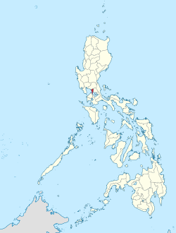
National Capital Region (NCR) | 13 | Luzon | Manila | 636.00 km2 (245.56 sq mi) | 13,484,462 (12.41%) | 20,247/km2 (52,440/sq mi) | |||
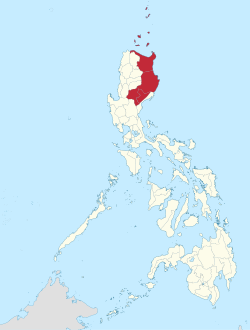
Cordillera Administrative Region (CAR) | 14 | Luzon | Baguio | 19,422.03 km2 (7,498.89 sq mi) | 1,791,121 (1.65%) | 89/km2 (230/sq mi) | |||
Ilocos Region (Region I) | 01 | Luzon | San Fernando | 13,012.60 km2 (5,024.19 sq mi) | 5,292,297 (4.87%) | 386/km2 (1,000/sq mi) | |||
Cagayan Valley (Region II) | 02 | Luzon | Tuguegarao | 28,228.83 km2 (10,899.21 sq mi) | 3,679,748 (3.39%) | 122/km2 (317/sq mi) | |||
Central Luzon (Region III) | 03 | Luzon | San Fernando | 22,014.63 km2 (8,499.90 sq mi) | 12,387,811 (11.40%) | 510/km2 (1,320/sq mi) | |||
Calabarzon (Region IV-A) | 04 | Luzon | Calamba | 16,873.31 km2 (6,514.82 sq mi) | 16,139,770 (14.85%) | 854/km2 (2,213/sq mi) | |||
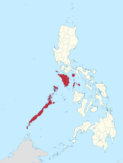
Southwestern Tagalog Region (Mimaropa) [d] | 17 | Luzon | Calapan | 29,620.90 km2 (11,436.69 sq mi) | 3,212,287 (2.96%) | 100/km2 (259/sq mi) | |||
Bicol Region (Region V) | 05 | Luzon | Legazpi | 18,155.82 km2 (7,010.00 sq mi) | 6,067,290 (5.58%) | 319/km2 (827/sq mi) | |||
Western Visayas (Region VI) | 06 | Visayas | Iloilo City | 12,750.63 km2 (4,923.05 sq mi) | 4,730,771 (4.35%) | 371/km2 (961/sq mi) | |||
Negros Island Region (NIR) | 18 | Visayas | Bacolod and Dumaguete (interim/de facto) | 13,525.56 km2 (5,222.25 sq mi) | 4,760,340 (4.38%) | 352/km2 (912/sq mi) | |||
Central Visayas (Region VII) | 07 | Visayas | Cebu City | 10,114.52 km2 (3,905.24 sq mi) | 6,545,603 (6.02%) | 647/km2 (1,676/sq mi) | |||
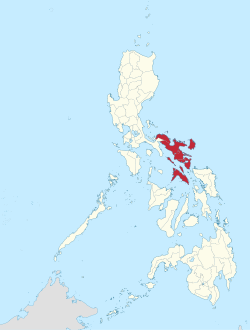
Eastern Visayas (Region VIII) | 08 | Visayas | Tacloban | 23,251.10 km2 (8,977.30 sq mi) | 4,531,512 (4.17%) | 191/km2 (495/sq mi) | |||
Zamboanga Peninsula (Region IX) | 09 | Mindanao | Pagadian | 17,056.73 km2 (6,585.64 sq mi) | 3,862,588 (3.55%) | 213/km2 (551/sq mi) | |||
Northern Mindanao (Region X) | 10 | Mindanao | Cagayan de Oro | 20,496.02 km2 (7,913.56 sq mi) | 5,007,798 (4.61%) | 229/km2 (593/sq mi) | |||
Davao Region (Region XI) | 11 | Mindanao | Davao City | 20,357.42 km2 (7,860.04 sq mi) | 5,223,802 (4.81%) | 245/km2 (634/sq mi) | |||
Soccsksargen (Region XII) | 12 | Mindanao | Koronadal | 22,513.30 km2 (8,692.43 sq mi) | 4,351,773 (4.0%) | 202/km2 (523/sq mi) | |||
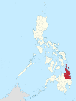
Caraga (Region XIII) | 16 | Mindanao | Butuan | 21,478.35 km2 (8,292.84 sq mi) | 2,795,340 (2.57%) | 121/km2 (313/sq mi) | |||
Bangsamoro (BARMM) [g] | 19 | Mindanao | Cotabato City | 11,935.7 km2 (4,608.4 sq mi) | 3,944,692 (3.63%) | 330/km2 (856/sq mi) | |||
Notes
|
As far as the judiciary is concerned, specifically the first and second level courts, the country is divided into judicial regions as provided by Batas Pambansa Bilang 129. The coverage of these judicial regions generally coincides with that of the administrative regions in 1980, with some exceptions.
Representation for the Interim Batasang Pambansa was mostly through parliamentary districts based on how regions were organized in 1978. Metro Manila was "Region IV", while Southern Tagalog was "Region IV-A". This was the only time the national legislature was represented via regions; in a 1984 plebiscite, voters approved a constitutional amendment that reverted to representation per province and city.
The following are regions that no longer exist, listed along with their current status:
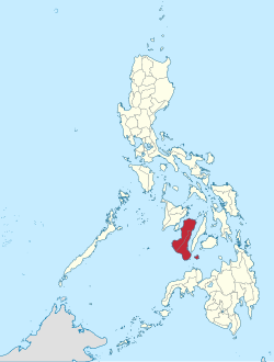
Zamboanga Peninsula is an administrative region in Mindanao, Philippines, designated as Region IX. It consists of the provinces of Zamboanga del Norte, Zamboanga Sibugay and Zamboanga del Sur, and the cities of Isabela and Zamboanga City. The region was previously known as Western Mindanao. Pagadian serves as the regional center, while Zamboanga City is the commercial and industrial center.
Mimaropa, officially the Southwestern Tagalog Region, is an administrative region in the Philippines. The name is an acronym combination of its constituent provinces: Mindoro, Marinduque, Romblon, and Palawan. It is the only region in the country outside the Visayas that has no land border with another region.
Cotabato, formerly and still commonly referred to as North Cotabato and officially the Province of Cotabato, is a landlocked province in the Philippines located in the Soccsksargen region in Mindanao. Its capital is the city of Kidapawan, the most populous in the province. Some of its municipalities are under the jurisdiction of the nearby Bangsamoro Autonomous Region.
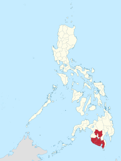
Soccsksargen, formerly known as Central Mindanao, is an administrative region of the Philippines, designated as Region XII. Located in south-central Mindanao, its name is an acronym that stands for the region's four provinces and one highly urbanized city. The regional center is in Koronadal, located in the province of Cotabato del Sur, and the center of commerce and industry is General Santos, which is the most populous city in the region.
The Autonomous Region in Muslim Mindanao was an autonomous region of the Philippines, located in the Mindanao island group of the Philippines, that consisted of five predominantly Muslim provinces: Basilan, Lanao del Sur, Maguindanao, Sulu, and Tawi-Tawi. It was the only region that had its own government. The region's de facto seat of government was Cotabato City, although this self-governing city was outside its jurisdiction.
The Cordillera Administrative Region, also known as the Cordillera Region and Cordillera, is an administrative region in the Philippines, situated within the island of Luzon. It is the only landlocked region in the archipelago, bordered by the Ilocos Region to the west and southwest, and by the Cagayan Valley Region to the north, east, and southeast.
The government of the Philippines has three interdependent branches: the legislative, executive, and judicial branches. The Philippines is governed as a unitary state under a presidential representative and democratic constitutional republic in which the president functions as both the head of state and the head of government of the country within a pluriform multi-party system.
The Philippines is divided into four levels of administrative divisions, with the lower three being defined in the Local Government Code of 1991 as local government units (LGUs). They are, from the highest to the lowest:
The super regions of the Philippines are an informal and de facto defunct grouping of parts of regions and provinces of the Philippines based on their economic strengths. According to Executive Order No. 561, which establishes these regions,
"[These] groupings neither supersede current political boundaries nor alter the regional development councils as established by existing laws and issuances."
The National Economic and Development Authority is an independent cabinet-level agency of the Philippine government responsible for economic development and planning. It is headed by the president of the Philippines as chairman of the NEDA board, with the Secretary of Socioeconomic Planning as vice-chairman. A number of Cabinet members, the Governor of the Bangko Sentral ng Pilipinas, the Chairperson of the Metropolitan Manila Development Authority, the Chief Minister of Bangsamoro, the Secretary of Information and Communications Technology, the Chairman of the Subic–Clark Area Development Corporation, and the National President of the Union of Local Authorities of the Philippines are members of the NEDA Board.
The Philippine Drug Enforcement Agency is the lead anti-drug law enforcement agency, responsible for preventing, investigating and combating any dangerous drugs, controlled precursors and essential chemicals within the Philippines. The agency is tasked with the enforcement of the penal and regulatory provisions of Republic Act No. 9165, otherwise known as the Comprehensive Dangerous Drugs Act of 2002.
In the Philippines, local government is divided into three levels: provinces and independent cities, component cities and municipalities, and barangays, all of which are collectively known as local government units (LGUs). In some areas, above provinces and independent chartered cities are autonomous regions, such as the Bangsamoro Autonomous Region in Muslim Mindanao. Some towns and cities remit their revenue to national government and is returned through the national government through a process called internal revenue allotment. Below barangays in some cities and municipalities are sitios and puroks. All of these, with the exception of sitios and puroks, elect their own executives and legislatures. Sitios and puroks are often but not necessarily led by an elected barangay councilor.
Bangsamoro, officially the Bangsamoro Autonomous Region in Muslim Mindanao, is an autonomous region in the Philippines, located in the southwestern portion of the island of Mindanao.
An autonomous region of the Philippines is a first-level administrative division that has the authority to control a region's culture and economy. The Constitution of the Philippines allows for two autonomous regions: in the Cordilleras and in Muslim Mindanao. Currently, Bangsamoro, which largely consists of the Muslim-majority areas of Mindanao, is the only autonomous region in the country.
The Cordillera autonomy movement in the Philippines refers to the campaign for greater autonomy for the Cordilleras.
A plebiscite for the ratification of the organic act creating the Cordillera Autonomous Region was held on January 30, 1990, to ask if the voters in the Cordillera Administrative Region wanted to be an autonomous region under Republic Act No. 6766. The Cordillera Administrative Region (CAR) consists of the provinces of Abra, Benguet, Ifugao, Kalinga-Apayao, and Mountain Province, and the city of Baguio. Only Ifugao voted in favor of autonomy, and a Supreme Court case later disallowed the creation of an autonomous region with just one province.
Regional Development Councils (RDCs) are the highest policy-making body governing the administrative regions of the Philippines. They serve as the subnational counterpart of the National Economic and Development Authority. All but two of the Philippines 17 regions has a Regional Development Council although Metro Manila has a metropolitan body which serves the same function as an RDC. Bangsamoro, an autonomous region, also has its own equivalent to a RDC.
The National Prosecution Service is the official prosecutorial agency of the Philippines. Although it is an official prosecutorial agency, it is not autonomous from the Department of Justice unlike its counterparts such as the Philippine National Police, National Bureau of Investigation, Philippine Drug Enforcement Agency, National Intelligence Coordinating Agency, Bureau of Customs, Bureau of Corrections, and the Bureau of Immigration.
The 1977 Southern Philippines autonomy plebiscite was a plebiscite to create an autonomous region held on April 17, 1977 in parts of Mindanao and Palawan in the Philippines.