| Date | Time‡ | Region(s) | Magnitude | Intensity | Casualties | Notes | Sources |
|---|
| 1601 January 16 | 16:00 | Metro Manila, Calabarzon, and Central Luzon | | VIII | Several | Earthquake duration lasted about 7 minutes. Aftershocks experienced the whole year. | [3] [4] |
| 1636 December 12 | | Zamboanga Peninsula | | IX | | Large-scale landslides are reported to have occurred at Point Flechas which is between the Moro Gulf's large bays of Illana and Sibuguey. | [3] [4] |
| 1645 November 30 | 20:00 | Central Luzon, Cagayan Valley, Cordillera, Ilocos Region, Calabarzon, Metro Manila, and Mimaropa | 7.5 | X | 600 dead,
3,000 injured | Dubbed as the "most terrible earthquake" in the annals of the Philippines. Greatly damaged ten newly constructed cathedrals in Manila, residential villas and buildings in the city and nearby provinces. Provinces in the north reported several alteration of the ground, disappearances of small villages, changes in the river course, sand eruptions, etc. Small tsunamis were reported in southern Luzon. | [4] |
| 1645 December 5 | 23:00 | Central Luzon, Calabarzon, and Metro Manila | | VIII | | Major aftershock of the November 30, 1645 Luzon earthquake that further destroyed remaining buildings in Manila and nearby towns. Aftershocks ceased around March 1646. | [3] [4] |
| 1665 June 19 | | Metro Manila, Calabarzon, and Mimaropa | | VIII | 19 | Areas with significant damage are Batangas and Mindoro. Only the Jesuit Church in Manila experienced great damage. | [4] |
| 1743 January 12 | 08:00 | Calabarzon | | X | 5 deaths | Destructive in Tayabas Province (now Quezon), wrecking masonry structures in the town of Tayabas and others. | [3] [4] |
| 1787 July 13 | 07:00 | Western Visayas | | X | Many | Known as the "1787 Panay Earthquake". Many deaths are unrecorded, but there were 15 deaths reported in one building. | [3] [4] |
| 1840 March 22 | | Bicol Region | 6.5 | IX | 17 deaths, 200 injured | Numerous masonry buildings, churches and homes were destroyed across Sorsogon, Albay and Masbate | [3] [4] |
| 1852 September 16 | 18:45 | Central Luzon, Calabarzon, and Metro Manila | | IX | 3 | Several buildings were destroyed, many fissures opened, subsidences and landslides occurred. | [3] [4] |
| 1863 June 3 | 19:20 | Metro Manila, Central Luzon, and Calabarzon | 6.5 | X | 400–1,000 deaths, 2,000+ injuries | 1863 Manila earthquake | [3] [4] |
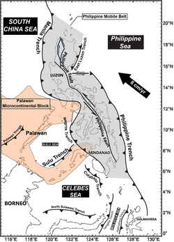
| 1879 July 1 | 00:50 | Caraga, and Northern Mindanao | | X | | 1879 Surigao earthquake | [3] [4] |
| 1880 July 14–25 | 04:40 | Calabarzon, Metro Manila, and Central Luzon | | X | 20 dead, 50 injured | 1880 Luzon earthquakes | [3] [4] [5] |
| 1892 March 16 | 20:58 | Cordillera, and Ilocos Region | | X | 2 | Stretches from Abra to La Union and Pangasinan. | [3] [4] |
| 1897 September 21 | 13:15 | Zamboanga Peninsula, and Bangsamoro | 7.5 | IX | 13–100+ (second event) | 1897 Mindanao earthquakes A pair of large earthquakes off Mindanao | [3] [4] |