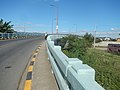
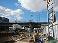
List of crossings of the Marikina River

Last updated

Metro Manila location map.svg
Red pog.svg
6
Red pog.svg
7
Red pog.svg
8
Red pog.svg
9
Red pog.svg
10
Red pog.svg
11
Red pog.svg
12
Red pog.svg
13
Red pog.svg
14
Red pog.svg
15
Red pog.svg
16
Red pog.svg
17
Red pog.svg
18
Locations of the river's bridges within Metro Manila

This is a list of bridges and other crossings of the Marikina River in Rizal and eastern Metro Manila, Philippines.

Contents

The crossings are listed in order, starting from its source at the tri-junction with the Boso Boso River and the Sapa Bute River and proceeding downstream at the Pasig River.

As of 2015, there are a total of sixteen bridge spans that cross the Marikina River, including one rail bridge, carrying the LRT Line 2 track.

Crossings

#CrossingImageWest bankCarriesEast bankBuiltCoordinates
1Pacific Bridge Rodriguez, Rizal Two lanes to Pacific Concrete Products Inc. Access Road Rodriguez, Rizal 14°26′N121°06′E / 14.44°N 121.10°E / 14.44; 121.10
2Rancho Luisito Way BridgeTwo lanes of Rancho Luisito Way 14°26′N121°54′E / 14.44°N 121.9°E / 14.44; 121.9
3Eastwood Greenview BridgeEastwood Greenview Drive 14°26′N121°54′E / 14.44°N 121.9°E / 14.44; 121.9
4Phil Rock Spillway BridgeTwo lanes of C. Reyes Street 14°26′N121°54′E / 14.44°N 121.9°E / 14.44; 121.9
5San Jose Bridge
Montalban Bridge
1437Rodriguez, Rizal Barangays Roads Landmarks 36.jpg Four lanes of Rodriguez Highway 14°26′N121°42′E / 14.43°N 121.7°E / 14.43; 121.7
6Batasan–San Mateo Bridge 51Quezon City San Mateo, Rizal Landmarks 09.jpg Quezon City Four lanes of Batasan-San Mateo Road San Mateo, Rizal 14°24′N121°36′E / 14.40°N 121.6°E / 14.40; 121.6
7Gil Fernando Bridge
Tumana Bridge
5745Marikina City Metro Manila Landmarks 17.jpg Marikina Two lanes between Moscow Street and Bagong Farmers 1 Avenue Marikina 2007 [1] 14°23′N121°30′E / 14.39°N 121.5°E / 14.39; 121.5
8Marikina Bridge
A. Bonifacio Bridge
0280jfBarangay Santo Nino A. Bonifacio Avenue Bridge River Marikina Cityfvf 23.jpg Four lanes of A. Bonifacio Avenue1979 [2] 14°23′N121°30′E / 14.38°N 121.5°E / 14.38; 121.5
9 Marcos Bridge 0431jf Marcos Highway Bridge fvf 21.jpg Six lanes of N59 (Philippines).svg N59 ( Marcos Highway )1979 [2] 14°23′N121°12′E / 14.39°N 121.20°E / 14.39; 121.20
10LRT Line 2 bridge Line 2 Bridge Marikina River fvf 01.jpg LRT Line 2 14°22′N121°24′E / 14.37°N 121.4°E / 14.37; 121.4
11Diosdado Macapagal Bridge Industrial Valley, Marikina (Rizal, Metro Manila; 2023-08-09) E911a 08.jpg Four lanes of FVR Road 14°22′N121°24′E / 14.37°N 121.4°E / 14.37; 121.4
12Caruncho Bridge
F. Manalo Bridge
Quezon City Two lanes of Caruncho Road Pasig 14°22′N121°30′E / 14.36°N 121.5°E / 14.36; 121.5
13Bridgetowne Viaduct Bridgetowne (Metro Manila; 2023-08-09) E911a 37.jpg Two lanes of Bridgetowne Boulevard2019 [3] 14°36′N121°06′E / 14.6°N 121.1°E / 14.6; 121.1
14Rosario Bridge 0337jfCircumferential Road 34 Ortigas Avenue Ugong Rosario Bridge Pasig City Marikina Riverfvf.jpg Pasig Six lanes of N60 (Philippines).svg N60 ( Ortigas Avenue )1979 [2] 14°21′N121°30′E / 14.35°N 121.5°E / 14.35; 121.5
15Sandoval Bridge 09846jfDr. Sixto Antonio Avenue Sandoval Bridge Ugong Maybunga Pasig Cityfvf 07.jpg Two lanes of Eagle Street 14°35′10″N121°01′30″E / 14.586°N 121.025°E / 14.586; 121.025
16Kaginhawaan Bridge Caruncho Manalo Kaginhawaan Bridge Pasig4.jpg Lanuza Avenue to P. Conducto Street2017 14°20′N121°02′E / 14.34°N 121.04°E / 14.34; 121.04
17Vargas Bridge 04006jfVargas Bridge Kapasigan Bagong Ilog Pasig Boulevard River Cityfvf 17.jpg Four lanes of Pasig Boulevard Extension1992 [2] 14°20′N121°16′E / 14.33°N 121.27°E / 14.33; 121.27
18Santa Rosa de Lima Bridge 03581jfSanta Rosa Bridge Bagong Ilog Bagong Katipunan Pasig Cityfvf 14.jpg Two lanes of Dr. Garcia Street 14°20′N121°24′E / 14.33°N 121.4°E / 14.33; 121.4

Planned crossings

CrossingWest bankCarriesEast bankProjected
completion
Coordinates
Kabayani–Katipunan Bridge [4] Pansol, Quezon City Kabayani Road and Katipunan StreetMalanday, Marikina
Reposo–Guatemala Bridge [5] Reposo Street and Guatemala Street
J.P. Rizal–Yale Bridge [6] J.P. Rizal Street and Yale Street
G. Gabriel Street–Mercury Avenue Bridge [7] Libis, Quezon CityG. Gabriel Street and Mercury AvenueSantolan, Pasig

References

  1. Navarro, Ronaldo (May 4, 2007). "New bridge in Marikina". The Manila Times . p. A2. Retrieved March 7, 2023.
  2. 1 2 3 4 "Road and Bridge Inventory". Department of Public Works and Highways. Archived from the original on June 30, 2022. Retrieved July 16, 2022.
  3. "New QC-Pasig bridge opens to public". Philippine Daily Inquirer. September 6, 2019. Retrieved June 27, 2023.
  4. Lamentillo, Anna Mae (3 November 2017). "Build Build Build: Metro Manila Logistics Infrastructure Network". Manila Bulletin. Retrieved 23 January 2018.
  5. Aning, Jerome (July 20, 2017). "BGC-Ortigas Center link to ease traffic across the Pasig". Manila Bulletin. Retrieved January 23, 2018.
  6. Unite, Betheena Kae (July 19, 2017). "Bridge to link Pasig, Taguig business hubs". Manila Bulletin. Retrieved January 23, 2018.
  7. Iglesias, Myla (July 20, 2017). "BGC-Ortigas road starts construction". Manila Bulletin. Retrieved January 23, 2018.