Santa Maria, officially the Municipality of Santa Maria (Pangasinan: Baley na Santa Maria; Ilocano: Ili ti Santa Maria; Tagalog: Bayan ng Santa Maria), is a municipality in the province of Pangasinan, Philippines. According to the 2024 census, it has a population of 34,452 people.[5]
Santa Maria was formerly a barrio of the Municipality of Tayug. It was founded on January 10, 1855 as a separate town and was governed by a captain until 1863. In 1864, the town was reincorporated into the municipality of Tayug due to its inability to maintain its financial stability.
In 1877, the inhabitants of Santa Maria again applied for separation as a distinct municipality. The application was granted and Santa Maria, again became a town under the governance of Captain Eugenio Vinluan.
For many years, during the Spanish Regime, religion was the basis of educating the masses. From time to time missionaries of different orders were sent out to Santa Maria to carry out religious services as required of them. It was during the routine visit of a certain priest from the town of Asingan, which was then the most eastern town of the province of Pangasinan, who had extended his mission farther into the east and came to a village. The village was located on a plain in which the Agno River ran and which with a little effort could be irrigated. The missionary believed that the village could be developed into a prosperous community. Finding the residents to be hospitable, he chatted with them and, in the course of conversation, he thought of giving the place a name. Since it was the Virgin Mary's Day, he called the people of the village to him and with a simple but impressive solemnity proclaimed this place as Santa Maria on this, the Virgin Mary's day.
American invasion era
In 1903, the Americans arrived in Santa Maria and their rule began. In 1901 there was an election for the president of Santa Maria. This was during the United States military government of the islands. The President was given a two years term, due to his good administration.
In 1903, Santa Maria was incorporated again into the town of Tayug for financial reasons, as before, but in 1907 a special election was held for the purpose of returning all small municipalities that had incorporated with bigger towns. Don Alejandro Gonzales was then elected president and served until 1910 when he was succeeded by Don Mariano de Guzman who served to 1912. From this date to the present, the different successions of presidents, alcaldes and mayors had occurred all over the islands.
Contemporary
In the course of time prominent people improved the locality and transferred the town site from Namagbagan, which is now a barrio of the municipality, to its present site near a clay promontory where it formed an impregnable defense against the yearly erosion of the Agno, thus annexing "De Pila" to the original name and making Santa Maria de Pila its final name, a name which is known beyond the confines of the province of Pangasinan.
The economic activities of the town are fueled in part by its close proximity to the neighboring municipalities of Rosales and Tayug.
Geography
Santa Maria is situated 58.78 kilometres (36.52mi) from the provincial capital Lingayen, and 186.00 kilometres (115.58mi) from the country's capital city of Manila.
Barangays
Santa Maria is politically subdivided into 23 barangays. Each barangay consists of puroks and some have sitios.
Santa Maria is part of the sixth congressional district of the province of Pangasinan. It is governed by a mayor, designated as its local chief executive, and by a municipal council as its legislative body in accordance with the Local Government Code. The mayor, vice mayor, and the councilors are elected directly by the people through an election which is being held every three years.
The Sta. Maria Schools District Office governs all educational institutions within the municipality. It oversees the management and operations of all private and public, from primary to secondary schools.[21]
Primary and elementary schools
Bal-loy Elementary School
Bantog-Capandanan Elementary School
Caboluan Elementary School
Cal-litang Elementary School
Dalayap Elementary School
Namagbagan Elementary School
Our Lady of the Pillar Catholic School
Pataquid Elementary School
Pilar-Cauplasan Elementary School
Pugot Elementary School
Samon Elementary School
San Francisco Elementary School
San Pablo Elementary School
San Vicente Elementary School
West Central School
Sta. Rosa Elementary School
Secondary schools
Sta. Cruz Integrated School
Sta. Maria East Integrated School
St. Mary’s Integrated School Inc.
Eastern Pangasinan Agricultural College
Higher educational institution
Pangasinan State University - Santa Maria Campus
Gallery
Santa Maria Town Hall
Public Market road to municipal hall and public park
Public market
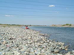
Part of Agno River flowing near Barangay San Vicente, Santa Maria Pangasinan. A faint image of Narciso Ramos Bridge can be seen at a distance.
This page is based on this Wikipedia article Text is available under the CC BY-SA 4.0 license; additional terms may apply. Images, videos and audio are available under their respective licenses.