This article needs additional citations for verification .(November 2012) |
Dasol | |
|---|---|
| Municipality of Dasol | |
 Welcome arc | |
 Seal | |
 Map of Pangasinan with Dasol highlighted | |
OpenStreetMap  | |
 Dasol Location within the Philippines | |
| Coordinates: 15°59′23″N119°52′50″E / 15.98964°N 119.88053°E | |
| Country | Philippines |
| Region | Ilocos Region |
| Province | Pangasinan |
| District | 1st district |
| Founded | 1 January 1911 |
| Barangays | 18 (see Barangays) |
| Government | |
| • Type | Sangguniang Bayan |
| • Mayor | Rizalde J. Bernal |
| • Vice Mayor | Edgardo C. Fontelera |
| • Representative | Arthur F. Celeste |
| • Municipal Council | Members |
| • Electorate | 23,745 voters (2025) |
| Area | |
• Total | 166.60 km2 (64.32 sq mi) |
| Elevation | 39 m (128 ft) |
| Highest elevation | 169 m (554 ft) |
| Lowest elevation | 0 m (0 ft) |
| Population (2024 census) [4] | |
• Total | 31,842 |
| • Density | 191.13/km2 (495.02/sq mi) |
| • Households | 7,586 |
| Demonym | Dasolinians |
| Economy | |
| • Income class | 3rd municipal income class |
| • Poverty incidence | 22.98 |
| • Revenue | ₱ 200.1 million (2022) |
| • Assets | ₱ 576.4 million (2022) |
| • Expenditure | ₱ 148.9 million (2022) |
| • Liabilities | ₱ 72.47 million (2022) |
| Service provider | |
| • Electricity | Pangasinan 1 Electric Cooperative (PANELCO 1) |
| • Water | Dasol Water District |
| • Telecommunications | Smart Globe Digitel |
| • Cable & Satellite | Cignal Sky Direct G Sat |
| Time zone | UTC+8 (PST) |
| ZIP code | 2411 |
| PSGC | |
| IDD : area code | +63 (0)75 |
| Native languages | Pangasinan Tagalog Ilocano Sambal |
| Major religions | Roman Catholic Iglesia ni Cristo Iglesia Filipina Independiente Protestantism |
| Feast date | 1st Friday of Lent |
| Patron saint | Saint Vincent Ferrer |
| Website | www |
Dasol, officially the Municipality of Dasol (Pangasinan : Baley na Dasol; Ilocano : Ili ti Dasol; Tagalog : Bayan ng Dasol), is a municipality in the province of Pangasinan, Philippines. According to the 2024 census, it has a population of 31,842 people. [6]
Contents
- Etymology
- History
- Spanish Colonial Era
- American Invasion Era
- Japanese occupation
- Geography
- Barangays
- Climate
- Demographics
- Religions
- Economy
- Mining Areas
- Government
- Local government
- Elected officials
- Political History
- Culture
- Annual festivals
- Education
- Primary and elementary schools
- Secondary schools
- Higher educational institution
- Gallery
- See also
- References
- External links
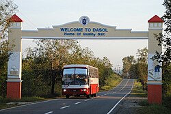
The town is a popular town for the commercial production of table salt. Seawater is fed into large ponds and water is drawn out through natural evaporation which allows the salt to be harvested. Dasol Bay occupies the whole coastline of Dasol and is where the town gets its saltwater.


