This article needs additional citations for verification .(September 2013) |
Basista | |
|---|---|
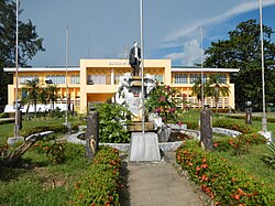
| Municipality of Basista | |
 | |
 Seal | |
| Nickname: Home of the finest musicians | |
 Map of Pangasinan with Basista highlighted | |
 Interactive map of Basista | |
 Basista Location within the Philippines | |
| Coordinates: 15°51′09″N120°23′51″E / 15.8524°N 120.3976°E | |
| Country | Philippines |
| Region | Ilocos Region |
| Province | Pangasinan |
| District | 2nd district |
| Founded | September 5, 1961 |
| Chartered | May 8, 1967 |
| Barangays | 13 (see Barangays) |
| Government | |
| • Type | Sangguniang Bayan |
| • Mayor | Jolly R. Resuello |
| • Vice Mayor | Dante P. Bustarde |
| • Representative | Mark Cojuangco |
| • Municipal Council | Members |
| • Electorate | 26,433 voters (2025) |
| Area | |
• Total | 24.00 km2 (9.27 sq mi) |
| Elevation | 15 m (49 ft) |
| Highest elevation | 48 m (157 ft) |
| Lowest elevation | 6 m (20 ft) |
| Population (2024 census) [3] | |
• Total | 37,840 |
| • Density | 1,577/km2 (4,084/sq mi) |
| • Households | 8,824 |
| Economy | |
| • Income class | 4th municipal income class |
| • Poverty incidence | 18.54 |
| • Revenue | ₱ 170.6 million (2022) |
| • Assets | ₱ 195.3 million (2022) |
| • Expenditure | ₱ 140.2 million (2022) |
| • Liabilities | ₱ 28.54 million (2022) |
| Service provider | |
| • Electricity | Central Pangasinan Electric Cooperative (CENPELCO) |
| Time zone | UTC+8 (PST) |
| ZIP code | 2422 |
| PSGC | |
| IDD : area code | +63 (0)75 |
| Native languages | Pangasinan Ilocano Tagalog |
Basista, officially the Municipality of Basista (Pangasinan : Baley na Basista; Ilocano : Ili ti Basista; Tagalog : Bayan ng Basista), is a municipality in the province of Pangasinan, Philippines. According to the 2024 census, it has a population of 37,840 people. [5]
Contents
- History
- Geography
- Barangays
- Climate
- Demographics
- Economy
- Government
- Local government
- Elected officials
- Education
- Primary and elementary schools
- Secondary schools
- References
- External links
Basista is 29 kilometres (18 mi) from Lingayen, 198 kilometres (123 mi) from Manila, 10 kilometres (6.2 mi) from San Carlos, and 8 kilometres (5.0 mi) from Bayambang.