Anda, Pangasinan

Last updated
Anda
Municipality of Anda
Anda Municipal Hall.jpg
Anda Municipal Hall
Flag of Anda, Pangasinan (2022-present).png
Ph locator pangasinan anda.png
Map of Pangasinan with Anda highlighted
OpenStreetMap
Anda, Pangasinan
Philippines location map (square).svg
Red pog.svg
Anda
Location within the Philippines
Coordinates: 16°17′23″N119°56′57″E / 16.289614°N 119.9491°E / 16.289614; 119.9491
Country Philippines
Region Ilocos Region
Province Pangasinan
District 1st district
Founded 1852
Named for Simón de Anda y Salazar
Barangays 21 (see Barangays)
Government
[1]
  Type Sangguniang Bayan
   Mayor Joganie C. Rarang
   Vice Mayor Artemio B. Carolino Jr.
   Representative Arnold D. Celeste
   Municipal Council
Members
   Electorate 27,028 voters (2022)
Area
[2]
  Total74.55 km2 (28.78 sq mi)
Elevation
5.0 m (16.4 ft)
Highest elevation
132 m (433 ft)
Lowest elevation
0 m (0 ft)
Population
 (2020 census) [3]
  Total41,548
  Density560/km2 (1,400/sq mi)
   Households
10,588
Economy
   Income class 3rd municipal income class
   Poverty incidence
12.40
% (2018) [4]
   Revenue 150.9 million (2020)
   Assets 461.3 million (2020)
   Expenditure 153.8 million (2020)
   Liabilities 50.24 million (2020)
Service provider
  ElectricityPangasinan 1 Electric Cooperative (PANELCO 1)
Time zone UTC+8 (PST)
ZIP code
2405
PSGC
IDD : area code +63(0)75
Native languages Bolinao
Pangasinan
Ilocano
Tagalog
Website www.andapangasinan.gov.ph

Anda, officially the Municipality of Anda (Bolinao: Babali nin Anda; Pangasinan : Baley na Anda; Ilocano : Ili ti Anda; Tagalog : Bayan ng Anda), is a 3rd class municipality in the province of Pangasinan, Philippines. Unique in this part of the province, The Sambalic language of Bolinao or Binubolinao is primarily spoken in the municipality and the adjacent town of Bolinao. According to the 2020 census, it has a population of 41,548 people. [3]

Contents

History

On the north-west portion of Lingayen Gulf lies a group of islands which comprise the territory of Anda.

Before the middle of the nineteenth century, the islands which comprise the municipality were uninhabited. Only occasionally did seafarers and fishermen use the coast as havens.

Andres de la Cruz Cacho, fondly called in Bolinao as Andales Kulayo, discovered a vast tract of land suitable for grazing and fertile lowlands, and an abundant spring for agriculture. It was he who brought families from the town of Bolinao aboard a big boat and dispersed them on the island of Cabarruyan in 1842. The spread of population was rapid.

On May 10, 1842, the pioneers landed on what is now the barrio of Dolaoan, put up a settlement, and chose San Miguel Arcangel as their Patron Saint. On May 25, 1842, they established Carot and Cabungan with Santa Lucia as the common Saint of the two settlements.

In the first of June of same year, Tondol was founded. Sablig was settled in the middle of June. By the third week of June, Macaleeng was occupied.

No family was willing, to stay in Toritori at the time and so the place was bypassed. The settlers proceeded to Awile and Aruab (now Roxas) and by early July, they have established settlements in the area.

By August, Mal-Ong, Awag, Santa Rita, and San Nicolas were established. Within a period of only four months, May to August, 1842, the whole island of Cabarruyan was populated.

A steady stream of settlers followed the first pioneers and soon within a few years, the population was large enough to form a municipality.

In January, 1849 a conference of leaders was called by Don Pablo Cacho Valerio through his son Don Domingo with the end in view to established a new town. The leaders drafted a petition for the creation of a new town and sent copies on March 15, 1849, to Don Jose Sanchez y Guerrero, the then Alcalde at Iba, Zambales and to the Archbishop of Manila.

On May 26, 1849, the Alcalde brought the reply granting the petition. Accompanied by the Parish Priest, Rev. Fr. Juan Migrano, Capitan Felipe Cacho Valerio, and other municipal officials of Bolinao, the Alcalde came to Cabarruyan to choose a suitable location for the town site. They agreed on Segat in the center of the island which is now known as Namagbagan. The site for the plaza, church, town hall, convent, cemetery, and streets were laid out on January 20, 1850, by order of the Alcalde.

Anda was once a part of the municipality of Bolinao.

Geography

The municipality consists primarily of Cabarruyan Island (also known as Anda Island), as well as minor surrounding islets. Because of Anda's proximity near the Hundred Islands, a popular tourist destination for its caves and beaches, it is the so-called "Mother of the Hundred Islands."

Anda is 77 kilometres (48 mi) from Lingayen and 283 kilometres (176 mi) from Manila.

Barangays

Anda is politically subdivided into 18 barangays. [5] Each barangay consists of puroks and some have sitios.

  • Awile
  • Awag
  • Batiarao
  • Cabungan
  • Carot
  • Dolaoan
  • Imbo
  • Macaleeng
  • Macando-candong
  • Mal-ong
  • Namagbagan
  • Poblacion
  • Roxas
  • Sablig
  • San Jose
  • Siapar
  • Tondol
  • Tori-tori

Climate

Climate data for Anda, Pangasinan
MonthJanFebMarAprMayJunJulAugSepOctNovDecYear
Average high °C (°F)31
(88)
31
(88)
31
(88)
33
(91)
32
(90)
32
(90)
30
(86)
30
(86)
30
(86)
31
(88)
31
(88)
31
(88)
31
(88)
Average low °C (°F)21
(70)
21
(70)
22
(72)
24
(75)
24
(75)
24
(75)
23
(73)
23
(73)
23
(73)
23
(73)
23
(73)
22
(72)
23
(73)
Average precipitation mm (inches)5.1
(0.20)
11.6
(0.46)
21.1
(0.83)
27.7
(1.09)
232.9
(9.17)
350.8
(13.81)
679.8
(26.76)
733.1
(28.86)
505
(19.9)
176.6
(6.95)
67.2
(2.65)
17.7
(0.70)
2,828.6
(111.38)
Average rainy days333414182325221584142
Source: World Weather Online [6]
Cabarruyan island satellite image captured by Sentinel-2 in 2016 Cabarruyan Island, PH, Sentinel-2.jpg
Cabarruyan island satellite image captured by Sentinel-2 in 2016

Demographics

Population census of Anda
YearPop.±% p.a.
1903 3,916    
1918 6,403+3.33%
1939 8,989+1.63%
1948 11,213+2.49%
1960 14,580+2.21%
1970 16,917+1.50%
1975 19,262+2.64%
1980 20,454+1.21%
1990 26,856+2.76%
1995 28,739+1.28%
2000 32,833+2.90%
2007 34,398+0.64%
2010 37,011+2.70%
2015 39,504+1.25%
2020 41,548+1.00%
Source: Philippine Statistics Authority [7] [8] [9] [10]

Language

The people of Anda generally speak Pangasinan, Bolinao, and Ilocano.

Economy

Anda Bridge Anda Bridge.jpg
Anda Bridge

The town thrives on farming and deep-sea fishing.

In the past, progress in the town was sluggish due to its dependence to a landing barge to cross the Catubig Channel separating Anda to mainland Bolinao. In 1996, trade has increased due to a bridge connecting the municipality to the mainland. This bridge, known as Anda Bridge, was sponsored and inaugurated by then President Fidel V. Ramos, who hails from Pangasinan. Main roads have been concreted for faster access to the barangays, especially tourism related places.

Government

Local government

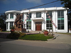
Anda, belonging to the first congressional district of the province of Pangasinan, is governed by a mayor designated as its local chief executive and by a municipal council as its legislative body in accordance with the Local Government Code. The mayor, vice mayor, and the councilors are elected directly by the people through an election which is being held every three years.

Elected officials

Members of the Municipal Council
(2019–2022) [18]
PositionName
CongressmanArnold F. Celeste
MayorJoganie C. Rarang
Vice-MayorArtemio B. Carolino Jr.
CouncilorsErwin C. Catabay
Lorenzo C. Cabalquinto
Ester C. Carpo
Lilybeth C. Kiongson
Ruel B. Quilla
Marvin Charles C. Caranay
Christian C. Cacho
Jocelle Z. Celeste

Transportation

A Five Star bus in the municipality. FiveStar Coach In Anda, Pangasinan.jpg
A Five Star bus in the municipality.

The town is accessible through land transportation. Two main bus companies serve commuters to and from Anda to Manila or neighboring towns and cities. These are Dagupan Bus Co., Inc.and Pangasinan Five Star Bus Co. Mini buses and jeepneys are also available for commuters going to neighboring towns and cities, like Alaminos and Dagupan.

Fossil Finds

In the year 2000, fossils were found in barangay San Jose and barangay Awile. Fossils in barangay Awile were found only a few centimeters from the surface due to extensive erosion in the area. In San Jose, the fossils were discovered 3 meters from the ground surface. Most of the fossils were found in clay layer with limestone rubbles.

Among the faunal fossils discovered were from Stegodon sp., Elephas sp (large)., Elephas beyeri Von Koenigsvald (dwarf), Rhinoceros philippinensis, Cerpis sp. and Bovid sp.

See also

Related Research Articles

<span class="mw-page-title-main">Binmaley</span> Municipality in Pangasinan, Philippines

Binmaley, officially the Municipality of Binmaley, is a 1st class municipality in the province of Pangasinan, Philippines. According to the 2020 census, it has a population of 86,881 people.

<span class="mw-page-title-main">Sison, Pangasinan</span> Municipality in Pangasinan, Philippines

Sison, officially the Municipality of Sison, is a 3rd class municipality in the province of Pangasinan, Philippines. The town's original name was Alava. According to the 2020 census, it has a population of 52,320 people.

<span class="mw-page-title-main">Pangasinan</span> Province in Ilocos Region, Philippines

Pangasinan, officially the Province of Pangasinan, is a coastal province in the Philippines located in the Ilocos Region of Luzon. Its capital is Lingayen. Pangasinan is in the western area of Luzon along Lingayen Gulf and the South China Sea. It has a total land area of 5,451.01 square kilometres (2,104.65 sq mi). According to the 2020 census, it has a population of 3,163,190. The official number of registered voters in Pangasinan is 1,651,814. The western portion of the province is part of the homeland of the Sambal people, while the central and eastern portions are the homeland of the Pangasinan people. Due to ethnic migration, the Ilocano people settled in the province.

<span class="mw-page-title-main">Villasis</span> Municipality in Pangasinan, Philippines

Villasis, officially the Municipality of Villasis, is a 1st class municipality in the province of Pangasinan, Philippines. According to the 2020 census, it has a population of 65,047 people.

<span class="mw-page-title-main">Agno, Pangasinan</span> Municipality in Pangasinan, Philippines

Agno, officially the Municipality of Agno, is a 3rd class municipality in the province of Pangasinan, Philippines. According to the 2020 census, it has a population of 29,947 people.

<span class="mw-page-title-main">Aguilar, Pangasinan</span> Municipality in Pangasinan, Philippines

Aguilar, officially the Municipality of Aguilar, is a 3rd class municipality in the province of Pangasinan, Philippines. According to the 2020 census, it has a population of 45,100 people.

<span class="mw-page-title-main">Alaminos, Pangasinan</span> Component city in Pangasinan, Philippines

Alaminos, officially the City of Alaminos, is a 4th class component city in the province of Pangasinan, Philippines, and is known for being the home of the Hundred Islands National Park, which is composed of 124 islands and is located off the coast of Barangay Lucap. According to the 2020 census, it has a population of 99,397 people. The city is named after Juan Alaminos y de Vivar, a former governor-general of the Philippines.

<span class="mw-page-title-main">Bani, Pangasinan</span> Municipality in Pangasinan, Philippines

Bani, officially the Municipality of Bani, is a 2nd class municipality in the province of Pangasinan, Philippines. According to the 2020 census, it has a population of 52,603 people.

<span class="mw-page-title-main">Basista</span> Municipality in Pangasinan, Philippines

Basista, officially the Municipality of Basista, is a 4th class municipality in the province of Pangasinan, Philippines. According to the 2020 census, it has a population of 37,679 people.

<span class="mw-page-title-main">Bolinao</span> Municipality in Pangasinan, Philippines

Bolinao, officially the Municipality of Bolinao, is a 1st class municipality in the province of Pangasinan, Philippines. According to the 2020 census, it has a population of 83,979 people.

<span class="mw-page-title-main">Burgos, Pangasinan</span> Municipality in Pangasinan, Philippines

Burgos, officially the Municipality of Burgos, is a 4th class municipality in the province of Pangasinan, Philippines. According to the 2020 census, it has a population of 23,749 people.

<span class="mw-page-title-main">Mabini, Pangasinan</span> Municipality in Pangasinan, Philippines

Mabini, officially the Municipality of Mabini, is a 3rd class municipality in the province of Pangasinan, Philippines. According to the 2020 census, it has a population of 26,454 people.

<span class="mw-page-title-main">Manaoag</span> Municipality in Pangasinan, Philippines

Manaoag, officially the Municipality of Manaoag, is a 1st class municipality in the province of Pangasinan, Philippines. According to the 2020 census, it has a population of 76,045 people.

<span class="mw-page-title-main">Mapandan</span> Municipality in Pangasinan, Philippines

Mapandan, officially the Municipality of Mapandan, is a 3rd class municipality in the province of Pangasinan, Philippines. According to the 2020 census, it has a population of 38,058 people.

<span class="mw-page-title-main">San Quintin, Pangasinan</span> Municipality in Pangasinan, Philippines

San Quintin, officially the Municipality of San Quintin, is a 3rd class municipality in the province of Pangasinan, Philippines. According to the 2020 census, it has a population of 33,980 people.

<span class="mw-page-title-main">Santa Maria, Pangasinan</span> Municipality in Pangasinan, Philippines

Santa Maria, officially the Municipality of Santa Maria, is a 4th class municipality in the province of Pangasinan, Philippines. According to the 2020 census, it has a population of 34,220 people.

<span class="mw-page-title-main">Sual</span> Municipality in Pangasinan, Philippines

Sual, officially the Municipality of Sual, is a 1st class municipality in the province of Pangasinan, Philippines. According to the 2020 census, it has a population of 39,091 people.

<span class="mw-page-title-main">Tayug</span> Municipality in Pangasinan, Philippines

Tayug, officially the Municipality of Tayug, is a 3rd class municipality in the province of Pangasinan, Philippines. According to the 2020 census, it has a population of 45,241 people.

<span class="mw-page-title-main">Umingan</span> Municipality in Pangasinan, Philippines

Umingan, officially the Municipality of Umingan, is a 1st class municipality in the province of Pangasinan, Philippines. According to the 2020 census, it has a population of 77,074 people.

<span class="mw-page-title-main">Urbiztondo</span> Municipality in Pangasinan, Philippines

Urbiztondo, officially the Municipality of Urbiztondo, is a 3rd class municipality in the province of Pangasinan, Philippines. According to the 2020 census, it has a population of 55,557 people.

References

  1. Municipality of Anda | (DILG)
  2. "2015 Census of Population, Report No. 3 – Population, Land Area, and Population Density" (PDF). Philippine Statistics Authority. Quezon City, Philippines. August 2016. ISSN   0117-1453. Archived (PDF) from the original on May 25, 2021. Retrieved July 16, 2021.
  3. 1 2 Census of Population (2020). "Region I (Ilocos Region)". Total Population by Province, City, Municipality and Barangay. Philippine Statistics Authority . Retrieved 8 July 2021.
  4. "PSA Releases the 2018 Municipal and City Level Poverty Estimates". Philippine Statistics Authority. 15 December 2021. Retrieved 22 January 2022.
  5. "Province: PANGASINAN". PSGC Interactive. Makati, Philippines: National Statistical Coordination Board. Archived from the original on 14 November 2012. Retrieved 26 November 2012.
  6. "Anda, Pangasinan: Average Temperatures and Rainfall". World Weather Online. Retrieved 23 September 2015.
  7. Census of Population (2015). "Region I (Ilocos Region)". Total Population by Province, City, Municipality and Barangay. Philippine Statistics Authority . Retrieved 20 June 2016.
  8. Census of Population and Housing (2010). "Region I (Ilocos Region)" (PDF). Total Population by Province, City, Municipality and Barangay. National Statistics Office . Retrieved 29 June 2016.
  9. Censuses of Population (1903–2007). "Region I (Ilocos Region)". Table 1. Population Enumerated in Various Censuses by Province/Highly Urbanized City: 1903 to 2007. National Statistics Office.
  10. "Province of Pangasinan". Municipality Population Data. Local Water Utilities Administration Research Division. Retrieved 17 December 2016.
  11. "Poverty incidence (PI):". Philippine Statistics Authority. Retrieved December 28, 2020.
  12. "Estimation of Local Poverty in the Philippines" (PDF). Philippine Statistics Authority. 29 November 2005.
  13. "2003 City and Municipal Level Poverty Estimates" (PDF). Philippine Statistics Authority. 23 March 2009.
  14. "City and Municipal Level Poverty Estimates; 2006 and 2009" (PDF). Philippine Statistics Authority. 3 August 2012.
  15. "2012 Municipal and City Level Poverty Estimates" (PDF). Philippine Statistics Authority. 31 May 2016.
  16. "Municipal and City Level Small Area Poverty Estimates; 2009, 2012 and 2015". Philippine Statistics Authority. 10 July 2019.
  17. "PSA Releases the 2018 Municipal and City Level Poverty Estimates". Philippine Statistics Authority. 15 December 2021. Retrieved 22 January 2022.
  18. "2019 National and Local Elections" (PDF). Commission on Elections. Retrieved March 6, 2022.