San Quintin | |
|---|---|
| Municipality of San Quintin | |
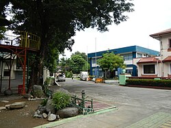 Street in San Quintin | |
 Flag  Seal | |
| Motto: Farah Sa Bayan. Bagong San Quintin!! | |
 Map of Pangasinan with San Quintin highlighted | |
OpenStreetMap  | |
 San Quintin Location within the Philippines | |
| Coordinates: 15°59′04″N120°48′54″E / 15.98444°N 120.815°E | |
| Country | Philippines |
| Region | Ilocos Region |
| Province | Pangasinan |
| District | 6th district |
| Founded | December 23, 1863 |
| Named after | Don Quintin Lictawa |
| Barangays | 21 (see Barangays) |
| Government | |
| • Type | Sangguniang Bayan |
| • Mayor | Farah Lee Lumahan |
| • Vice Mayor | John Valiente |
| • Representative | Marlyn Primicias-Agabas |
| • Municipal Council | Members |
| • Electorate | 25,350 voters (2025) |
| Area | |
• Total | 115.90 km2 (44.75 sq mi) |
| Elevation | 146 m (479 ft) |
| Highest elevation | 1,172 m (3,845 ft) |
| Lowest elevation | 61 m (200 ft) |
| Population (2024 census) [3] | |
• Total | 34,322 |
| • Density | 296.13/km2 (766.99/sq mi) |
| • Households | 8,683 |
| Economy | |
| • Income class | 3rd municipal income class |
| • Poverty incidence | 18.63 |
| • Revenue | ₱ 191.4 million (2022) |
| • Assets | ₱ 263.3 million (2022) |
| • Expenditure | ₱ 177.1 million (2022) |
| • Liabilities | ₱ 27.16 million (2022) |
| Service provider | |
| • Electricity | Pangasinan 3 Electric Cooperative (PANELCO 3) |
| Time zone | UTC+8 (PST) |
| ZIP code | 2444 |
| PSGC | |
| IDD : area code | +63 (0)75 |
| Native languages | Pangasinan Ilocano Tagalog |
| Website | sanquintinpangasinan |
San Quintin, officially the Municipality of San Quintin (Pangasinan : Baley na San Quintin; Ilocano : Ili ti San Quintin; Tagalog : Bayan ng San Quintin), is a municipality in the province of Pangasinan, Philippines. According to the 2024 census, it has a population of 34,322 people. [5]
