
The administrative units of Pakistan comprise four provinces, one federal territory, and two disputed territories: the provinces of Punjab, Sindh, Khyber Pakhtunkhwa, and Balochistan; the Islamabad Capital Territory; and the administrative territories of Azad Jammu and Kashmir and Gilgit–Baltistan. As part of the Kashmir conflict with neighbouring India, Pakistan has also claimed sovereignty over the Indian-controlled territories of Jammu and Kashmir and Ladakh since the First Kashmir War of 1947–1948. It also has a territorial dispute with India over Junagadh, but has never exercised administrative authority over either regions. All of Pakistan's provinces and territories are subdivided into divisions, which are further subdivided into districts, and then tehsils, which are again further subdivided into union councils.
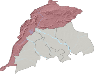
Kohat Division is one of the seven divisions in the Khyber Pakhtunkhwa province of Pakistan. It consists of five districts: Hangu, Karak, Kohat, Kurram, and Orakzai. The division borders Bannu Division to the south and west, Peshawar Division to the north and east, the province of Punjab to the east, and Afghanistan to the northwest. CNIC code of Kohat Division is 14.

Bannu Division is one of seven divisions in Pakistan's Khyber Pakhtunkhwa province. It consists of three districts: Bannu, Lakki Marwat, and North Waziristan. The division borders Dera Ismail Khan Division to the south and west, Kohat Division to the north and east, and the province of Punjab, Pakistan to its east. CNIC code of Bannu Division is 11.
Wazir Tehsil is an administrative subdivision (tehsil) of Bannu District, Bannu Division, Khyber Pakhtunkhwa Province, Pakistan. The total population, according to the 1998 census, was 19,600, 98.1% of which have Pashto as a first language, and the remaining 1.9% speak Punjabi. Most of the population belong to the Wazir tribe of Pashtuns.

Bettani Tehsil is an administrative subdivision (tehsil) of Lakki Marwat District in Khyber Pakhtunkhwa province of Pakistan. This subdivision shares its boundary on the north with Bannu Subdivision, on the west with Jandola Tehsil, to the west with North and South Waziristan and to the northeast with the district of Lakki Marwat. Its total area is 132 square kilometers.

Drazanda Tehsil is an administrative subdivision (tehsil) of Dera Ismail Khan District in Khyber Pakhtunkhwa province of Pakistan. The subdivision borders South Waziristan to the north, Dera Ghazi Khan and Musa Khel to the south and Zhob to the west.
The Federally Administered Tribal Areas, commonly known as FATA, was a semi-autonomous tribal region in north-western Pakistan that existed from 1947 until being merged with the neighbouring province of Khyber Pakhtunkhwa in 2018 through the Twenty-fifth amendment to the constitution of Pakistan. It consisted of seven tribal agencies (districts) and six frontier regions, and were directly governed by the federal government through a special set of laws called the Frontier Crimes Regulations.

The Frontier Constabulary is a federal paramilitary force of Pakistan under the control of the Interior Secretary of Pakistan, which is largely drawn from Khyber Pakhtunkhwa province, but operates in several districts of Pakistan. It is responsible for maintaining law and order, and dealing with situations beyond the capabilities of the civilian Khyber Pakhtunkhwa Police. It also guards against tribal incursions, criminal gangs, and contraband smuggling.
Jandola Tehsil is an administrative subdivision (tehsil) of Tank District in Khyber Pakhtunkhwa province of Pakistan. The subdivision borders South Waziristan to the north, south and west and Lakki Marwat District to the north-east.
Hassan Khel Tehsil is an administrative subdivision (tehsil) of Peshawar District in Khyber Pakhtunkhwa province of Pakistan. This subdivision borders Nowshera District to the east and Kohat Subdivision to the south.
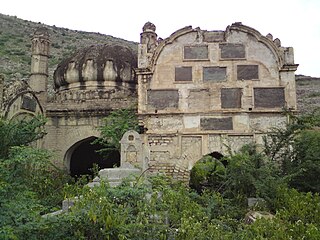
Dara Adam Khel Tehsil is an administrative subdivision (tehsil) of Kohat District in Khyber Pakhtunkhwa province of Pakistan. This subdivision shares its boundary with Peshawar District to the north, Nowshera District to the east and Orakzai District to the west.

There are many types of gemstones of Pakistan. They can be found among the nation's three mountain ranges - the Hindu Kush, the Himalayas, and the Karakoram - in the provinces of Khyber Pakhtunkhwa, Gilgit-Baltistan, Balochistan, and the Federally Administered Tribal Areas. The gemstone industry in Pakistan has the city of Peshawar as its hub, and there are many companies working in it.

FATA University is a public sector university situated in Akhorwal, Tribal Sub-Division Darra Adam Khel, Kohat, Khyber Pakhtunkhwa, Pakistan. The university is run by the Higher Education Department, Government of Khyber Pakhtunkhwa.
Administrative System of FATA was the system by which semi-autonomous tribal region of Federally Administered Tribal Areas was governed.

The Twenty-fifth Amendment to the Constitution of Pakistan was passed by the Parliament of Pakistan and the Khyber Pakhtunkhwa Assembly in May 2018. Under the amendment, the Federally Administered Tribal Areas (FATA) and Provincially Administered Tribal Areas (PATA) are to be merged with the province of Khyber Pakhtunkhwa (KP).
The Khasadar were paramilitary forces operating throughout the Federally Administered Tribal Areas (FATA), now a part of Khyber Pakhtunkhwa province in Pakistan. The Khasadar were a locally recruited and maintained tribal security forces, paid for through a stipend provided directly to their tribes by the Pakistani government. Around 40,000 Khasadar served seven former tribal agencies and six frontier regions.
The Pakistan Levies, or Federal Levies, are provincial paramilitary forces (gendarmeries) in Pakistan, whose primary missions are law enforcement, assisting the civilian police in maintaining law and order, and conducting internal security operations at the provincial level. The various Levies Forces operate under separate chains of command and wear distinct patches and badges.
On 31 May 2018, with the application of 25th Amendment, Federally Administrated Tribal Areas ceased to exist, and stood merged into neighbouring province of Khyber Pakhtunkhwa.

Shoukat Aziz is a Pakistani human rights activist known for abolishing the Frontier Crimes Regulation and co-founding the youth rights group FATA Youth Organization (FYO). He advocates for students' rights, human rights, and minority tribal rights, with a particular emphasis on the rights of those living in the Federally Administrated Tribal Areas (FATA) of Pakistan. He was responsible for abolishing the Frontier Crimes Regulation, a group of laws which had long been denounced by international human rights activists.

