Khajjak

Last updated

The Khajjak [1] is a village at a 8 kilometers distance from Sibi city of Balochistan, Pakistan. The whole of the Khajjak town is very rich particularly in wheat. The Khajjak tribe hold the means of irrigation by the Nari completely in their hands and their crops extent of cultivation were unequaled in any part of Kachhi District.

Contents

Anglo Khajjak Battle 1841

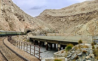
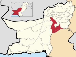
The Khajjak Town is situated 8 Kilometers distance from Sibi city Balochistan province of Pakistan . This tract is generally uncultivated till within about 4 miles South of Kurak, thence as far North as the hills the area is very productive. [2] The whole of the Khajjak circle of which the Fort of that name is the capital is very rich particularly in wheat. The Khajjak Tribe as before stated held the means of irrigation by the Nari completely [3] in their hands and crops extent of cultivation were unequaled in any part of Kachhi District.

The Khajjak Fort is described as strong and surrounded by a deep dry ditch through which the troops advanced to a gateway, within which was the gate attacked. This was lined with 800 to 900 Khajjaks and was therefore a strong position. It was opposite this gate that captain Leslie opened fire to cover the advance of the infantry and it was endeavoring to force this that Lieutenant Falconer at the head of the grenadiers was killed with five or six of his men. Lieutenant Shaw again attempting it was severely wounded.[ citation needed ]

Sardar Panju Khan Khajjak Tomb Sardar Panju Khan Khajjak Tomb.jpg
Sardar Panju Khan Khajjak Tomb

In January 1841 Brigadier Valiant's brigade consisting of two troops Horse Artillery, a nine pounder Field Battery two wings of Cavalry the 40th Regiment, a wing of the 41st Regiment, two battalions of Bombay native Infantry, the 20th and 21st and a mass of irregular horse, marched from Sakkar (Where it had arrived from Karachi in December 1840) and proceeded to mengal-ka-Shahir near Bhag. Where it remained for some time in camp. Whilst there a small force with guns was sent to Khajjaks in the Sibi country about 30 miles North-east of Dhadar, under Colonel Wilson [4] of the Bombay Cavalry to coerce the Khajjaks of that place, but met with a disaster, two officers being killed and Colonel Wilson himself mortally wounded. The cause of this disaster was that the detachment was marched into the body of the town without taking possession of the houses right and left. The Khajjaks waited till they had come in and then poured in a fire from under cover. [5] A second attempt by dismounted Artillerymen under Lieutenant Creed was defeated owing to the want of support and Lieutenant Creed himself was among the slain. The place was subsequently occupied and destroyed by the Brigadier. The British Troops lost 4 officers including 55 men of the army and 90 people of Khajjak Tribes are martyred. The Khajjaks are the descendants of a kakar tribe.

Shaheedan Khajjak 1841 Shaheedan-khajjak.jpg
Shaheedan Khajjak 1841

The Khajjak who resided with nine other Kakar chiefs in a village Mekhtar Loralai District in consequence of a feud in which Khajjaks with their family and dependents migrated to Sibi. The names of the Khajjak chiefs, the descendants of sons of khajjak are, 1-Ismail Khan son of Panjo Khan( The head chief Panjo being the eldest son.) 2- Issa Khan son of Ali Khan 3-Syud Khan son of Dur Khan 4-Karim Khan son of Taj Muhammad 5-Hassan khan son of Mir Khan 6- Meeran Khan son of Jan Muhammad 7- Dur Khan son of Naseer Khan 8- Kamal Khan son of Akbar Khan The Khajjak Tribe is said to have numbered from seven hundred to one thousand fighting men this year. [6]

Related Research Articles

<span class="mw-page-title-main">Bolan Pass</span> Mountain pass in Balochistan, Pakistan

Bolan Pass is a valley and a natural gateway through the Toba Kakar range in Balochistan province of Pakistan. It is situated 120 km (75 mi) south of Pakistan's border with Afghanistan. The pass is an 89 km (55 mi) stretch of the Bolan River valley from Rindli in the south to Darwāza near Kolpur in the north. It is made up of a number of narrow gorges and stretches. It connects Quetta with Sibi by road and railway.

<span class="mw-page-title-main">Barkhan District</span> District of Balochistan in Pakistan

Barkhan is a district in the province of Balochistan in Pakistan. It shares its borders with the province of Punjab to the east and the Balochistan districts of Dera Bugti to the south, Kohlu to the west, Loralai to the northwest and Musakhel to the north. The town of Barkhan serves as the district's headquarters. It was granted the status of a separate district on 31 December 1991, prior to which it was a tehsil within Loralai District.

<span class="mw-page-title-main">Kachhi District</span> District of Balochistan in Pakistan

Kachhi or Kacchi, previously known until 2008 as Bolan District, is a district located in the central part of the Balochistan province in Pakistan. The Bolan area remained under one district Kacchi until 31 December 1991. The Deputy Commissioner's office started functioning on 17 May 1992, and Bolan became one of the four districts of Naseerabad Division, until the abolition of Divisions in 2000.

<span class="mw-page-title-main">Sibi District</span> District of Balochistan in Pakistan

Sibi is a district in the Balochistan province of Pakistan. The main mountain ranges are Zen, Bambore and Dungan. The climate and topography of Sibi District is quite varied compared to the other districts of Balochistan. It is also known as the "hotspot" of Pakistan where the temperatures in the summer has exceeded 52.6 °C (126.7 °F). Until 2013 the district had two sub-divisions, Sibi and Lehri, further organized into Tehsils and sub-tehsils: Sibi, Lehri, Kutmandi and Sangan. Lehri was rejoined with Sibi district in 2018.

The Marri are a Balochi-speaking tribe of the Baloch people, who inhabit a large arid region in northeastern Balochistan, Pakistan. The Marri area is bounded to the west by the plains of Sibi. To the north are the Kakar and Loni tribes of the Pashtuns; to the east lie the lands of the Khetrans, to the south the Bugti tribe.

Sibi is a city situated in the Balochistan province of Pakistan. The city serves as the administrative headquarters of the district and tehsil of the same name.

<span class="mw-page-title-main">Dadu District</span> District of Sindh in Pakistan

Dadu District, is a district of Sindh Province, Pakistan. With headquarters the city of Dadu, the district was created in 1931 by merging Kotri and Mahal Kohistan tehsils from Karachi District and Mehar, Khairpur Nathan Shah, Dadu, Johi and Sehwan tehsils from Larkana District. In 2004, several talukas in the south were split off to create the new Jamshoro District. Its boundary touches with four districts of Sindh i.e. Jamshoro, Naushahro Feroze, Shaheed Benazirabad and Kamber Shahdadkot.

Bhag is a city located within Kachhi District of Balochistan Province of Pakistan. It is the largest city of the district and sits at an altitude of 90 meters.

<span class="mw-page-title-main">Nasirabad Division</span> Administrative division of Balochistan, Pakistan

Nasirabad Division is an administrative division of Balochistan Province, Pakistan. It is the only Irrigation & Agricultural Division of Balochistan, The division connects Balochistan with Sindh. Nasirabad division created by bifurcation of Sibi division in 1987. Its Divisional headquarters are at Dera Murad Jamali. CNIC Code of Nasirabad Division is 53.

Lehri tribe is a Baloch tribe in Balochistan, Pakistan. They are descended from the Rind Baloch and have emerged from the Domki tribe.

Shahrigh is a town and union council of Sibi District in the Balochistan province of Pakistan. It is located at 30°11'23N 67°42'34E and has an altitude of 1217 m (3996 ft).

<span class="mw-page-title-main">2008 Ziarat earthquakes</span> Earthquake in Balochistan, Pakistan

The 2008 Ziarat earthquakes hit the Pakistani province of Balochistan on October 29 with a moment magnitude of 6.4. The US Geological Survey reported that the first earthquake occurred 60 km (37 mi) north of Quetta and 185 km (115 mi) southeast of the Afghanistan city of Kandahar at 04:09 local time at a depth of 15 km (9.3 mi), at 30.653°N, 67.323°E. It was followed by another shallower magnitude 6.4 earthquake at a depth of 14 km (8.7 mi) approximately 12 hours after the initial shock, at 30.546°N, 67.447°E. 215 people were confirmed dead. More than 200 were injured, and 120,000 were homeless. Qamar Zaman Chaudhry, director general of Pakistan Meteorological Department, stated the quake epicenter was 70 miles (110 km) north of Quetta, and about 600 km (370 mi) southwest of Islamabad.

Luni,, pronounced "Looni", or "Lundi" is a village in the Balochistan province of Pakistan. It is located about 11 kilometres (6.8 mi) north of the city of Sibi in Sibi District of Balochistan Province, at an altitude of 495 feet (151 m).

<span class="mw-page-title-main">Kacchi (Kalat)</span>

Kacchi was a division of the former princely state of Kalat in Baluchistan, Pakistan, with an area 5,310 square miles (13,800 km2). It was located in the Kacchi Plain.

Marghzani tribe is one of prominent tribes of Sibi and Musakhail.They are scattered in many areas like Sibi,Hyderabad and Musakhail. The tribe is descendent of Panni Pashtoons, which comprises many other tribes including Khajak and Luni. The tribe as per its lineage must have spoken Pashto as those belonging to Musakhail do speak but the ones living in areas of Sibi speak a mixture of languages because of cultural proximity with Sindh. Sibi is famous for its diversity wherein each ethnic group despite its background speaks Sindhi. There are almost nine villages of Marghazani tribe in Sibi, located and named according to their sub-groups. The names of some are Mullazai, Kach Walahri, Dawi, Gulushahr, Samezai, Bostanzai.

Kurak is a village at a 4 kilometers distance from Sibi city of Balochistan, Pakistan. The Kurak Town is the head quarter of Panni Tribe and ancestral village of Nawab barozai.

Talli is a village at a distance of 22 kilometers from Sibi city of Balochistan, Pakistan.

Mizri is a village near Sibi Balochistan Pakistan.

References

  1. "Khajjak Map | Pakistan Google Satellite Maps".
  2. Duke, O. T. (1 January 1883). "A Historical and Descriptive Report on the Districts of Thal-Chotiali and Harnai, with the Adjacent Country Inhabited by Baloch and Pathan Tribes" via Google Books.
  3. Britain), Royal Geographical Society (Great (1 January 2019). "The Journal of the Royal Geographical Society" via Google Books.
  4. "History of the Organization, Equipment, and War Services of the Regiment of Bengal Artillery". H.S. King and Company. 1 January 1895 via Google Books.
  5. Jones, H. Helsham (1 January 1879). "The History and Geography of Afghanistan and the Afghan Campaigns of 1838-9 and 1842: A Course of Lectures Delivered at the R.E. Institute, Chatham, December 1878". Spottiswoode via Google Books.
  6. http://www.sibidistrict.com/ Sibi District

See also

29°36′N67°59′E / 29.600°N 67.983°E / 29.600; 67.983