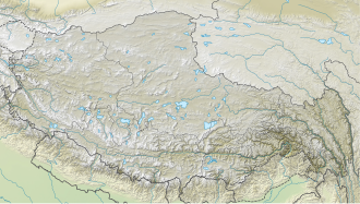
Khatling Glacier

Last updated

Khatling
India Uttarakhand relief map.svg
Red pog.svg
Khatling
Location in India
China Tibet Autonomous Region rel location map.svg
Red pog.svg
Khatling
Khatling (Tibet)
India relief location map.jpg
Red pog.svg
Khatling
Khatling (India)
TypeMountain glacier
Location Tehri Garhwal district Himalayas, Uttarakhand, India
Coordinates 30°49′40″N78°55′20″E / 30.82778°N 78.92222°E / 30.82778; 78.92222
Khatling Glacier

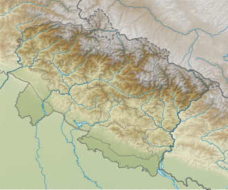
Khatling Glacier is a glacier located in the Tehri Garhwal district of Uttarakhand in India. [1]
Wildlife

In 2016, snow leopards were spotted for the first time near the glacier by the Wildlife Institute of India. [2]

Related Research Articles

<span class="mw-page-title-main">Garhwal division</span> Administrative division in India

Garhwal is one of the two administrative divisions of the Indian state of Uttarakhand. Lying in the Himalayas, it is bounded on the north by Tibet, on the east by Kumaon, on the south by Uttar Pradesh state, and on the northwest by Himachal Pradesh state. It includes the districts of Chamoli, Dehradun, Haridwar, Pauri Garhwal, Rudraprayag, Tehri Garhwal, and Uttarkashi. The people of Garhwal are known as Garhwali and speak the Garhwali language. The administrative center for Garhwal division is the town of Pauri. The Divisional Commissioner is the administrative head of the Division, and is a senior Indian Administrative Service officer. As the administrative head of the division, the Commissioner is overall incharge of the 7 districts in the Garhwal region of Uttarakhand, and is aided in his duties by an additional commissioner and the district magistrates. Sushil Kumar is the divisional commissioner of the Garhwal Division since December 2021.

New Tehri is a city and a municipal board in Tehri Garhwal District in the Indian state of Uttarakhand. It is the administrative headquarters of Tehri Garhwal District. This urban municipality area has 11 wards, from Vidhi Vihar to Vishwakarma Puram.

<span class="mw-page-title-main">Yamunotri</span> Glacier in Uttarakhand, India

Yamunotri, also Jamnotri, is the source of the Yamuna River and the seat of the Goddess Yamuna in Hinduism. It is situated at an altitude of 3,293 metres (10,804 ft) in the Garhwal Himalayas and located approximately 150 kilometres (93 mi) North of Uttarkashi, the headquarters of the Uttarkashi district in the Garhwal Division of Uttarakhand, India. It is one of the four sites in India's Chota Char Dham pilgrimage. The sacred shrine of Yamunotri, source of the river Yamuna, is the westernmost shrine in the Garhwal Himalayas, perched atop a flank of the Bandarpunch mountain. The chief attraction at Yamunotri is the temple devoted to the Goddess Yamuna and the holy thermal springs at Janki Chatti which is 7 km away.

<span class="mw-page-title-main">Uttarakhand</span> State in northern India

Uttarakhand, formerly known as Uttaranchal, is a state in northern India. The state is bordered by Himachal Pradesh to the northwest, Tibet to the north, Nepal to the east, Uttar Pradesh to the south and southeast, with a small part touching Haryana in the west. Uttarakhand has a total area of 53,483 km2 (20,650 sq mi), equal to 1.6 per cent of the total area of India. Dehradun serves as the state capital, with Nainital being the judicial capital. The state is divided into two divisions, Garhwal and Kumaon, with a total of 13 districts. The forest cover in the state is 45.4 per cent of the state's geographical area. The cultivable area is 16 per cent of the total geographical area. The two major rivers of the state, the Ganges and its tributary Yamuna, originate from the Gangotri and Yamunotri glaciers respectively.

<span class="mw-page-title-main">Devprayag</span> Town in Uttarakhand, India

Devprayag is a town and a nagar panchayat, near New Tehri city in Tehri Garhwal District in the state of Uttarakhand, India, and is the final one of the Panch Prayag of Alaknanda River where Alaknanda meets the Bhagirathi river and both rivers thereafter flow on as the Ganges river or Ganga.

<span class="mw-page-title-main">Tehri Garhwal district</span> District of Uttarakhand in India

Tehri Garhwal is a district in the hill state of Uttarakhand, India. Its administrative headquarters is at New Tehri. The district has a population of 618,931, a 2.35% increase over the previous decade. It is surrounded by Rudraprayag District in the east, Dehradun District in the west, Uttarkashi District in the north, and Pauri Garhwal District in the south. Tehri Garhwal is a part of the Himalayas.

<span class="mw-page-title-main">Rudraprayag district</span> District of Uttarakhand in India

Rudraprayag is a district of the state of Uttarakhand of northern India. The district occupies an area of 1984 km2. The town of Rudraprayag is the administrative headquarters of the district. The district is bounded by Uttarkashi District on the north, Chamoli District on the east, Pauri Garhwal District on the south, and Tehri Garhwal District on the west.

Garhwal may refer to the following topics associated with Uttarakhand, India:

<span class="mw-page-title-main">Bhilangna River</span>

Bhilangna River is a Himalayan river in Uttarakhand, India, which is the major tributary of the Bhagirathi river, the source stream of the Ganges River of India. Bhilangana is a combination of Bhil and Ganga.

Tehri Garhwal Lok Sabha constituency is one of the five Lok Sabha (parliamentary) constituencies in Uttarakhand. This constituency came into existence in 1957, following the delimitation of Lok Sabha constituencies. It comprises the districts of Dehradun (part), Tehri Garhwal (part) and Uttarakashi.

<span class="mw-page-title-main">Garhwali people</span> Indian ethno-linguistic group in the Garhwal region of the Indian state of Uttarakhand

The Garhwali people are an Indian ethnolinguistic group native to the Garhwal, in the Indian state of Uttarakhand, who speak Garhwali, an Indo-Aryan language.

<span class="mw-page-title-main">Geography of Uttarakhand</span>

Uttarakhand has a total geographic area of 53,483 km2, of which 86% is mountainous and 65% is covered by forest. Most of the northern parts of the state are part of Greater Himalaya ranges, covered by the high Himalayan peaks and glaciers, while the lower foothills were densely forested till denuded by the British log merchants and later, after independence, by forest contractors. Recent efforts in reforestation, however, have been successful in restoring the situation to some extent. The unique Himalayan ecosystem plays host to many animals, plants and rare herbs. Two of India's great rivers, the Ganges and the Yamuna take birth in the glaciers of Uttarakhand, and are fed by myriad lakes, glacial melts and streams.

<span class="mw-page-title-main">Garhwal Kingdom</span> Monarchy in Himalayan (823–1949)

Garhwal kingdom was an independent Himalayan kingdom in the current north-western Himalayan state of Uttarakhand, India, founded in 823 CE by Kanak Pal the progenitor of the Panwar dynasty that ruled over the kingdom uninterrupted until 1803 CE.

Uttarakhand is a state in the northern part of India. It is often referred to as the "Devbhoomi" due to its religious significance and numerous Hindu temples and pilgrimage sites found throughout the state. As a result, religious tourism forms a major portion of the tourism in the state. Uttarakhand is known for the natural environment of the Himalayas. 2019 Tourist Arrivals Domestic – 40,000,000 per/year and Foreigner – 150,000 per year. Tourism business in Uttarakhand generated 23,000 crores during 2013–14.

Auden's Col is a high altitude mountain pass connecting Rudugaira valley and Bhilangna valley in India. It is situated at 5,490 metres (18,010 ft) elevation and connects the ridge coming from Gangotri III peak on the north-west and the ridge coming from Jogin I on the east, and also binds a glacier coming from Jogin I on the north side of Rudugaira valley, and deadly Khatling glacier on the south side of Bhilangna valley.

<span class="mw-page-title-main">Tehri Assembly constituency</span> Constituency of the Uttarakhand legislative assembly in India

13-Tehri Legislative Assembly constituency is one of the seventy electoral Uttarakhand Legislative Assembly constituencies of Uttarakhand state in India.

<span class="mw-page-title-main">Outline of Uttarakhand</span> Overview of and topical guide to Uttarakhand

The following outline is provided as an overview of and topical guide to Uttarakhand:

<span class="mw-page-title-main">Dhan Singh Negi</span> Indian politician

Dhan Singh Negi is an Indian politician who was a member of the Uttarakhand Legislative Assembly from 2017 to 2022 representing the Tehri constituency in Tehri Garhwal district. Previously affiliated to the Bharatiya Janata Party (BJP), he switched to the Indian National Congress party (INC) in early 2022. Later he rejoined the BJP.In the 2017 state assembly elections, he defeated Dinesh Dhanai, then Cabinet Minister by a large margin.

<span class="mw-page-title-main">Jogin I</span> Mountain in Uttarakhand, India

Jogin I is a mountain of the Garhwal Himalaya in Uttarakhand India.The elevation of Jogin I is 6,465 metres (21,211 ft) and its prominence is 843 metres (2,766 ft). It is 94th highest located entirely within the Uttrakhand. Nanda Devi, is the highest mountain in this category. It lies 5.4 km east of Gangotri III and 7.4 km west of Bhrigupanth 6,772 metres (22,218 ft). It lies 2.2 km South of Jogin II. Its nearest higher neighbor is Gangotri III 6,577 metres (21,578 ft). It is located 6.9 km NW of Thalaysagar 6,904 metres (22,651 ft) and 8.8 km NW lies Gangotri I 6,682 metres (21,923 ft).

Jogin III is a mountain of the Garhwal Himalaya in Uttarakhand, India. The elevation of Jogin III is 6,116 metres (20,066 ft). It is 155th highest located entirely within the Uttrakhand. Nanda Devi, is the highest mountain in this category.

References

  1. "Khatling Glacier". District Tehri Garhwal, Government of Uttarakhand.
  2. "WII monitors tigers, snow leopards above 12,000 ft altitude in Tehri". Hindustan Times. 14 January 2018.