Khilek, Mae Taeng

Last updated
Khilek
ขี้เหล็ก
Tambon
Country Thailand
Province Chiang Mai
Amphoe Mae Taeng
Population (2014)
  Total 9,334
Time zone ICT (UTC+7)
Postal code50150
TIS 1099 500603

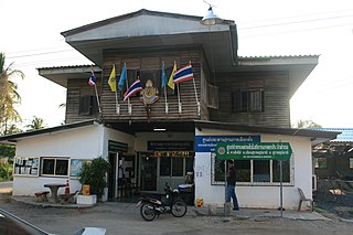
Khilek (Thai : ขี้เหล็ก) is a tambon (sub-district) of Mae Taeng District, in Chiang Mai Province, Thailand. In 2014 it had a population of 9,334 people. [1]

Thai language language spoken in Thailand

Thai, Central Thai, is the sole official and national language of Thailand and the first language of the Central Thai people and vast majority of Thai Chinese. It is a member of the Tai group of the Kra–Dai language family. Over half of Thai vocabulary is derived from or borrowed from Pali, Sanskrit, Mon and Old Khmer. It is a tonal and analytic language, similar to Chinese and Vietnamese.
Tambon central government unit in Thailand

Tambon is a local governmental unit in Thailand. Below district (amphoe) and province (changwat), they form the third administrative subdivision level. As of 2016 there were 7,255 tambons, not including the 180 khwaeng of Bangkok, which are set at the same administrative level, thus every district contains eight to ten tambon. Tambon is usually translated as "township" or "subdistrict" in English — the latter is the recommended translation, though also often used for king amphoe, the designation for a subdistrict acting as a branch of the parent district. Tambon are further subdivided into 69,307 villages (muban), about ten per tambon. Tambon within cities or towns are not subdivided into villages, but may have less formal communities called chumchon (ชุมชน) that may be formed into community associations.

Mae Taeng District District in Chiang Mai, Thailand

Mae Taeng is a district (amphoe) in the northern part of Chiang Mai Province in northern Thailand.

Contents

Administration

Central administration

The tambon is divided into 11 administrative villages ( muban ).

Muban Administrative village in Thailand

Muban is the lowest administrative sub-division of Thailand. Usually translated as village and sometimes as hamlet, they are a subdivision of a tambon. As of 2008, there were 74,944 administrative muban in Thailand. As of the 1990 census, the average village consisted of 144 households or 746 persons.

No. Name Thai
1.Ban Buak Mueบ้านบวกหมื้อ
2.Ban Mae Malaiบ้านแม่มาลัย
3.Ban Dong Pa Lanบ้านดงป่าลัน
4.Ban Nong Khongบ้านหนองโค้ง
5.Ban Sai Munบ้านทรายมูล
6.Ban Ram Poengบ้านร่ำเปิง
7.Ban Mae Khachanบ้านแม่ขะจาน
8.Ban Pong Paoบ้านปางเปา
9.Ban Huai Raiบ้านห้วยไร่
10.Ban Thung Si Thongบ้านทุ่งสีทอง
11.Ban Pong Saeng Thongบ้านปงแสงทอง

Local administration

The area of the sub-district is shared by two local governments.

Related Research Articles

Chiang Dao is a town and tambon (sub-district) of Chiang Dao District, in Chiang Mai Province, Thailand. In 2005 it had a population of 15,194 people. The tambon contains 16 villages. It is 87 km due north of Chiang Mai.

Thesaban local government type in Thailand

Thesaban are the municipalities of Thailand. There are three levels of municipalities: city, town, and sub-district. Bangkok and Pattaya are special municipal entities not included in the thesaban system.

Mae Ai is a tambon (subdistrict) of Mae Ai District, in Chiang Mai Province, Thailand. In 2014 it had a total population of 9,699 people.

Pho Thale District Amphoe in Phichit, Thailand

Pho Thale is a district (amphoe) in the southwestern part of Phichit Province, central Thailand.

Mueang Bueng Kan District District in Bueng Kan, Thailand

Mueang Bueng Kan is a capital district of Bueng Kan Province, northeastern Thailand. It is 759 km north-northwest of Bangkok.

Mae Taeng is a town and tambon (sub-district) of Mae Taeng District, in Chiang Mai Province, Thailand. In 2005 it had a population of 4,548 people. The tambon contains eight villages.

Pa Daet is a tambon (subdistrict) of Mueang Chiang Mai District, in Chiang Mai Province, Thailand. In 2009 it had a total population of 16,859 people.

Mae Na is a tambon (sub-district) of Chiang Dao District, in Chiang Mai Province, Thailand. In 2005 it had a population of 9,782 people. The tambon contains 13 villages.

Mueang Khong is a tambon (sub-district) of Chiang Dao District, in Chiang Mai Province, Thailand. In 2005 it had a population of 4,244 people. The tambon contains six villages.

Sop Poeng is a tambon (sub-district) of Mae Taeng District, in Chiang Mai Province, Thailand. In 2005 it had a population of 7,977 people. The tambon contains 13 villages.

Pa Pae is a tambon (sub-district) of Mae Taeng District, in Chiang Mai Province, Thailand. In 2005 it had a population of 6,847 people. The tambon contains 14 villages.

Kuet Chang is a tambon (sub-district) of Mae Taeng District, in Chiang Mai Province, Thailand. In 2005 it had a population of 5,834 people. The tambon contains eight villages.

Inthakhin Tambon in Thailand

Inthakhin is a tambon (sub-district) of Mae Taeng District, in Chiang Mai Province, Thailand. In 2014 it had a population of 12,867 people.

Khilek is a tambon (subdistrict) of Mae Rim District, in Chiang Mai Province, Thailand. In 2014 it had a total population of 7,476 people.

Samoeng Nuea is a tambon (sub-district) of Samoeng District, in Chiang Mai Province, Thailand. In 2005 it had a population of 3,426 people. The tambon contains six villages. It lies 73 km northwest of Chiang Mai.

Ban Klang is a tambon (subdistrict) of San Pa Tong District, in Chiang Mai Province, Thailand. In 2014 it had a total population of 9,676 people.

Nam Phrae is a tambon (subdistrict) of Hang Dong District, in Chiang Mai Province, Thailand. In 2016 it had a total population of 6,830 people.

Wiang Tai is a village and tambon (sub-district) of Pai District, in Mae Hong Son Province, Thailand. In 2005 it had a population of 6,493 people. The tambon contains six villages.

Mae Na Toeng Tambon in Thailand

Mae Na Toeng is a village and tambon (sub-district) of Pai District, in Mae Hong Son Province, Thailand. In 2005 it had a population of 6,417 people. The tambon contains 14 villages.

Nam Chan is a tambon (sub-district) of Seka District, in Bueng Kan Province, Thailand. In 2015 it had a population of 6,418 persons.

References

  1. "Population statistics 2014" (in Thai). Department of Provincial Administration. Retrieved 2015-04-03.

Coordinates: 19°03′45″N98°56′23″E / 19.0625°N 98.9396°E / 19.0625; 98.9396

Geographic coordinate system Coordinate system

A geographic coordinate system is a coordinate system that enables every location on Earth to be specified by a set of numbers, letters or symbols. The coordinates are often chosen such that one of the numbers represents a vertical position and two or three of the numbers represent a horizontal position; alternatively, a geographic position may be expressed in a combined three-dimensional Cartesian vector. A common choice of coordinates is latitude, longitude and elevation. To specify a location on a plane requires a map projection.