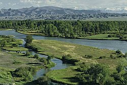
Mongolia is a landlocked country in East Asia, located between China and Russia. The terrain is one of mountains and rolling plateaus, with a high degree of relief. The total land area of Mongolia is 1,564,116 square kilometres. Overall, the land slopes from the high Altai Mountains of the west and the north to plains and depressions in the east and the south. The Khüiten Peak in extreme western Mongolia on the Chinese border is the highest point. The lowest point is at 560 m (1,840 ft), is the Hoh Nuur or lake Huh. The country has an average elevation of 1,580 m (5,180 ft).

The Altai Mountains, also spelled Altay Mountains, are a mountain range in Central Asia and Eastern Asia, where Russia, China, Mongolia, and Kazakhstan converge, and where the rivers Irtysh and Ob have their headwaters. The massif merges with the Sayan Mountains in the northeast, and gradually becomes lower in the southeast, where it merges into the high plateau of the Gobi Desert. It spans from about 45° to 52° N and from about 84° to 99° E.

The Sayan Mountains are a mountain range in southern Siberia spanning southeastern Russia and northern Mongolia. Before the rapid expansion of the Tsardom of Russia, the mountain range served as the border between Mongolian and Russian cultures and cultural influences.

The Pallas's cat, also known as the manul, is a small wild cat with long and dense light grey fur, and rounded ears set low on the sides of the head. Its head-and-body length ranges from 46 to 65 cm with a 21 to 31 cm long bushy tail. It is well camouflaged and adapted to the cold continental climate in its native range, which receives little rainfall and experiences a wide range of temperatures.
Straubing-Bogen is a Landkreis (district) in the eastern part of Bavaria, Germany. Neighboring districts are Cham, Regen, Deggendorf, Dingolfing-Landau, Landshut and Regensburg. The independent town of Straubing is surrounded by the district. The seat of the government of the district (Landratsamt) is located in Straubing.
Tsengel is a sum (district) of Bayan-Ölgii Province in western Mongolia. The capital of Tsengel is Khushoot, located in the west of the sum.

Khovd, formerly known as Kobdo or Khobdo, is the capital of the Khovd Province of Mongolia. It is the administrative seat of the Jargalant sum.

Tariat is a sum (district) of Arkhangai Province in central Mongolia. As of 2009 it had a population of 5086 people in 2009, 644 of whom lived in the village of Tariat.

Burqin County is a county in Xinjiang, China and is under the administration of the Kazakh autonomous area of Altay Prefecture. It has an area of 10,362 km2 (4,001 sq mi) with a population of 70,000. The postcode is 836600.

Scholars do not have a consensus on the exact location where Genghis Khan is buried. The location of the burial place of Genghis Khan has been the subject of much speculation and research. The site remains undiscovered, although it is generally believed that it is near the Mongol sacred mountain of Burkhan Khaldun in the Khentii Mountains.
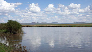
Kherlen River is a 1,254 km river in Mongolia and China. It is also one of the two longest rivers in Mongolia, along with the Orkhon River.
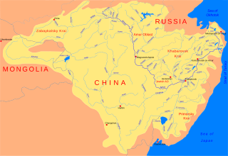
The Khalkh River is a river in eastern Mongolia and northern China's Inner Mongolia region. The river is also referred to with the Mongolian genitive suffix -iin as the Khalkhin Gol, or River of Khalkh.

Dörgön is a sum (district) of Khovd Province in western Mongolia. It is 106 km away from the city of Khovd.

Erdenekhairkhan is a sum of Zavkhan Province in western Mongolia. The sum centre is 13 km South to Goliin Ekh, the source of Elsiin River running to the Airag Lake. In 2005, its population was 1,771.
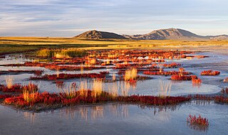
Uvs Lake Basin is an endorheic basin located on the territorial border of Mongolia and Tuva, a republic of the Russian Federation. The basin is part of the Central Asian Internal Drainage Basin and is named after Uvs Lake, a large saline lake situated in the western part of its drainage basin, and is one of the last remnants of the mammoth steppes. Uvs Lake is a shallow lake with an area of 3,350 km2 (1,290 sq mi). Its entire basin, which includes several smaller lakes, is 70,000 km2 (27,000 sq mi).

The Gobi Desert is a large, cold desert and grassland region located in northern China and southern Mongolia. It is the sixth largest desert in the world. The name of the desert comes from the Mongolian word Gobi, used to refer to all of the waterless regions in the Mongolian Plateau; in Chinese, Gobi is used to refer to rocky, semi-deserts such as the Gobi itself rather than sandy deserts.

Zavkhan River is a river in Mongolia. It flows from Khangai Mountains to Lake Khyargas, and has a draining area of over 77,840 square kilometres. The river forms most of the border between the Govi-Altai and Zavkhan aimags. The length of the river is 670 kilometres (420 mi).
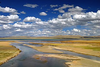
The Ulan Moron, Mar Qu (Tibetan), or Tuotuo River is a 336 km (209 mi) long river, located in Qinghai province in the People's Republic of China.

The Dangqu or Dam Chu is a 234 km (145 mi) river in the Qinghai province of the People's Republic of China. It runs from its source in an eastern offshoot of the Tanggula Mountains (唐古拉山), receives its main tributary the Buqu (布曲), and has a confluence with the Ulan Moron, where the Tongtian River is formed. The Dangqu has been discovered to be the actual headwater of the Yangtze River under modern criteria, although the nearby Ulan Moron or Tuotuo was traditionally regarded as the primary river of the two.
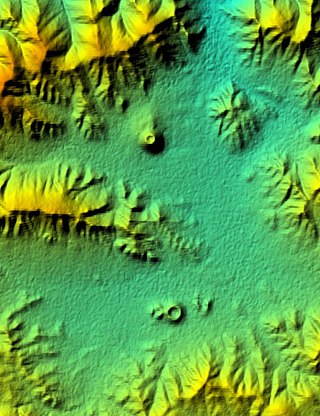
Khanuy-Gol is a volcanic field in Mongolia. Khanuy-Gol is located in the northern Hangai range, north of the settlement of Bulgan.
