Clondalkin is a suburban town in County Dublin, 10 km (6 mi) west of Dublin city centre, Ireland, under the administrative jurisdiction of South Dublin. It features an 8th-century round tower that acts as a focal point for the area.

Sutton is a residential suburb on the Northside of Dublin, Ireland. It occupies the tombolo which links Howth Head to the mainland, some of the lower slopes of Howth Hill, and a little of the adjacent coasts. The area lies within the jurisdiction of Fingal County Council. There is a small commercial core at the Sutton Cross road intersection.

The Abbey of Kells is a former monastery in Kells, County Meath, Ireland, 59 kilometres (37 mi) north-west of Dublin. It was founded in the early 9th century, and the Book of Kells was kept there during the later medieval and early modern periods before finally leaving the abbey in the 1650s. Much of the Book of Kells may have been created there, but historians cannot be certain of the exact date and circumstances of its creation.

Kilcoole is a town in County Wicklow, Ireland. It is 3 kilometres (2 mi) south of Greystones, 14 km (9 mi) north of Wicklow, and about 28 km (17 mi) south of Dublin. The town is in a townland and civil parish of the same name. Kilcoole was used as a filming location for the Irish television series Glenroe, which ran through the 1980s and 1990s.

Stepaside is a village in the townland of Kilgobbin, located in south County Dublin, in Dún Laoghaire–Rathdown, Ireland. The area is 4 kilometres (2.5 mi) south of Dundrum.

The villages of Killucan and Rathwire are co-located in the east of County Westmeath, Ireland. As of the 2016 census, they had a combined population of 1,370. Killucan is on the R156 road about 15 km (9.3 mi) from Mullingar and 60 km (37 mi) from Dublin.

Glenamoy is a village in the civil parish of Kilcommon, Erris in the northern part of County Mayo in Ireland. The R314 road passes through Glenamoy.

Killamery is a village in County Kilkenny, Ireland. Located near the County Tipperary border, it is in a townland and civil parish of the same name. Killamery lies on the N76 national secondary road, halfway between Kilkenny to the northeast and Clonmel to the southwest.
The Kildalton Cross is a monolithic high cross in Celtic cross form in the churchyard of the former parish church of Kildalton (from Scottish Gaelic Cill Daltain, "Church of the Foster Son" on the island of Islay in the Inner Hebrides, Scotland. It was carved probably in the second half of the 8th century AD, and is closely related to crosses of similar date on Iona. It is often considered the finest surviving Celtic cross in Scotland, and is certainly one of the most perfect monuments of its date to survive in western Europe. The cross and the adjacent roofless medieval parish church are in the care of Historic Environment Scotland and are jointly a scheduled ancient monument. A simpler cross of late medieval date stands nearby.

Kilworth is a village in north County Cork, located about 2 kilometres north of Fermoy near the river Funcheon. The M8 Cork–Dublin motorway passes nearby. Kilworth has an army camp, located on the R639 regional road between Mitchelstown and Fermoy. Kilworth is part of the Cork East Dáil constituency.
Kilcolgan, is a village on the mouth of the Kilcolgan River at Dunkellin Bay in County Galway, Ireland. The settlement is at the junction of the N67 and R458 roads, which lies between Gort and Clarinbridge. The village is near the site of the Galway Bay drowning tragedy. Kilcolgan was designated as a census town by the Central Statistics Office for the first time in the 2016 census, at which time it had a population of 141 people.
Kilteel is the name of a village, townland and civil parish located in the barony of South Salt, County Kildare, Ireland. The townland of Kilteel Upper contains the remains of a church with a decorated Romanesque chancel arch, the ruins of a 13th-century preceptory of the Knights Hospitaller and a well-preserved 15th-century tower house. The historic settlement is located on the southwest corner of the English Pale and served an important function as a border fortress during the medieval period.

Saint Gobhan has long been linked with the parish of Seagoe – recorded for instance as Teach dho-Ghobha – in County Armagh, Ireland.
Kilcurl comprises the two townland areas of Kilcurl Anglesey and Kilcurl Feronsby. The townlands are situated one mile (1.6 km) from its nearest village, Knocktopher, and located on a road to Carrickshock monument one mile (1.6 km) away and two miles (3.2 km) to Ballyhale. The village of Knocktopher is situated in the parish of Ballyhale, south County Kilkenny, in Ireland.

Killoughternane Church is a 10th-century Celtic Christian church located in County Carlow, Ireland. It was built on the remains of a timber church said to have been built by Fortiarnán in the 5th century AD.

Kill of the Grange, often Kill o' the Grange, is a suburban community and ancient parish in the half-barony of Rathdown, within the traditional County Dublin, in the jurisdiction of Dún Laoghaire–Rathdown. It contains an early religious site, which is a National Monument. The area, sometimees described as a twin of, and sometimes as part of, Deansgrange, is 5 miles southeast of Dublin.

Killursa is a medieval church and national monument in County Galway, Ireland. The church is located on the outskirts of Westport, about east-northeast of the town of Galway. It has a rectangular mass in the Early Christian or Romanesque style, with an octagonal tower at its northeast corner. The tower was apparently added in the 15th century. The church is datable from the 12th century, and may have been founded by St. Columba. The current structure is from the 16th century.

Kilmalkedar is a medieval ecclesiastical site and National Monument located in County Kerry, Ireland.
Drumcliff Monastery was located in Cairbre Drom Cliabh, now County Sligo, five miles north of the modern town of Sligo. The site consists of the remains of a round tower and several high crosses, including one outstanding example. It is currently also the site of a Church of Ireland parish church and a graveyard. It is the burial place of the poet William Butler Yeats. Founded in the 6th century by Saint Colmcille, he is said to have declared in a later literary fragment:
Beloved to my heart also in the West— Drumcliffe at Culcinne's strand.

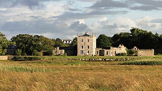
Kilgobbin Castle is a 15th-century tower house in Dublin, Ireland.