Related Research Articles
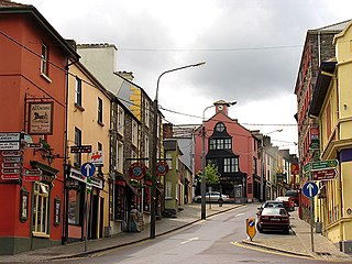
Killorglin is a town in County Kerry, Ireland. As of the 2022 census, the town's population was 2,163. Killorglin is on the Ring of Kerry tourist route, and annual events include the August Puck Fair festival, which starts with the crowning and parading of a "king" wild goat. The town is 26 km south of Tralee along the N70 road, and 22 km west of Killarney along the N72 road. Killorglin is in a civil parish of the same name.
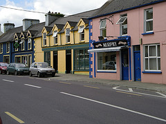
The twin villages of Ballineen and Enniskeane, or Enniskean, in County Cork in Ireland are 43 km (26.72 mi) southwest of Cork City, on the R586 road. The linear settlement lies on the River Bandon between Bandon and Dunmanway. The combined settlement is designated as a 'key village' by Cork County Council for planning purposes and, as of the 2016 census, had a population of 692 people.

Kilgarvan is a small village in County Kerry, Ireland. It is situated on the banks of the Roughty River which flows into Kenmare Bay. The nearest town is Kenmare which is 11 km to the west along the R569 road. Killarney is 18 km to the north. Kilgarvan is part of the civil parish of the same name.
Ballinlough is a mainly residential townland and suburb on the southside of Cork city, in Ireland. It is located between Ballintemple and the larger suburbs of Douglas and Blackrock.
Brosna is a village and parish situated in the Sliabh Luachra area of County Kerry, Ireland. It lies 16 km (9.9 mi) from the town of Castleisland. The civil parish of Brosna consists of the village and a number of townlands. It is a mainly agricultural area, supporting two churches, two schools, a post office, and five public houses.

Kilcrohane is a village in County Cork, Ireland. It is the last coastal village on the Sheep's Head Peninsula after Durrus and Ahakista. Kilcrohane lies under the 'Shadow of Seefin' and is also close to Caher Mountain. The village overlooks Dunmanus Bay.

Glenamoy is a village in the civil parish of Kilcommon, Erris in the northern part of County Mayo in Ireland. The R314 road passes through Glenamoy.

Saint Gobnait, also known as Gobnat or Mo Gobnat or Abigail or Deborah, is the name of an early medieval female Irish saint whose church was Móin Mór, later Bairnech, in the village of Ballyvourney, County Cork in Ireland. She is associated with the Múscraige and her church and convent lay on the borders between the Múscraige Mittine and Eóganacht Locha Léin. Her feast day is February 11.
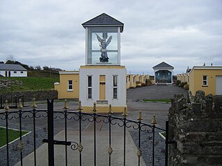
Kilmihil is a village in the Barony of Clonderlaw, west County Clare, Ireland. It is also a civil parish and an ecclesiastical parish in the Roman Catholic Diocese of Killaloe. The area was officially classified as part of the West Clare Gaeltacht; an Irish-speaking community; until 1956.

Kilnamona is a village and a civil parish in County Clare, Ireland. It is situated north-west of Ennis.

Kilmacrennan, also Kilmacrenan, is a village, townland and civil parish in County Donegal, Ireland. The village population was 753, as of the 2016 census. The village's population has increased steadily over the last decade with many new housing developments catering, in particular, for an overspill population from Letterkenny. Kilmacrennan was historically the caput of its eponymous Barony of Kilmacrennan, of the eight Baronies of Donegal.
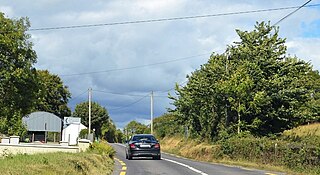
Kilderry is a rural area in County Kerry, Ireland. It lies close to the N70 National secondary road between Milltown (2.6 km) and Killorglin (4.8 km). The townlands of Kilderry North and Kilderry South are in the civil parish of Kilcolman.

Farran is a village in County Cork, Ireland, in the parish of Ovens. It lies on the southside of the River Lee. Farran is 12 miles (19 km) west from Cork City on the N22 road.
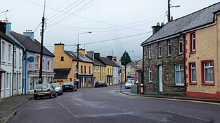
Drimoleague is a village on the R586 road at its junction with the R593 in County Cork, Ireland. It lies roughly halfway between the towns of Dunmanway and Bantry, within the civil parish of Dromdaleague. As of the 2016 census of Ireland, Drimoleague had 451 residents.

Kilkishen is a village in southeast County Clare, Ireland. The village is 8 kilometres (5 mi) east of Quin and 14 kilometres (8.7 mi) north of Shannon.
Peter Crowley is an Irish sportsperson. He plays Gaelic football with his local club Laune Rangers. Crowley was a member of the Kerry county football team at senior level between 2012 and 2021, and was on the 2014 All-Ireland Senior Football Championship winning team. He retired from inter-county football in April 2021.

Kilmocar or Kilmacar is a townland and civil parish in County Kilkenny, Ireland. The ruins of a medieval church lie within Kilmacar townland.

Kiltallagh, sometimes known as Kiltalla, is a civil parish in the historical barony of Trughanacmy in County Kerry, Ireland. Castlemaine is the largest settlement in the civil parish.

Kilmanahan is a townland in the historical barony of Glenahiry in County Waterford, Ireland. The townland, which has an area of approximately 2.75 square kilometres (1.06 sq mi), had a population of 40 people as of the 2011 census.
References
- ↑ "Cill Ghobnait / Kilgobnet". logainm.ie. Placenames Database of Ireland. Retrieved 16 March 2024.
- 1 2 "Kilgobnet Townland, Co. Kerry". townlands.ie. Retrieved 16 March 2024.
- ↑ "Kilgobnet Biddies: Kerry parish's unique way of celebrating St Brigid's Day". Irish Examiner. 1 February 2023. Retrieved 16 March 2024.
the small townland of Kilgobnet, near Killorglin in Kerry
- ↑ "'This is mighty': Biddy returns to Kilgobnet homes". rte.ie. RTÉ News. 1 February 2023. Retrieved 16 March 2024.
Kilgobnet is [..] sitting between wild mountain terrain of the Macgillycuddy Reeks and the gentle flow of the river Laune
- ↑ "CD156 - Kerry Population by Private Households, Occupied and Vacancy Rate". data.gov.ie. Central Statistics Office. Retrieved 16 March 2024.
Population [..] Townlands [..] Kilgobnet, Kilgobnet, Co. Kerry [..] 45
- 1 2 Archaeological Inventory of County Kerry. Volume I: South-West Kerry. Dublin: Government Stationery Office. 2009. ISBN 0755776232.
- ↑ "Gobna(i)t". Dictionary of Irish Biography. Royal Irish Academy. October 2009. doi:10.3318/dib.003502.v1 . Retrieved 16 March 2024.
Gobna(i)t [..] was patron of many other churches. These included Kilgobnet (Cill Ghobnait/ Ghobnatan) in the parishes of Clondrohid, Kilshannig, and [..] Knockane in Co. Kerry
- 1 2 O'Sullivan, Ann; Sheehan, John, eds. (1996). The Iveragh peninsula: an archaeological survey of South Kerry. Cork: Cork University Press. ISBN 9780902561847.
- ↑ "Kilgobnet National School - History of the School". kilgobnetns.scoilnet.ie. Retrieved 16 March 2024.
- ↑ "Directory Page - Kilgobnet N S". gov.ie. Department of Education. 22 January 2024. Retrieved 16 March 2024.