
William Smith King was a Republican U.S. Representative for Minnesota from March 4, 1875, to March 3, 1877. He was a journalist and businessman. He is best known for allegations of political corruption during this congressional term. The House of Representatives did not specify his offense, but decided it was constitutionally unable to punish him for actions that took place before he entered Congress. He did not run for reelection.
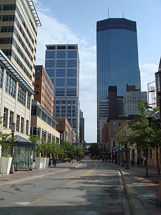
Nicollet Avenue is a major street in Minneapolis, Richfield, Bloomington, and Burnsville in the U.S. state of Minnesota. It passes through a number of locally well-known neighborhoods and districts, notably Eat Street in south Minneapolis and the traffic-restricted Nicollet Mall in downtown Minneapolis.

Thomas Lowry was an American lawyer, real-estate magnate, and businessman who oversaw much of the early growth of the streetcar lines in the Twin Cities area of Minneapolis, St. Paul, and surrounding communities in Minnesota. He became head of the Minneapolis Street Railway Co., later to become part of Twin City Rapid Transit (TCRT). He is not known to be a relative of Sylvanus Lowry, the slaveholder and profiteer of slavery-related enterprise from St. Cloud, Minnesota.

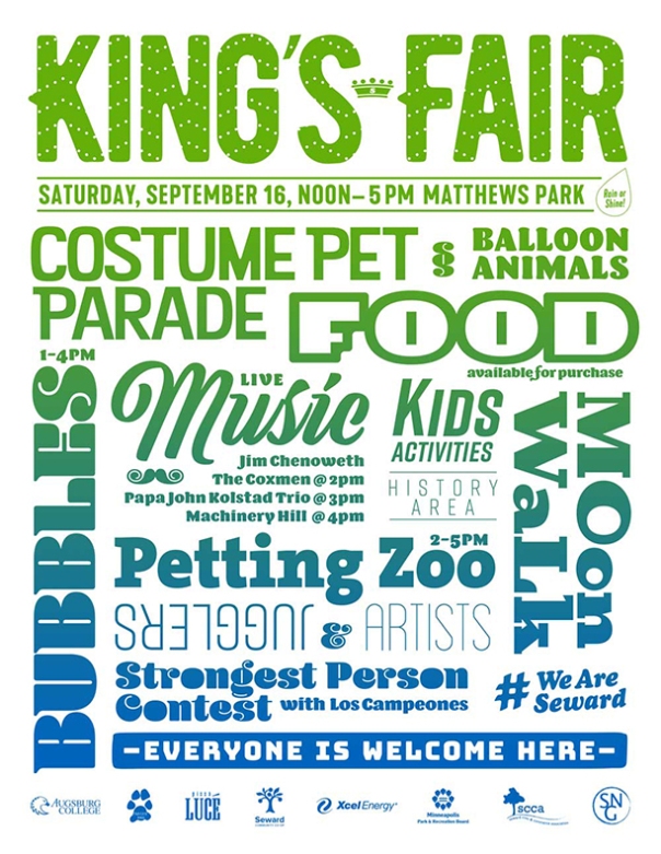
The Seward neighborhood in Minneapolis, Minnesota, United States, is geographically southeast of downtown, consisting of the land bordered by the Hiawatha Avenue industrial district to the west, Minneapolis Midtown Greenway to the south, the Mississippi River to the east, and Interstate 94 to the north. Seward's bordering neighborhoods are Cooper to the southeast, Longfellow to the south, East Phillips to the southwest, Ventura Village to the west, Cedar-Riverside to the north, and Prospect Park/East River Road across the Mississippi River to the east. It is one of the neighborhoods that is part of the larger Longfellow community. Seward was named after former New York senator, governor, and US Secretary of State William H. Seward.

The U.S. city of Minneapolis is officially defined by the Minneapolis City Council as divided into eleven communities, each containing multiple official neighborhoods. Informally, there are city areas with colloquial labels. Residents may also group themselves by their city street suffixes, North, Northeast, South, Southeast, and Southwest.

Lowry Hill East, also known as the Wedge, is a neighborhood in southwest Minneapolis, Minnesota, United States, part of the Calhoun Isles community. Lowry Hill East developed in the 1880s along a horse-drawn streetcar line built by Thomas Lowry. The interior of the neighborhood is residential, with large early 20th century homes and multi-unit apartment buildings, while the border streets are lined with bars, restaurants, grocery stores, coffeeshops, and other small businesses. Most housing is renter-occupied.

South Uptown is a residential neighborhood of Minneapolis, Minnesota. In 2018, the neighborhood voted to change its name to South Uptown from its former name CARAG. Other potential names for the neighborhood included "Bryant Park" and "Bryant Square". The Minneapolis City Council approved the name change in November 2018.

Marcy-Holmes is a neighborhood in the University community of Minneapolis. The majority of the area is residential and sits upon a bluff overlooking the river and the city skyline. However, a small section of the neighborhood along the river is an industrial zone.
East Harriet is a neighborhood in the Southwest community in Minneapolis. Its boundaries are West 36th Street to the north, Lyndale Avenue South to the east, West 46th Street to the south, and Lake Harriet, Lakewood Cemetery, and William Berry Parkway to the west.

Harrison is a neighborhood in the Near North community in the U.S. city of Minneapolis, located to the west of downtown. Its boundaries are roughly, Olson Memorial Highway to the north, Lyndale Avenue to the east, Bassett Creek to the south, and Theodore Wirth Park to the west.

Northrup-King Seed Company was founded in Minneapolis, Minnesota in 1896, and was based there until it was acquired and moved to Golden Valley, Minnesota in 1986. It is now a division of Syngenta.

King Field is a neighborhood in the Southwest community in Minneapolis, Minnesota. Its boundaries are 36th Street to the north, Interstate 35W to the east, 46th Street to the south, and Lyndale Avenue to the west. King Field, within the King Field neighborhood is a park named after Martin Luther King Jr.

The Milwaukee Avenue Historic District is a historic district in the Seward neighborhood of Minneapolis. The district comprises two city blocks of small homes on quarter-sized lots. These houses were built between 1884 and 1890 by William Ragan, a Minneapolis real estate speculator. Built for lower-income residents, the houses had deteriorated in condition by the end of World War II, and by the 1970s, were planned for demolition. A group of residents and concerned citizens fought to save the houses, eventually leading to their inclusion on the National Register of Historic Places and the federal protection and rehabilitation that comes with the designation. Today, the houses sit along a bike- and pedestrian-friendly mall on which motor traffic is prohibited.
Hosmer Library, originally known as the Thirty-Sixth Street Branch Library, is a branch library of the Hennepin County Library system serving the Central neighborhood of Minneapolis, Minnesota, United States. It was named the Hosmer Library in honor of James Kendall Hosmer and was listed on the National Register of Historic Places in 2000.
Lyndale Avenue is a major street in the U.S. state of Minnesota that traverses the cities of Minneapolis, Brooklyn Center, Richfield, and Bloomington. A noncontiguous portion also exists in Faribault, part of Highway 21. There are several commercial districts along the street, including Lyn-Lake in South Minneapolis, Shops at Lyndale in Richfield, and the Oxboro area in Bloomington. Portions of both Interstate 94 and Interstate 35 run on the right-of-way of Lyndale Avenue.

Wonderland was an amusement park that operated in the Longfellow neighborhood of Minneapolis from 1905 through 1911. The ten-acre site was located between Lake Street and 32nd Street and 31st and 33rd Avenues.
Dania Hall was a cultural center and performing arts space in the Cedar-Riverside neighborhood of Minneapolis. Completed in 1886, the building was destroyed by an accidental fire in 2000 at the outset of an extensive renovation project.

Hennepin History Museum is a museum dedicated to the history, people, and communities of Hennepin County, Minnesota, United States. The museum provides in-house exhibits, history-themed programming, and social events throughout the year.
Augsburg Park Library is a public library in Richfield, Minnesota. A Richfield branch library of Hennepin County Library has existed in various buildings in since 1951.


