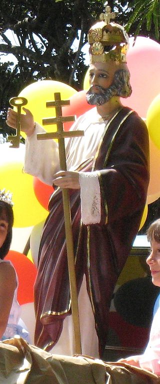
Alajuela is a district in the Alajuela canton of the Alajuela Province of Costa Rica. As the seat of the Municipality of Alajuela canton, it is awarded the status of city. By virtue of being the city of the first canton of the province, it is also the capital of the Province of Alajuela.

Nuevo Cartago y Costa Rica was a province of the Kingdom of Guatemala, created in 1540 during the reign of Charles V, Holy Roman Emperor. It was formed from two earlier Spanish territories. The first of these was Royal Veragua, the territories on the Caribbean coast that had been part of Columbian Veragua before the creation of the Duchy of Veragua in 1537 for Admiral Luis Colón y Toledo, namely present-day Nicaragua, Costa Rica and part of Panama. The second was the Pacific coast that had constituted Castilla de Oro, namely from the Gulf of Nicoya on the west to the borders of the Duchy of Veragua.

Heredia is a district in the Heredia canton of Heredia province, Costa Rica. As the seat of the municipality of Heredia canton, it is awarded the status of city, and by virtue of being the city of the first canton, it is the Province Capital of Heredia province as well. It is 10 kilometers to the north of the country's capital, San José.

Barva is the second canton in the province of Heredia in Costa Rica.

Santa Ana is the ninth canton in the San José province of Costa Rica. It is located in the Central Valley. It borders with the Alajuela canton to the north, the Mora canton to the south and west, the Escazú canton to the east, as well as the Belén canton to the north east. As of 2020, the canton has the highest Human Development Index of any region in Costa Rica with a HDI of 0.871.

La Cruz is a canton in the Guanacaste province of Costa Rica. The head city is in La Cruz district.

Esparza is a canton in the Puntarenas province of Costa Rica. The head city is Esparza in Espíritu Santo district.

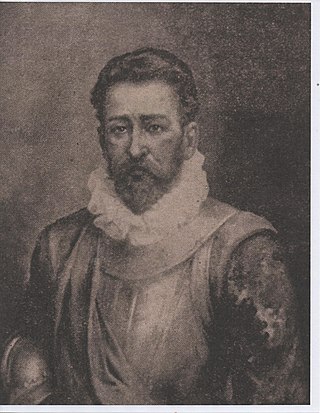
Juan Vázquez de Coronado y Anaya was a Spanish conquistador, remembered especially for his role in the colonization of Costa Rica, in Central America, where he gained a reputation for fairness, effective administration, and good relationships with the native population. He was a nephew of Francisco Vázquez de Coronado y Luján, who explored the southwestern United States between 1540 and 1542.

San Juan is a district of the Santa Bárbara canton, in the Heredia province of Costa Rica. The district consists of two major neighborhoods: San Juan Arriba, and San Juan Abajo.

Costa Rica’s municipal system is organized under the Municipal Code, the specific law that regulates the local governments. Municipalities are the second-level administration in Costa Rica after the central government. Each one of the 82 cantons of Costa Rica has a Municipality or Municipal Government constituted by a mayor and a proportional number of members of the Municipal Council. Districts of each of the cantons also have their local authorities and representatives. Some of the services manage by local governments include; solid waste management, building and administration of local roads, parks, libraries and schools, recollection of municipal taxes and in some cases local security. Worth noticing that in Costa Rica city and municipality are not the same thing, as a canton can have several cities within its borders, generally as districts.
Quitirrisí is a district of the Mora canton, in the San José province of Costa Rica.

The Kingdom of Nicoya, also called Cacicazgo or Lordship of Nicoya, was an indigenous nation that comprised much of the territory of the current Guanacaste Province, in the North Pacific of Costa Rica. Its political, economic and religious center was the city of Nicoya, located on the peninsula of the same name, which depends on several provinces located on both banks of the Gulf of Nicoya, as well as numerous tributary villages. In the 16th century, prior to the arrival of Europeans, Nicoya was the most important chiefdom of the North Pacific of present-day Costa Rica.

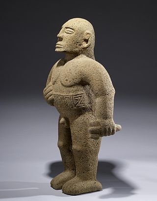
The Huetares were an important indigenous group of Costa Rica, who in the mid-16th century lived in the center of what is now the country. They are also mentioned with the name of güetares or pacacuas. Huetares were the most powerful and best-organized indigenous nation in Costa Rica upon the arrival of the Spaniards. During the 16th century, various chieftains dominated from the Costa Rican Atlantic coast to the Atlantic Slope. The Spanish chronicles mention a myriad of towns and the kings that ruled them, among them the Garabito Empire, located on the Central Atlantic Slope and the Tárcoles River basin, to the Virilla River and the Cordillera Central; the Kingdom of Pacaca, in the current canton of Mora, and the Lordship of el El Guarco, in the current Guarco Valley, in the Cartago Province, to the plains of the Central Caribbean and Chirripó. Their culture belonged to the Intermediate Area, and it stood out mainly for their works in stone, such as metates, sculptures, tables and ceremonial altars; and the non-practice of anthropophagy or cannibalism. Its language, the Huetar language, one of the so-called Chibcha languages, became the Lingua franca of the country. Although this language is extinct, it survives in a large number of place names in Costa Rica such as Aserrí, Tucurrique or Barva. One of the Greatest enemies of the Huetares were the Nicaraos, a Nahua branch that encroached and settled on part of its territory and displaced the Huetar people that inhabited Bagaces, which resulted in tribal warfare between the Nahuas and Huetares that lasted over a century.

The empire, domain or lordship of King Garabito was a vast territory controlled by Huetar King Garabito and that extended through most of the Central Valley of Costa Rica from the Virilla River in modern San José to the Atlantic Slope in what is now the north of the country. Garabito's domain transcended the borders of the Western Huetar Kingdom where it had multiple vassal populations such as Coyoche, Abacara, Chucasque, Cobobici, Cobux, Yurustí and Barva, and also included several submissive peoples but not incorporated into their kingdom; the Botos, Tises and Catapas.

The Western Huetar Kingdom, also called Lordship of Garabito, Kingdom of Garabito or Cacicazgo of Garabito, was an Amerindian nation located in Costa Rica. It was one of the two great indigenous kingdoms of the central part of the country, the other was the Eastern Huetar Kingdom or Lordship of El Guarco. It was made up of a confederation of smaller chieftains, subject to the authority of high chiefs who paid tribute to a major chieftain. It was located in the Central Valley of Costa Rica, spanning from the Pacific coast to the west bank of the Virilla River, following the Tárcoles river basin. At the time of the arrival of the Spaniards to Costa Rica, in the 16th century, the main towns were located in the plains of Esparza, Orotina and San Mateo, where King Garabito had his capital, who was the most important leader to sit during the Spanish conquest, in a place known as the Coyoche Valley, on the banks of the Susubres River, the current canton of San Mateo. At the time of contact, the nearby Kingdom of the Botos, located in the plains north of the Central Volcanic Mountain Range, paid tribute to the West.
The Eastern Huetar Kingdom, also known as Lordship of el Guarco, is one of the two great kingdoms in which the domain of the Huetar ethnic group was divided in the Central Valley of Costa Rica and at the time of the conquest the king was Correque, son of the feared chieftain El Guarco. Although smaller than the fellow Huetar nation, the Western Huetar Kingdom ruled by Garabito as part of its larger empire. The eastern Huetar territory extended from the banks of the Virilla River to the slopes of the Chirripó in the Tierradentro. The area of the modern Paraiso Canton was governed by the vassal chiefs Abituri and Turichiqui, in addition there were aboriginal settlements in Ujarrás and Orosi that were visited by the Spaniard Ignacio Cota in 1561.
El Guarco was a Costa Rican indigenous king, at the time of the Spanish conquest. Its name is preserved in the eastern sector of the Central Valley of Costa Rica, where the city of Cartago is located, in the El Guarco canton in the Cartago Province. Apparently his domains extended from the banks of the Virilla River to the Chirripó region in Tierra Adentro. It is possible that El Guarco was not a personal name, but the designation of its royal office, and that it meant "The Sentinel of Co". Some sources mention El Guarco as monarch of the so-called eastern huetares.
Correque was an indigenous monarch of Costa Rica, king of the Eastern Huetares, who lived in the 16th century. He had several residences and resisted the Conquistadors for some time until he moved one of his courts from Ujarrás to Tucurrique to escape them. He was preceded by El Guarco and succeeded by Alonso Correque.
Pacaca, also called Pacacua, was a Costa Rican indigenous kingdom of the 16th century, whose inhabitants belonged to the Huetar people and culture and whose main seat was in the current Mora Canton, San José Province, Costa Rica, in the place called today with the name of Tabarcia.
Toyopán, was the name of an old indigenous chieftaincy of Costa Rica, which in the 16th century, upon the arrival of the Spaniards, was ruled by the king Huedo Yorustí. The territories of the former Toyopán cacicazgo included the current cantons of Vázquez de Coronado and Tibás, in the San José Province, and San Isidro and Santo Domingo, in the Heredia Province. The main settlement of Toyopán, the city of Apaikan, was in the current district of San Rafael.


