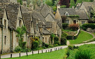
Gloucestershire is a ceremonial county in South West England. It is bordered by Herefordshire to the north-west, Worcestershire to the north, Warwickshire to the north-east, Oxfordshire to the east, Wiltshire to the south, Bristol and Somerset to the south-west, and the Welsh county of Monmouthshire to the west. The city of Gloucester is the largest settlement and the county town.
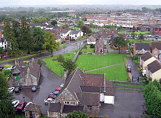
South Gloucestershire is a unitary authority area in the ceremonial county of Gloucestershire, South West England. Towns in the area include Yate, Chipping Sodbury, Kingswood, Thornbury, Filton, Patchway and Bradley Stoke. The southern part of its area falls within the Greater Bristol urban area surrounding the city of Bristol.

Avon was a non-metropolitan and ceremonial county in the west of England that existed between 1974 and 1996. The county was named after the River Avon, which flows through the area. It was formed from the county boroughs of Bristol and Bath, together with parts of the administrative counties of Gloucestershire and Somerset.
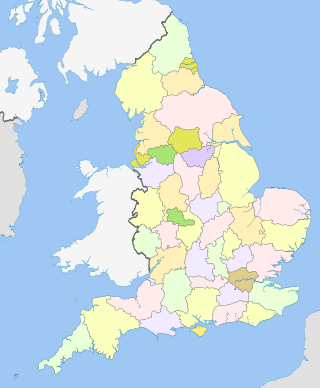
The counties of England are a type of subdivision of England. Counties have been used as administrative areas in England since Anglo-Saxon times. There are three definitions of county in England: the 48 ceremonial counties used for the purposes of lieutenancy; the 84 metropolitan and non-metropolitan counties for local government; and the 39 historic counties which were used for administration until 1974.

Northavon was a district in the English county of Avon from 1974 to 1996.

Glanford was, from 1974 to 1996, a local government district with borough status in the non-metropolitan county of Humberside, England.
The Local Government Act 1972 is an act of the Parliament of the United Kingdom that reformed local government in England and Wales on 1 April 1974. It was one of the most significant Acts of Parliament to be passed by the Heath Government of 1970–74.
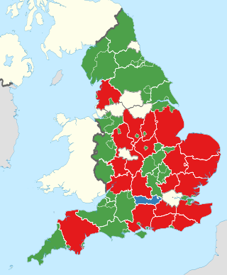
A non-metropolitan county, or colloquially, shire county, is a subdivision of England used for local government.

Kingswood was a borough constituency for the House of Commons of the Parliament of the United Kingdom. It elected one Member of Parliament (MP) at least once every five years by the first-past-the-post electoral system.

Wansdyke was a non-metropolitan district within the County of Avon west of England from 1974 to 1996.

Monmouth District was one of five local government districts in the county of Gwent in Wales between 1974 and 1996. In 1988 the district was granted a charter conferring borough status, becoming the Borough of Monmouth.
Greater Bristol is a term used for the conurbation which contains and surrounds the city of Bristol in the South West of England. There is no official "Greater Bristol" authority, but the term is sometimes used by local, regional and national authorities, and others as a synonym for either the "Bristol Urban Area" or a wider area of the former County of Avon, and by some, TfGB, to refer to the Province of Bristol as defined by C. B. Fawcett (1919) or Derek Senior (1969).
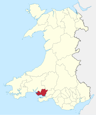
The Borough of Llanelli was one of six local government districts of the county of Dyfed, Wales from 1974 to 1996.

Rhondda was a local government district in the geographical area of the Rhondda Valley, south Wales, from 1877 until 1996, with various statuses through its history.

Port Talbot was one of the four local government districts of the county of West Glamorgan, Wales from 1974 to 1996. The borough was initially called Afan, changing its name to Port Talbot in 1986.

The District of Swansea was a local government district with city status in West Glamorgan, Wales from 1974 to 1996.

The Local Government Commission for England was the body responsible for reviewing the structure of local government in England from 1992 to 2002. It was established under the Local Government Act 1992, replacing the Local Government Boundary Commission for England. The Commission could be ordered by the Secretary of State to undertake "structural reviews" in specified areas and recommend the creation of unitary authorities in the two-tier shire counties of England. The Commission, chaired by John Banham, conducted a review of all the non-metropolitan counties of England from 1993 to 1994, making various recommendations on their future.

South Gloucestershire Council is the local authority of South Gloucestershire, a local government district in the ceremonial county of Gloucestershire, England, covering an area to the north of the city of Bristol. The council is a unitary authority, being a district council which also performs the functions of a county council; it is independent from Gloucestershire County Council. Since 2017 the council has been a member of the West of England Combined Authority.

